
Seo-gu
In the early 1900s, the West New Town project that was developed inside present day Seo-gu and part of present day Jung-gu was split into eleven neighborhoods (jeong in Japanese, dong in Korean). It was roughly a third of the size of the Japanese population in the Nampo concession.1 This West New Town could be called a factory town, for even in 1905 five of at least seven registered factories in Busan were located in this sector.2 This included a cannery built in 1904 and a tobacco factory that was built in 1905 – each of which employed at least one hundred workers.3 In these early days, the neighborhood of Bupyeong-jeong was a home for food and metalwork factories.4
The population steadily grew until the time of the Russo-Japanese War and the construction of the Seoul-Busan Railway in the Choryang area, after which the number of people in the West New Town dropped by by about three hundred before almost tripling in 1907.5 The reason for this shift can be attributed to the completion of the railroad. While at first, residents of West New Town moved near the train station, many more moved to the West New Town within two years. With rail transportation available, Busan attracted more industry. Indeed, by that time in 1907, the number of major registered factories in the West New Town had jumped from five to twenty five, and by 1927 there were at least one hundred thirty major factories in the area.6 The late 1920s saw the West New Town stagnating as some industries began to shift east towards areas reclaimed from the sea. Though the number of factories in each neighborhood varied from year to year, in the eleven years between 1927 and 1938, the total number of registered factories stayed roughly the same.
The neighborhood of Bupyeong-jeong, the largest industrial sector within the West New Town by 1917, had the highest Japanese population of the area.7 As Japanese settled in the flat land, which was previously rural space, it was then that the Korean populace was pushed towards the mountains, forming hill villages from which they had to commute everyday.8 This was due to the way the city had been redesigned by Japanese city planners; however, more and more rural Koreans from outside Busan were moving to the city as well. In the West New Town, displaced Korean farmers would be forced to live in the hill side and find factory work to survive.9 The Chosun Ilbo reported in 1931 that the Great Depression only encouraged the uprooted to move to hill villages due to weak grain prices and debt incurred from subsisting on their tenanted land.10
The spatial split seen here is a common theme in Korea’s early modern history. In Busan, it is not the city center that is occupied by settlers, but rather a new city center is formed from which everything else grows around. As the city expanded, rural citizens were displaced and made to relocate. Because foreigners in Korea generally had greater financial means, they would invest heavily in areas that they would occupy or further develop at a later time. Those who were made to live in the edges of the city in the hill side lacked the resources to invest in their own infrastructure, and those without money were separated from the better areas that were being developed by the Japanese. In this case, a physical (and symbolic) split was usually formed between the Japanese and many Koreans. This split could be found in every redeveloped area in Busan, but it was most prominent in Daesin-jeong, where the poor were particularly concentrated. Indeed, a 1928 survey by the Busan Police Department found that ninety six percent of the impoverished in Busan were Koreans. The Government-General Superintendent General of State Affairs was so put-off by the hill villages’ aesthetics, lack of sanitation, and fire-proneness that he and other government officials wanted the villages demolished.11 In 1928, The Busan Research Institute of Social Work proposed a plan to move the poor to what is now Gamcheon Culture Village.12 Hidden behind Ami-dong, it would have removed what some Japanese saw as being a blight on their beautiful, redeveloping city.
Important architectural sites in Seo-gu indicate that while it had factory sectors, parts of it would have been quite nice to live in. This is made evident by a few buildings, including the former Provincial Office, the provincial governor’s mansion, schools such as the former Gyeongnam Commercial High School, and companies like the former Namseon Electric building. The existence of such structures indicate that the area was not only occupied by factories, but by residents who may have supported and necessitated the construction of these institutions. These remaining buildings also indicate just how “Japanese” the area had become. By 1936, one man wrote that Busan had become ‘”a place with so little Korean culture, whether it be houses, food, clothing or language, it feels like a city initially created by Japanese in which a lot of Koreans live”‘.13
Chungmu-dong
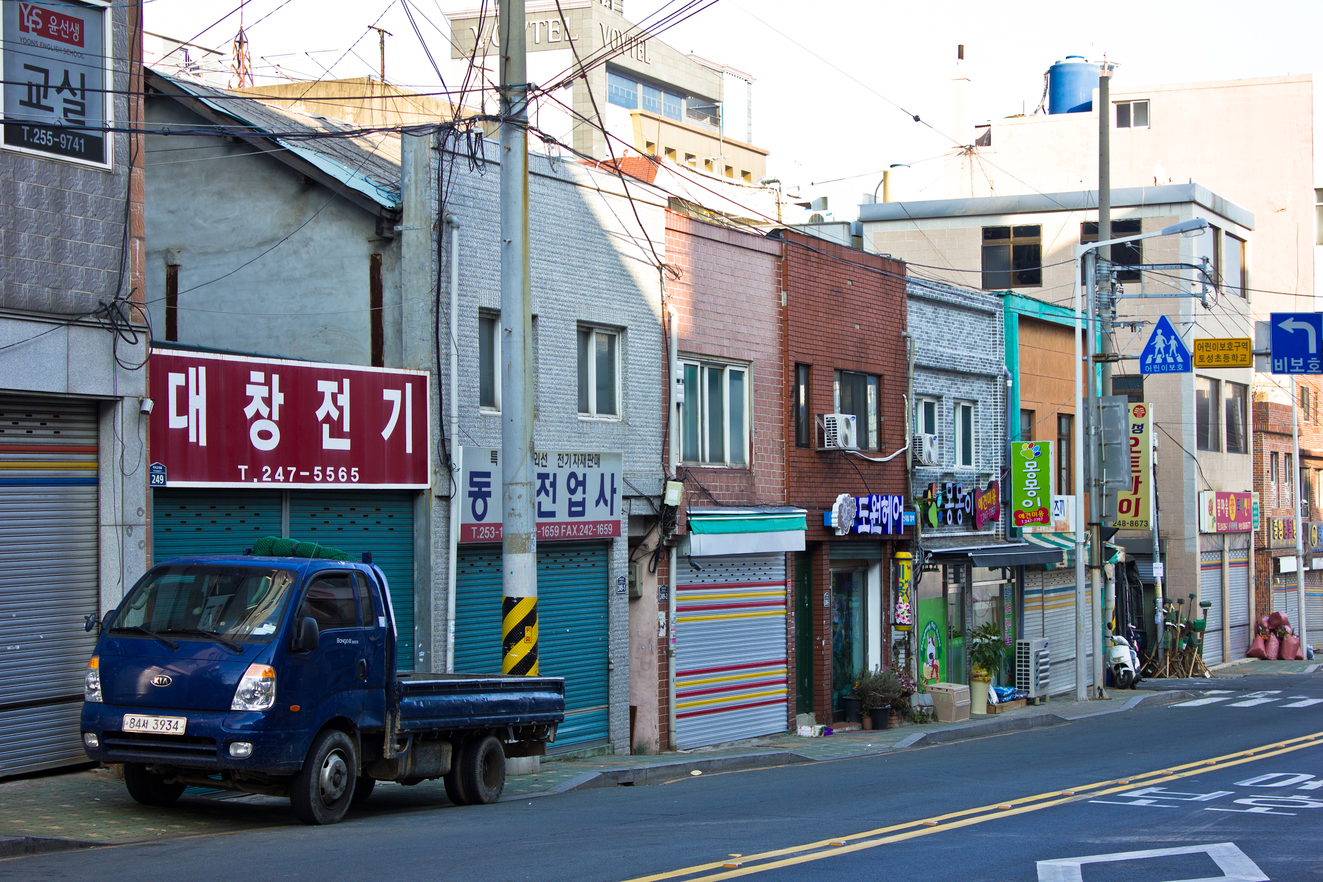
In this neighborhood, almost all of the building facades have been changed. This is true for most of the remaining buildings in Seo-gu, unfortunately. However, some of these structures, like the storefronts in the photos below, do actually date to the colonial or post-liberation period. If their general frames are not convincing enough, a quick glance down any of their tiny alleys reveals crumbling Japanese balconies.
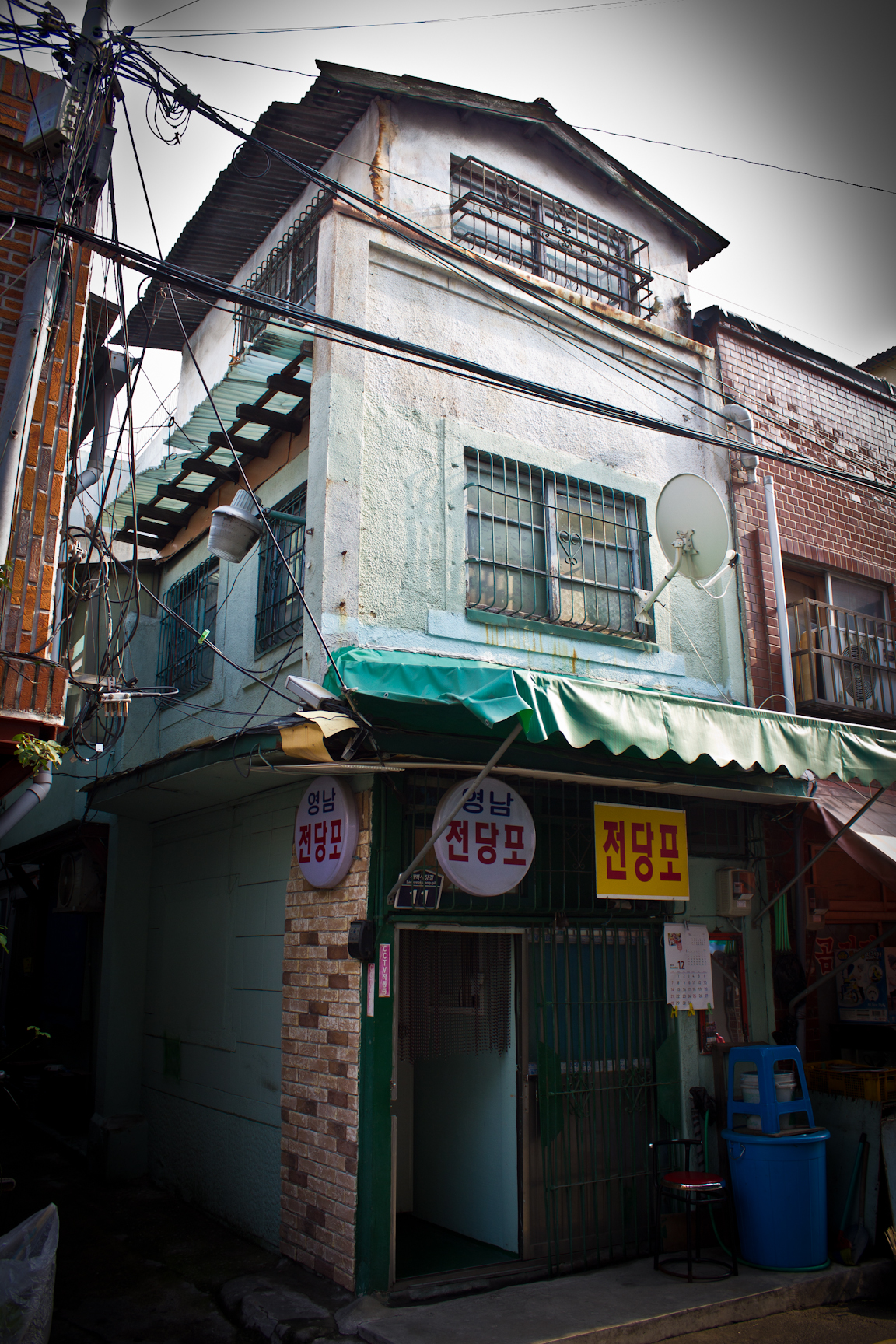

Down another street is a set of four tiny Japanese buildings that need to get cultural heritage status as soon as possible. In their current state, they are not much to look at, and aside from their frames, there doesn’t seem to be much to preserve either. However, these row structures are the only example of this style of colonial building that I have ever come across in Busan. For that reason alone, they should be protected.
Update – May 16, 2016: Thanks to info provided by a friend, apparently two of these four row buildings (pictured below) have been torn down. 😦
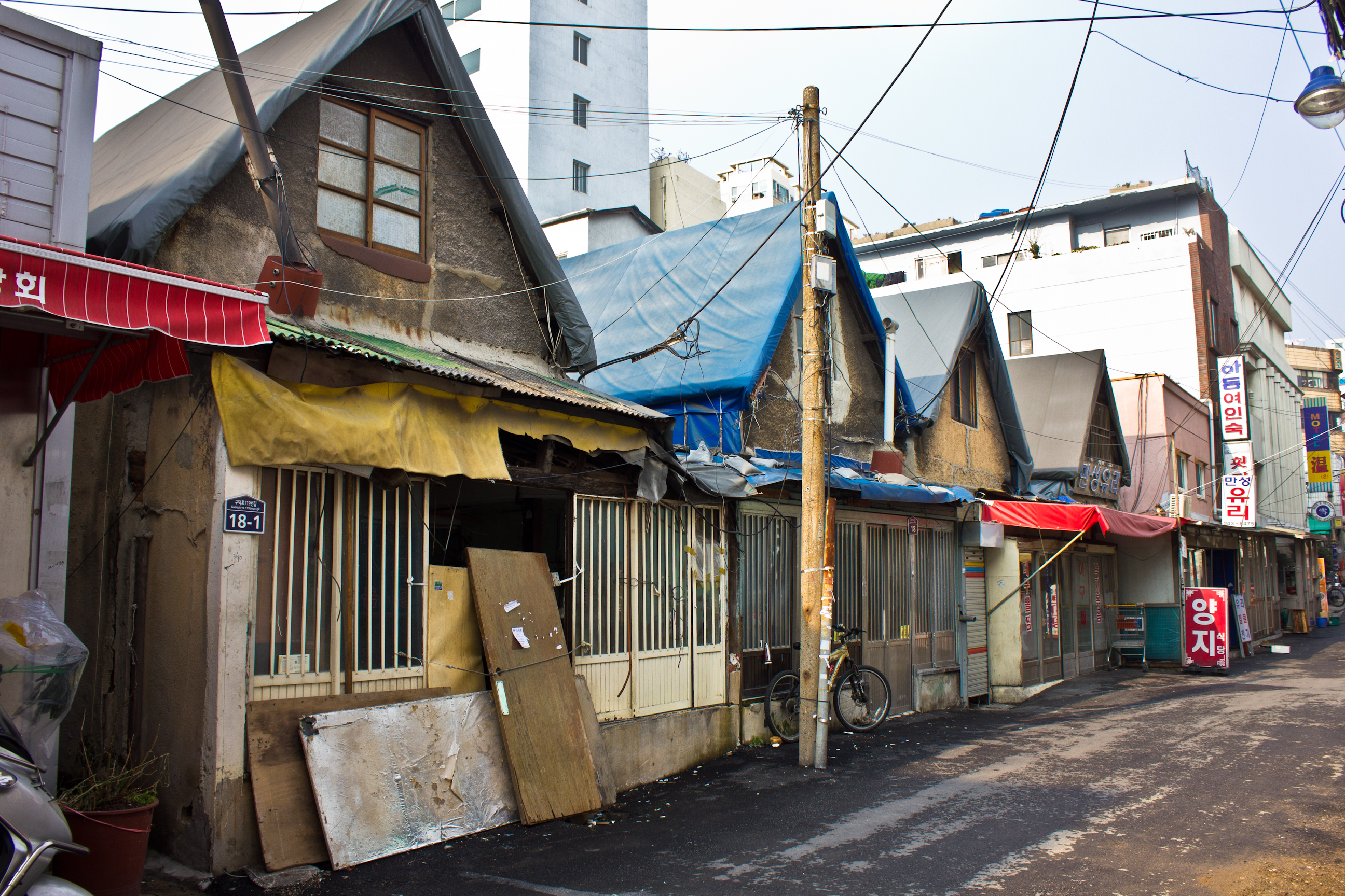
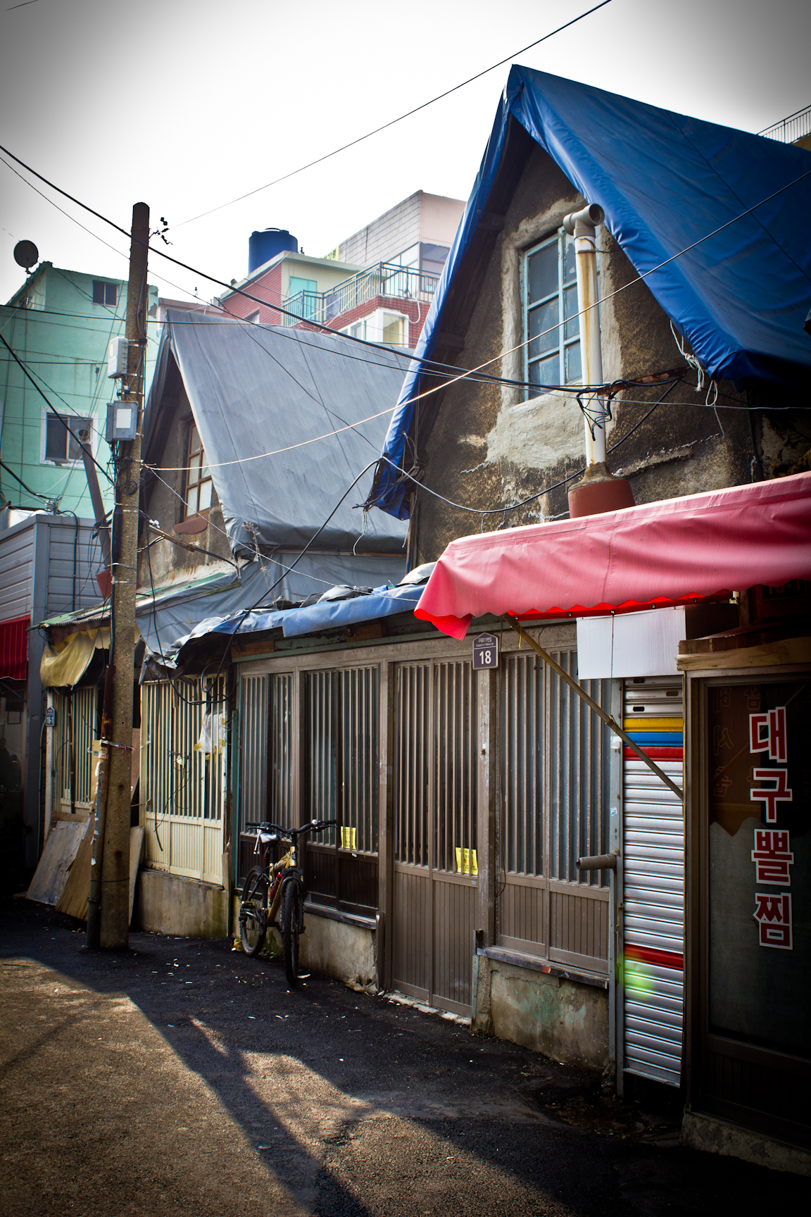
Chojang-dong and Ami-dong
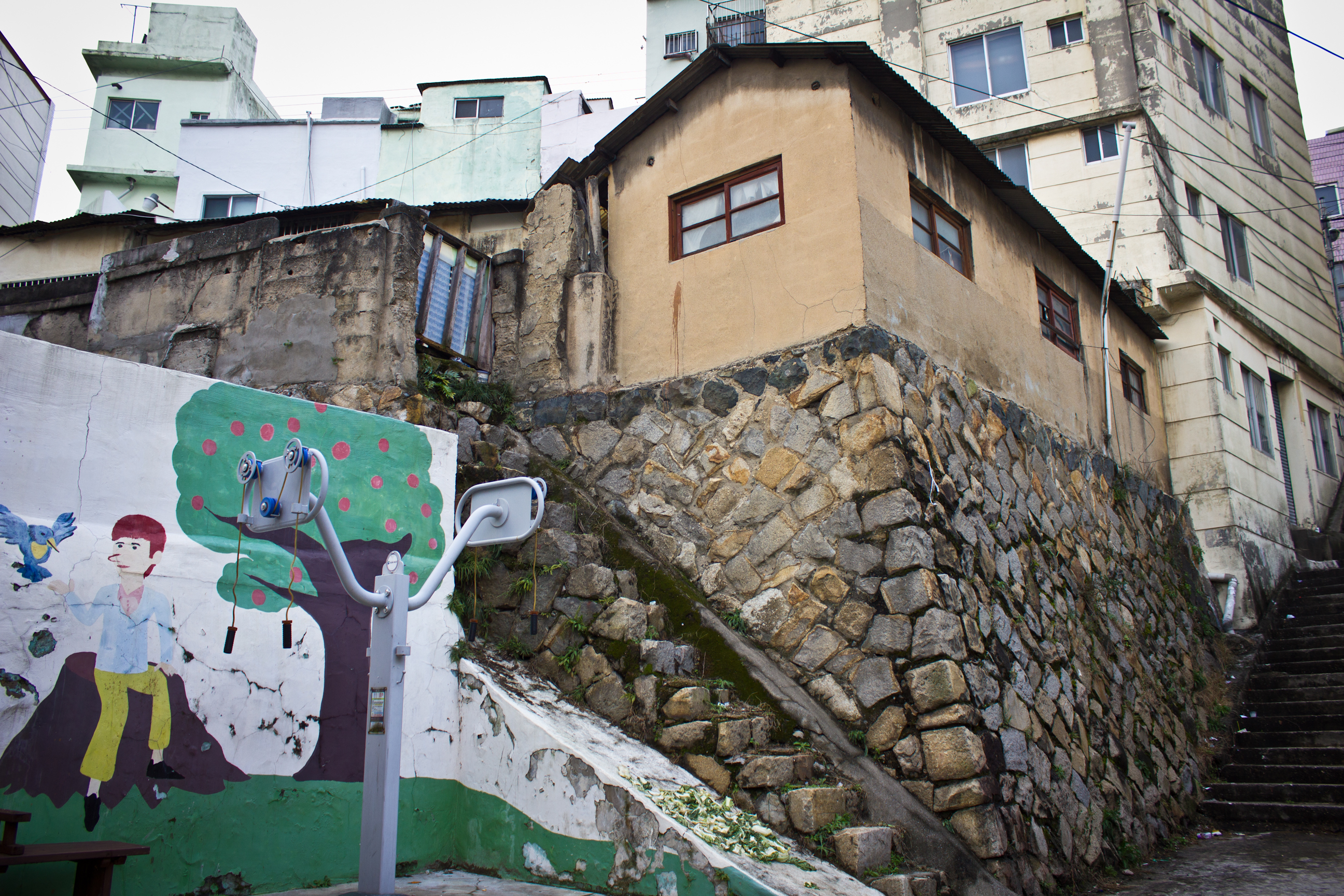
The two photos below perhaps show some of what is left of the old hill side homes in Seo-gu. The shacks and huts built by the displaced poor may no longer exist, but the buildings pictured here, which were probably built after the occupation, may offer a glimpse of what those hill villages looked like. They’re built atop some pretty old retaining walls. There are buildings like this around the hill side between Chojang-ro and Cheonma-ro 201beon-gil.
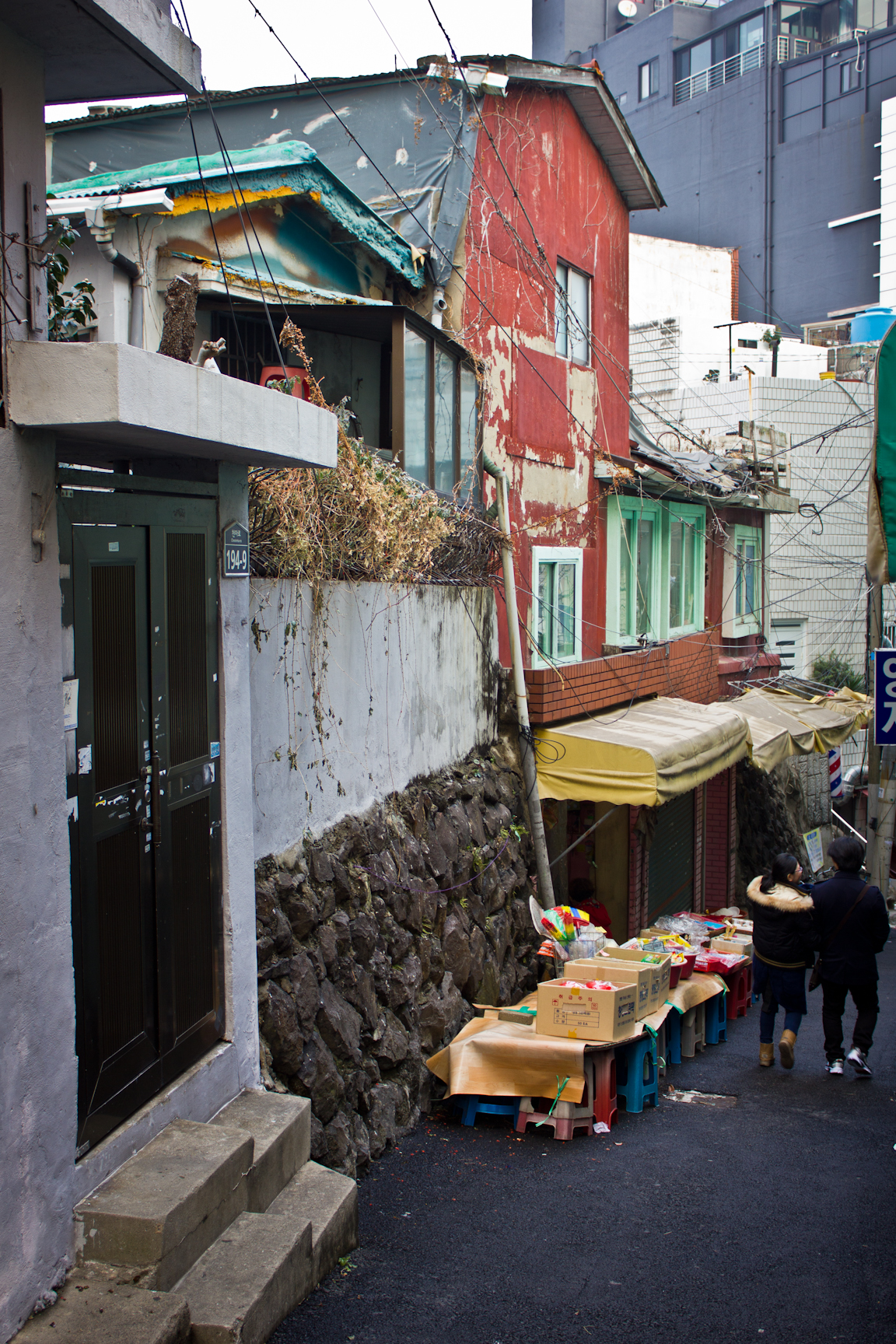
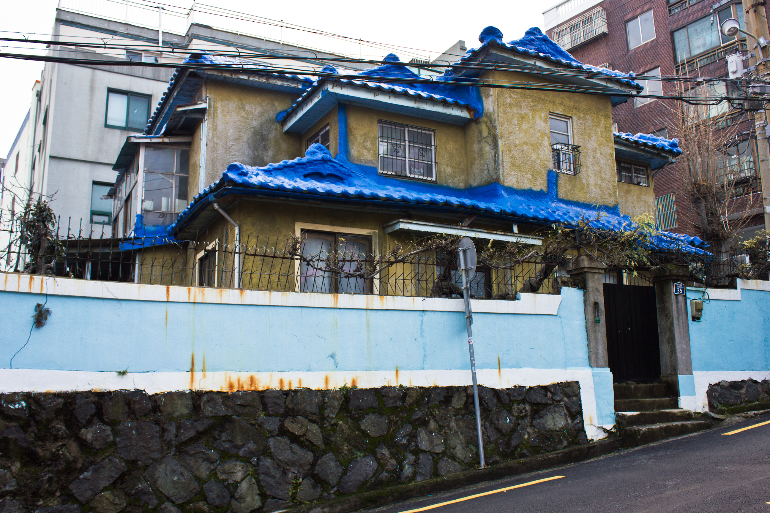
At an intersection along Amichojang-ro, there is a larger colonial Japanese house. Now covered in blue paint, it would feel more authentic if its original roof tiles were unpainted. Its neighbor, with a unique semi-circular section on the end, also appears to date to the early modern period. Across from both of these houses is a third Japanese house hidden behind some newer buildings. It features two circular windows and would have been quite nice in its heyday. All three of these are some of the better examples of Japanese architecture in Seo-gu.


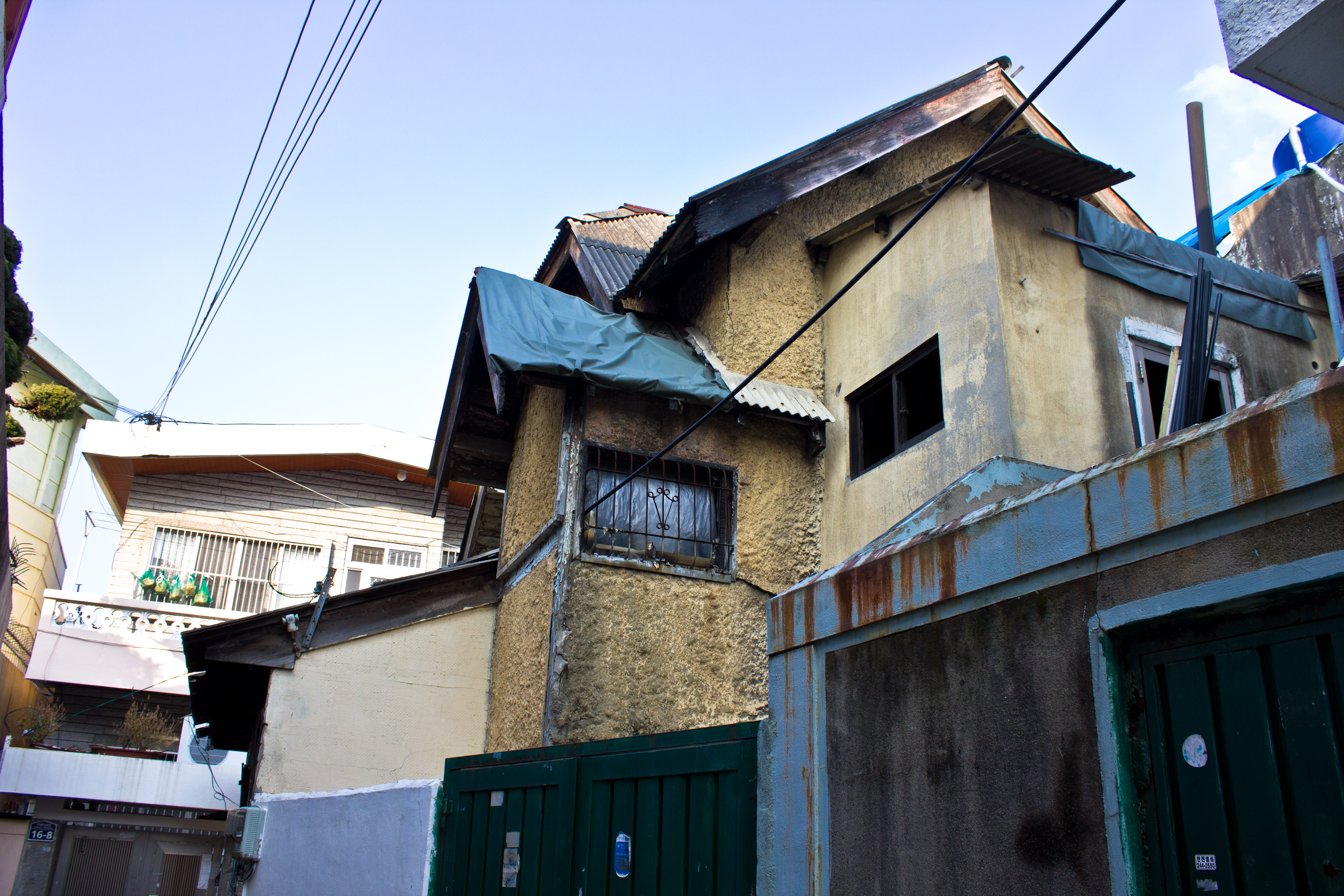
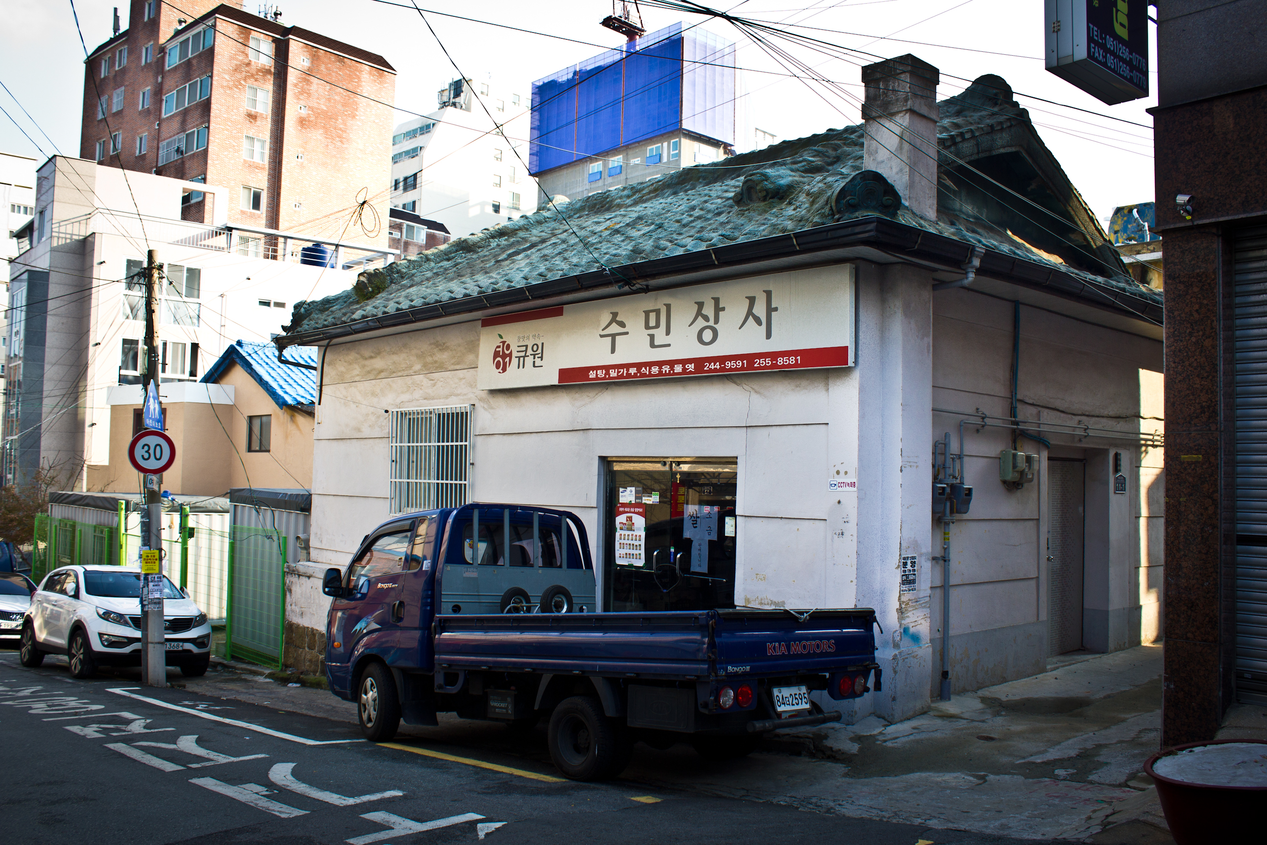
Edging over towards Ami-dong down in alley on Gudeok-ro 143beon-gil is another two-story Japanese house that is in pretty bad shape. A number of the windows on the second floor were gone when I photographed it in December of 2014 and its roof has been replaced at some point, perhaps in the 1960s when corrugated tin roofs were sometimes subsidized by the government. On the same street is another early modern building that may retain its original roof. A few streets over, on Gudeok-ro 157beon-gil, are three more buildings. The first one pictured below is a typical one-story Japanese structure. With parts of its window frames intact, the gabled entrance is the only part that’s in decent condition. Opposite of this structure is a two-story building with a neighbor of the same style but half its size. The larger one features a large circular, art deco window and its exterior has been refinished quite a bit. It now houses Chojang Tangje Won, a place for making traditional medicinal drinks and remedies.


Bumin-dong
Considering that Bumin-dong may have only ever had two major factories, this part of the West New Town would not have been considered an industrial neighborhood the way Bupyeong-dong was. In fact, the presence of the former Gyeongsangnam-do provincial governor’s mansion and government office indicates that the area would have been quite different from the busy factory sectors. Bumin-dong wasn’t quite in the country side, but photos from the colonial period show that the immediate grounds surrounding the two buildings were pretty large.
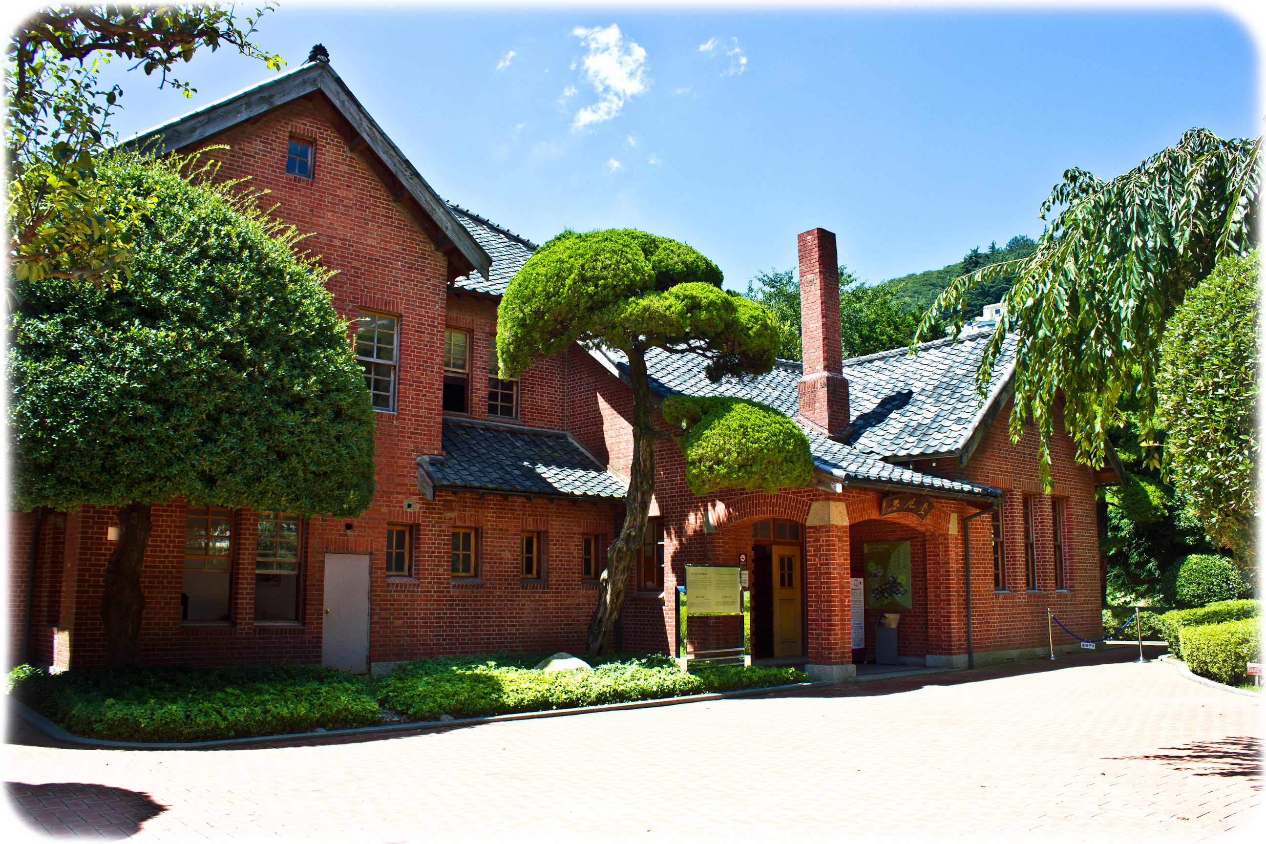
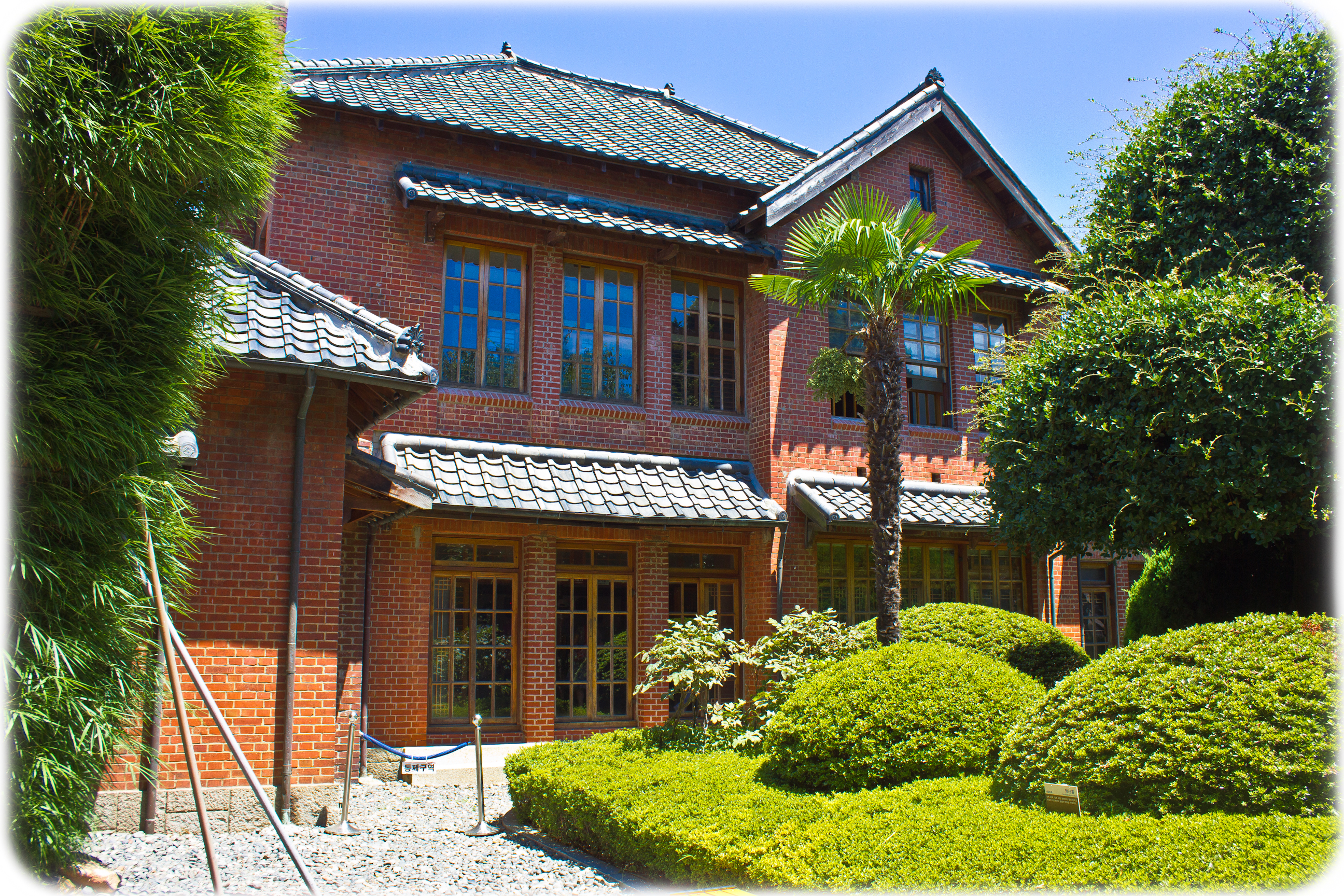
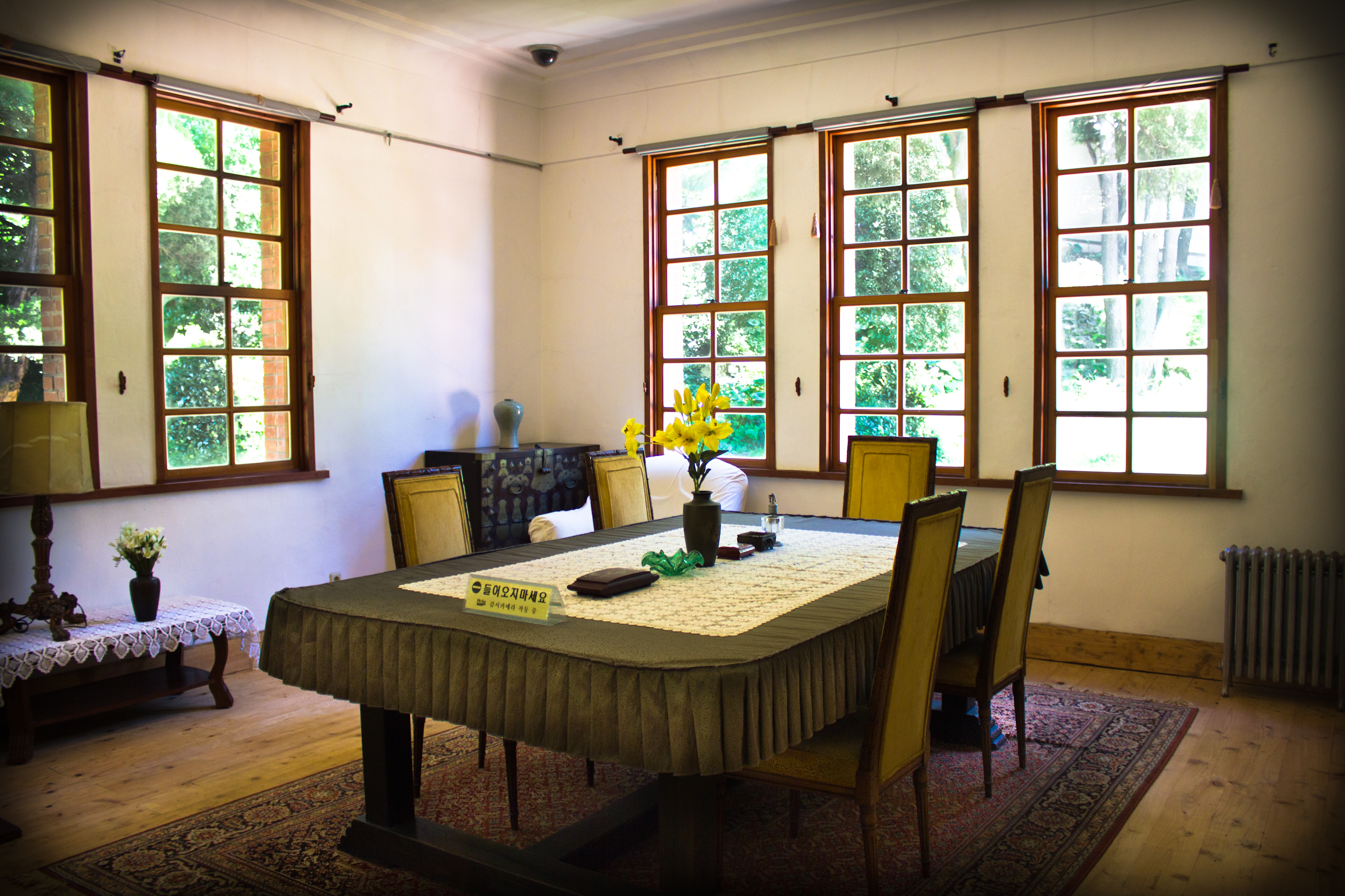
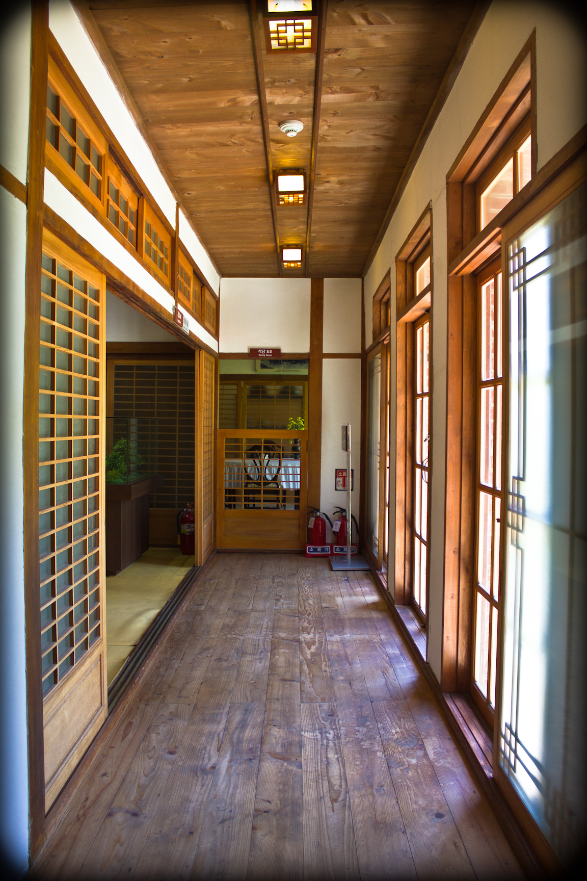
The former Gyeongsangnam-do provincial governor’s residence was completed about a year after the Provincial Office on August 10th, 1926. The former governor’s mansion is a two story building with a Western brick exterior and a wooden Japanese interior. The builders used giwa tiles to cover its gabled roof, including the section that swoops down over the front entrance. With ten rooms on the first floor alone, this modern house is a good example of the extravagance with which many government leaders lived. It was used as the residence of the Gyeongsangnam-do governor until 1983, but President Rhee occupied it between 1950 and 1953 when the North Korean Army pushed southern forces back to the Nakdong River. The city of Busan bought the house in 1984 after the provincial capital moved to Changwon. It now serves as the Provisional Capital Memorial Hall.
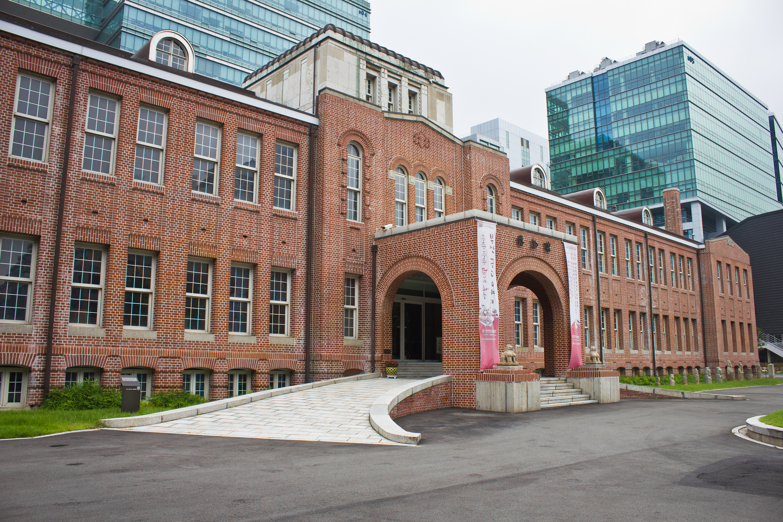
A few blocks from the mansion is the former Gyeongsangnam-do Provincial Office, which now houses the Dong-A University Museum. Construction on this massive building began in 1923 and was finished in 1925. It served the colonial Japanese government until liberation and in 1950 it was used by the provisional Korean government when Busan became the temporary capital during the war. After the Korean War, it went back to being used as a provincial government office. Throughout the 1980s and 1990s, the building was occupied by the Busan District Courthouse and the office of the Public Prosecutor. This change occurred when the Gyeongsangnam-do capital shifted to Changwon in 1983. Dong-A University bought the structure in 2002 and opened it as a museum seven years later.
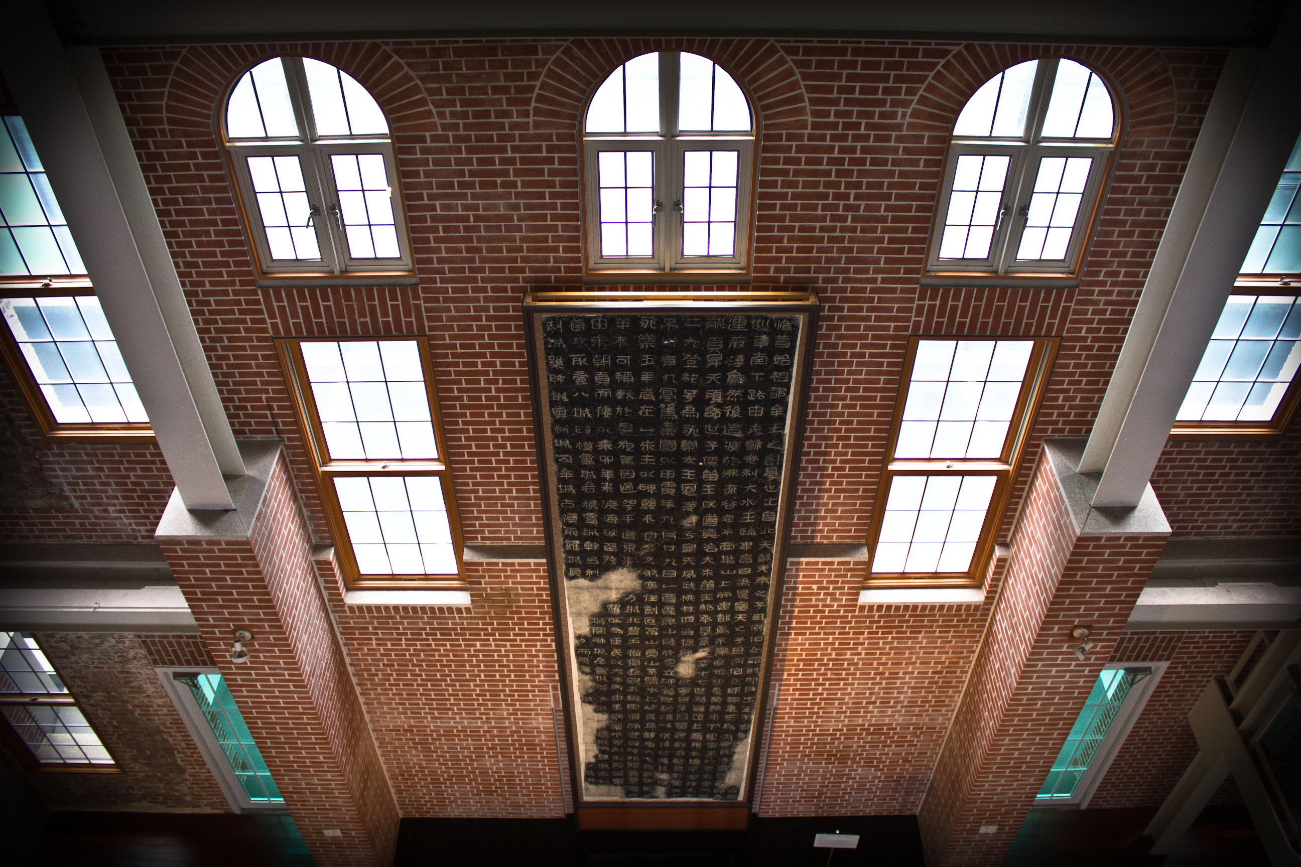
For decades it existed in a “ㅁ” shape. However, the back section was demolished and it is now shaped like a horseshoe “ㄷ”. The building’s massive roof was built with a modified girder truss for the facade and king post trusses for each wing. Both truss systems were employed at the junctions of the facade and wings. It is said that the pre-cast concrete beams were uneven, causing the building to be really unstable. It’s possible this is one of the reasons the building underwent renovation when it was purchased by Dong-A University. Regarding materials, the facade employed hemlock spruces and larch wood. The wings and rear section used pine spruces, pine trees, and Korean spruces. The timber that makes up the attic and roof system can still be seen on the upper floor of the museum where a small exhibit explains the construction of the building. The exterior seems to be typical of colonial Japanese brick buildings in that the brick was laid using alternating bonds with the occasional decorative joint. In some places, lime mortar was used. In others, cement. The exhibit also displays two types of tile that were used. One (unlabeled) tile is really corroded but it might be ceramic. The other tile is copper plated. With a giant turret in the center of the structure, the old Gyeongsangnam-do Provincial Office and its exhibits are worth a visit.
Toseong-dong
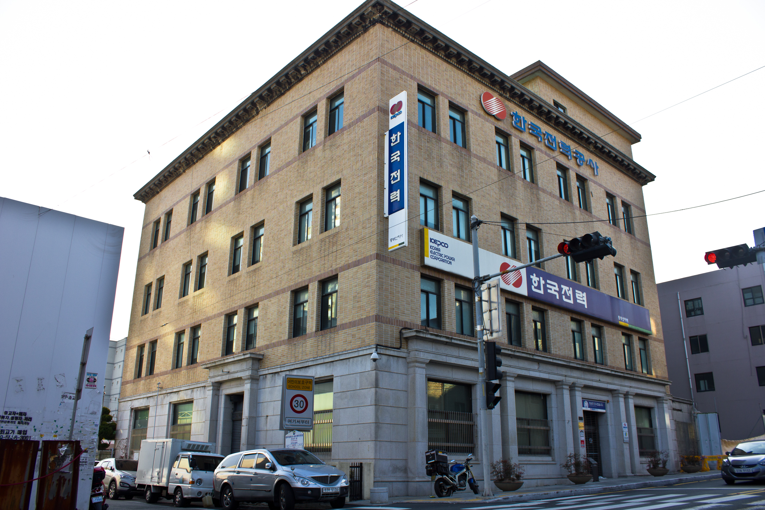
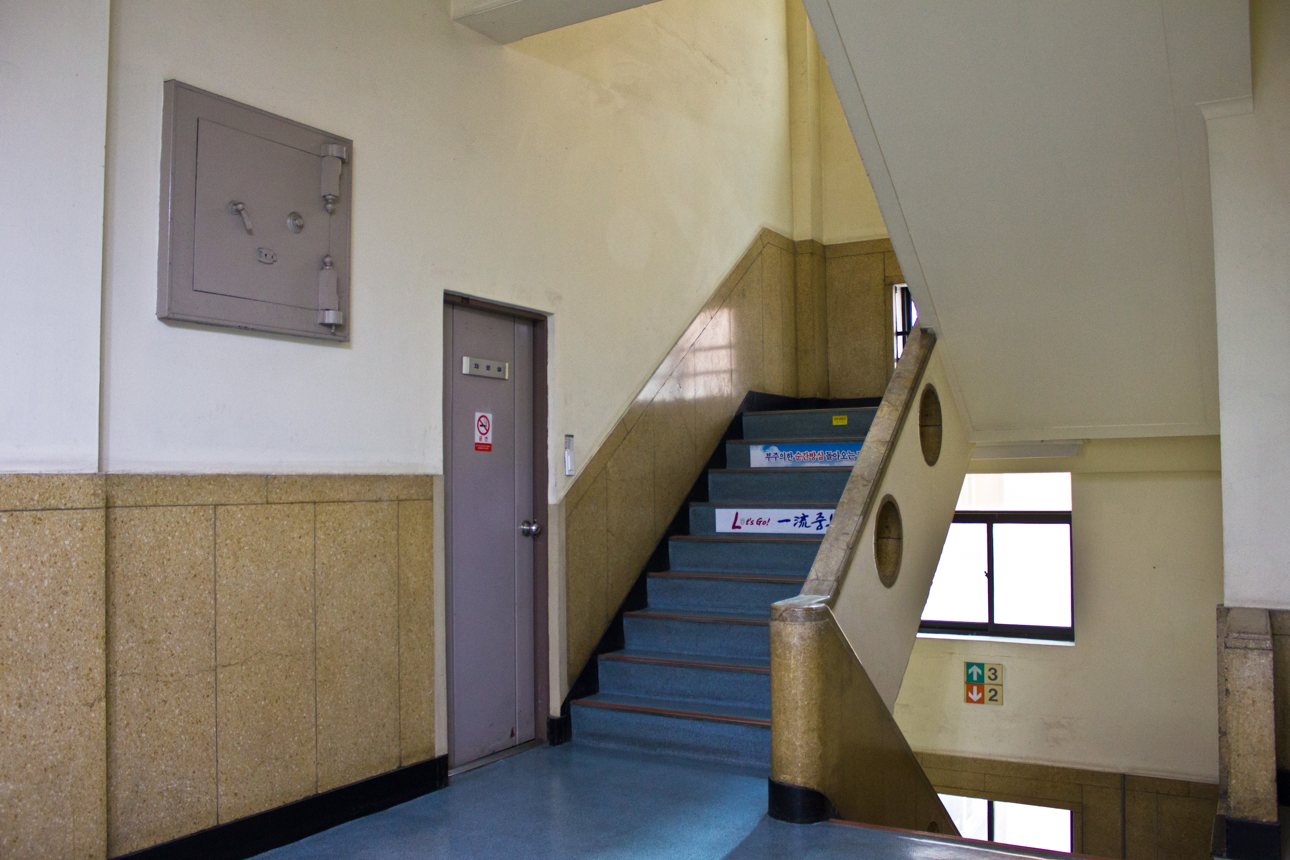
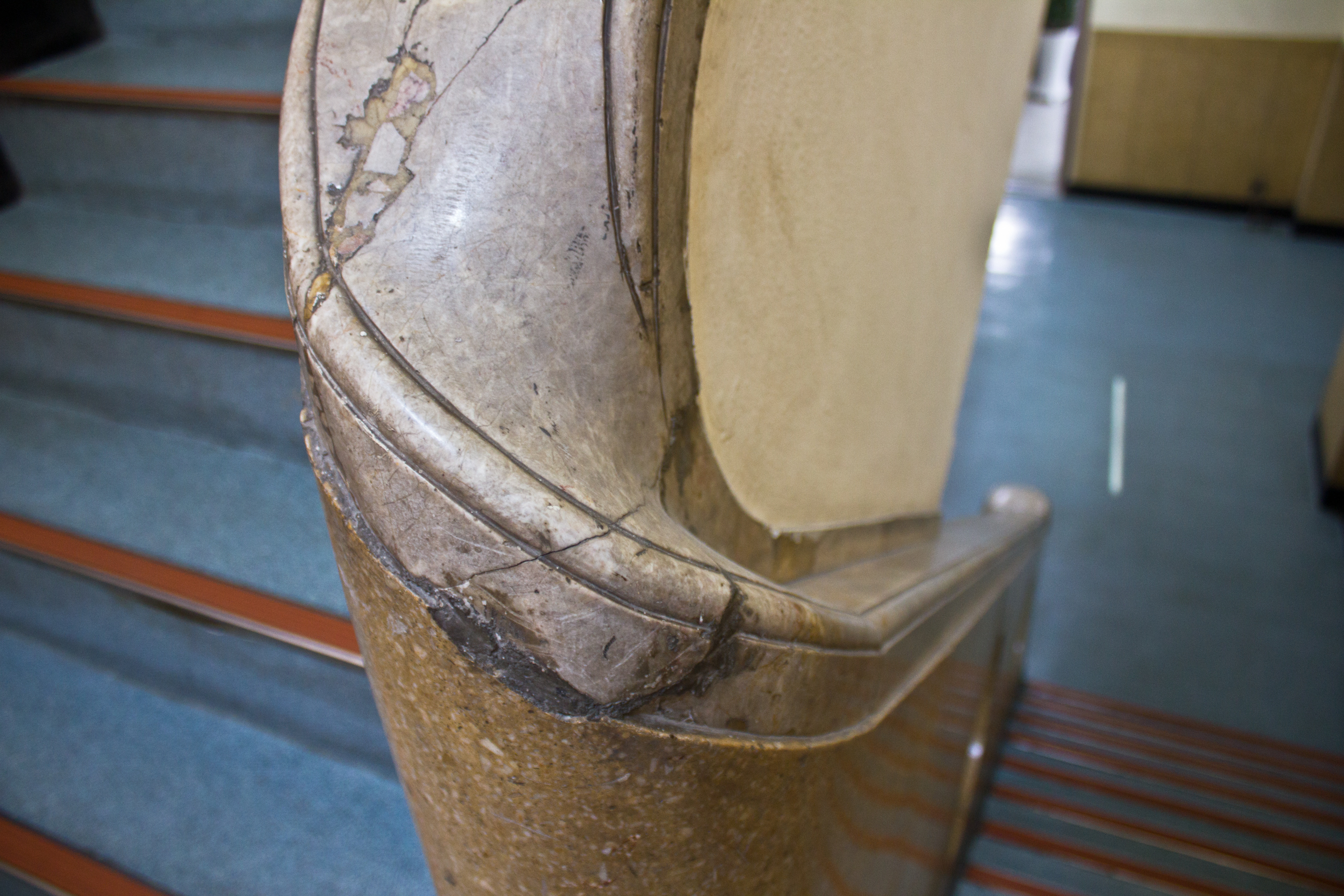
The former Office of Namseon Electric was constructed in 1932. It is unclear whether the Korea Electric Power Corporation bought out all of Namseon Electric or merely purchased the building, but as of the 1970s the former Namseon Electric office has served as the Busan branch of KEPCO. Of Korean build, the first floor exterior was finished in granite while the entrance was lined with rectangular columns. The rest of the exterior was covered in tiles with a decorative cornice under the eaves. As the first building in Busan to get an elevator, it actually still retains its original plates indicating which floor the elevator is on. Perhaps even more interesting is its beautiful staircase whose railing was finished in carved granite. The design is said to resemble a ship’s port holes. On the third floor is an old safe, on which is printed “Asahi Safe – Tokyo Japan.” This safe manufacturer seems to have been used in colonial banks all across the peninsula. A special thanks should be said to the team leader and his co-workers who took a few minutes out of their work day to show me around the building and give me access to the roof.


Right across from the former Namseon Electric building is what looks like a strip of buildings. However, a closer look shows that it is simply a row of facades built in front of one older building that has since been subdivided into individual businesses. Right around the corner, we can see two more buildings – one of which obviously dates to the colonial period as it retains its second floor Japanese style balcony.

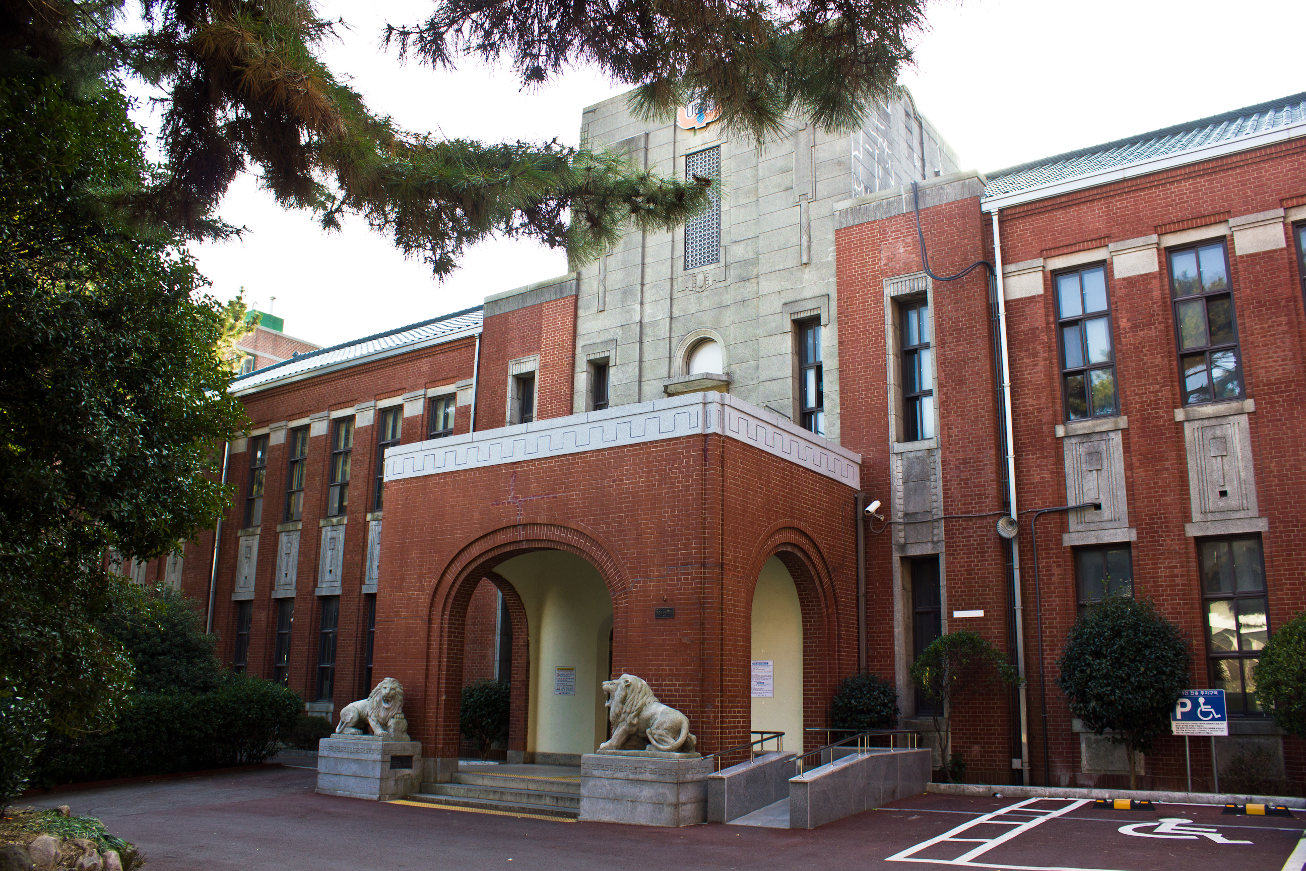
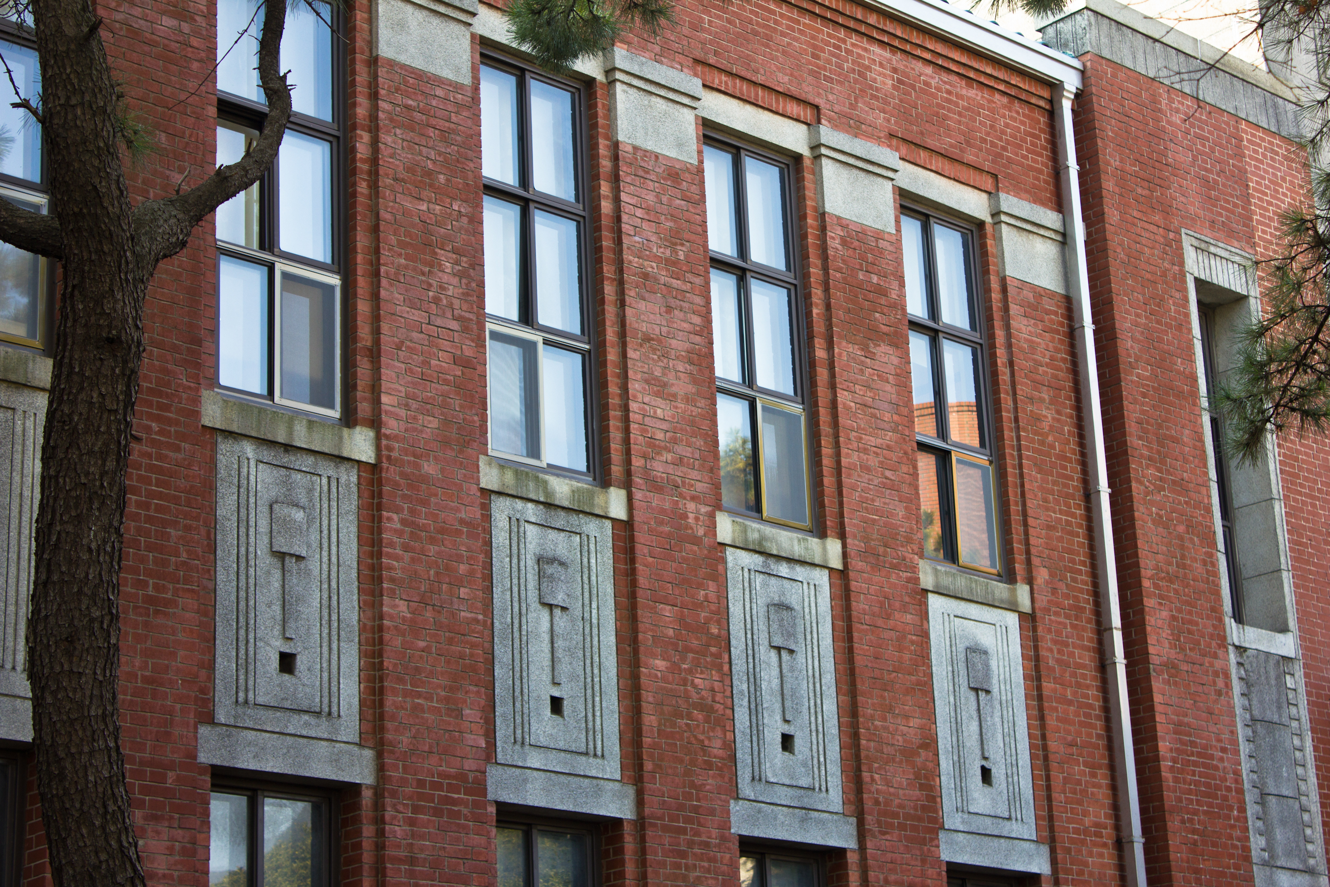
Seodaesin 3-dong
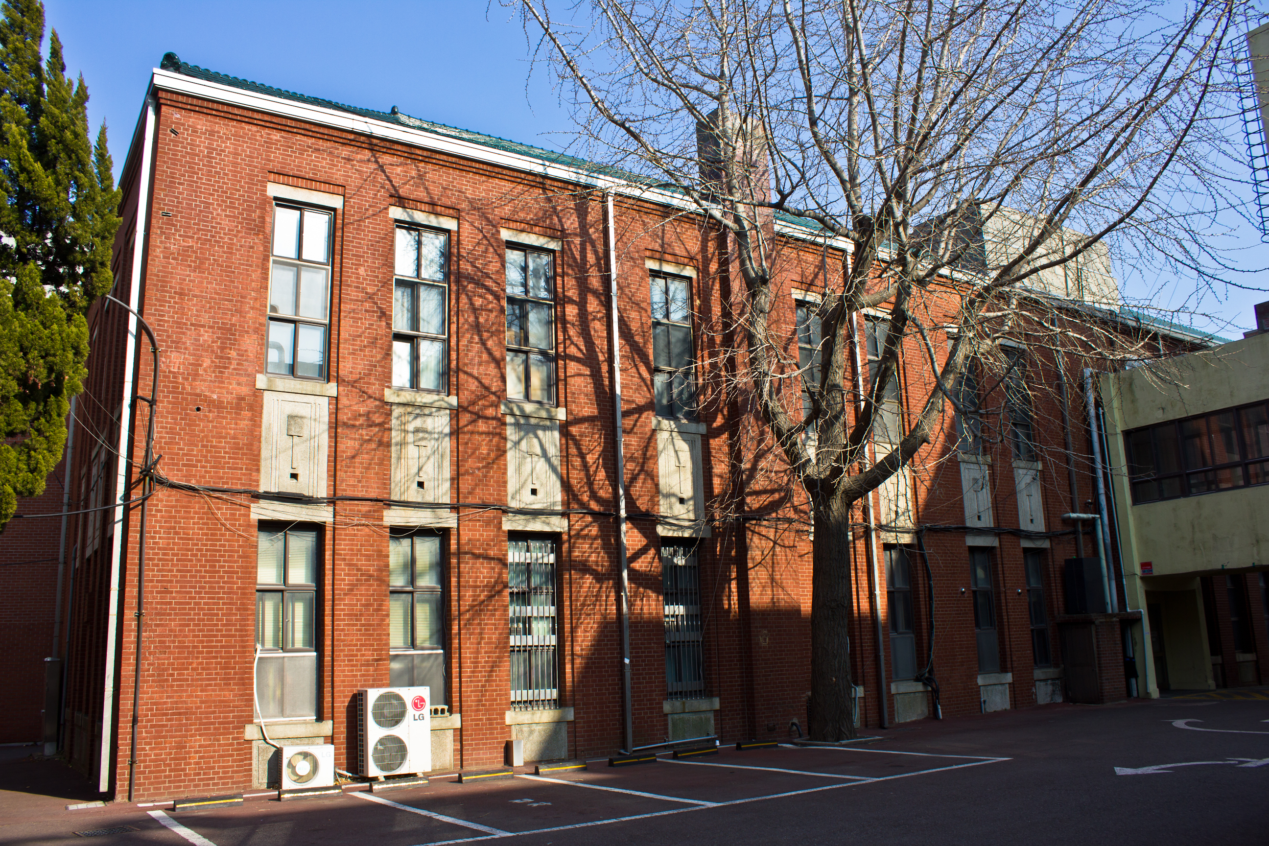
On the Pukyong National High School campus lies the old Gyeongnam Commercial High School main building. Built in 1927, it served as the Busan Jeil Public Commercial School for Japanese residents. Though typical of colonial Japanese school design in that its classrooms extend from a central point with a turret, this one has some interesting decorative details. For example, the section between the first and second floor windows is finished with a decorative concrete design that resembles a hammer or paddle. This design carries over onto the facade of the turret, where the design is a little more elongated. On the roof of the porch is a door with an arched window above it. Just above this is a geometric metal grid in the middle of the turret. At the pinnacle of each side of the turret is a small semi-circle decoration. Inside the semi-circle on the front facade we can see the outline of an emblem that has since been erased or carved out. It is not uncommon to see old writings and logos removed from Japanese buildings. All of these designs give the structure a kind of regal and borderline art deco aesthetic.

Dongdaesindong 3-ga
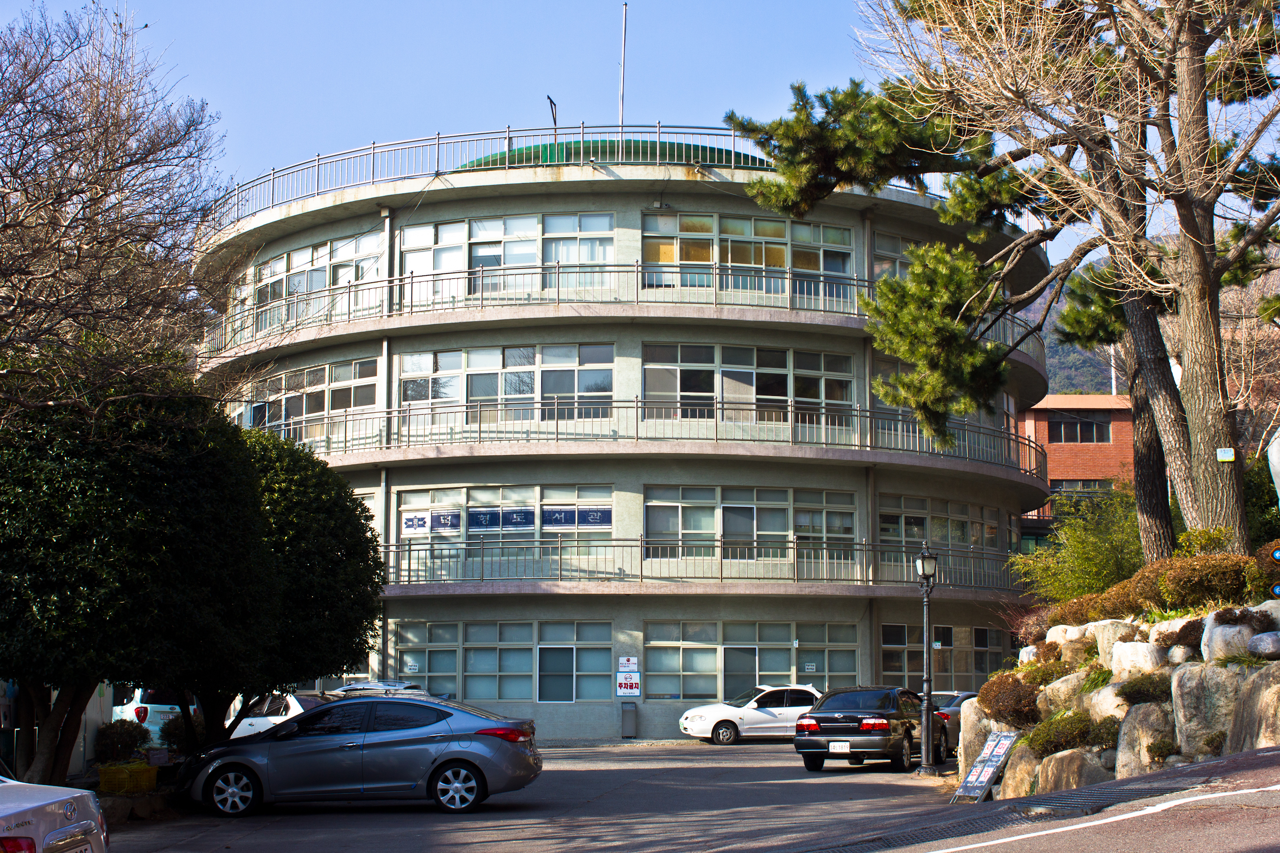
On the campus of this old high school lies a post-liberation circular building. Built in 1950 by architect Lee Cheon Seung, it is a unique example of what would have appeared very modern at the time.14 In fact, much like the old Shinhan Bank in Daejeon, the structure blends in well with its newer surroundings. It has served as Gyeongnam High School since its construction and, though similar in name to the previously mentioned former Gyeongnam Commercial High School, it is unclear whether or not the two are related. However, it is possible that the school simply moved from one campus to another.
To see the entire Flickr gallery, click here.
Footnotes
1Oh Mi-il, “The Spatial Arrangement and Residential Space of a Colonial City: The Spatio-temporality of Hill Villages in Busan, ” Korea Journal 53, no. 1 (2013): 180.
2Oh Mi-il, “The Spatial Arrangement and Residential Space of a Colonial City: The Spatio-temporality of Hill Villages in Busan, ” Korea Journal 53, no. 1 (2013): 184.
3Oh Mi-il, “The Spatial Arrangement and Residential Space of a Colonial City: The Spatio-temporality of Hill Villages in Busan, ” Korea Journal 53, no. 1 (2013): 185.
4Oh Mi-il, “The Spatial Arrangement and Residential Space of a Colonial City: The Spatio-temporality of Hill Villages in Busan, ” Korea Journal 53, no. 1 (2013): 186.
5Oh Mi-il, “The Spatial Arrangement and Residential Space of a Colonial City: The Spatio-temporality of Hill Villages in Busan, ” Korea Journal 53, no. 1 (2013): 180.
6Oh Mi-il, “The Spatial Arrangement and Residential Space of a Colonial City: The Spatio-temporality of Hill Villages in Busan, ” Korea Journal 53, no. 1 (2013): 184.
7Oh Mi-il, “The Spatial Arrangement and Residential Space of a Colonial City: The Spatio-temporality of Hill Villages in Busan, ” Korea Journal 53, no. 1 (2013): 187.
8Oh Mi-il, “The Spatial Arrangement and Residential Space of a Colonial City: The Spatio-temporality of Hill Villages in Busan, ” Korea Journal 53, no. 1 (2013): 187.
9Oh Mi-il, “The Spatial Arrangement and Residential Space of a Colonial City: The Spatio-temporality of Hill Villages in Busan, ” Korea Journal 53, no. 1 (2013): 190.
10Oh Mi-il, “The Spatial Arrangement and Residential Space of a Colonial City: The Spatio-temporality of Hill Villages in Busan, ” Korea Journal 53, no. 1 (2013): 193.
11Oh Mi-il, “The Spatial Arrangement and Residential Space of a Colonial City: The Spatio-temporality of Hill Villages in Busan, ” Korea Journal 53, no. 1 (2013): 194.
12Oh Mi-il, “The Spatial Arrangement and Residential Space of a Colonial City: The Spatio-temporality of Hill Villages in Busan, ” Korea Journal 53, no. 1 (2013): 194.
13Oh Mi-il, “The Spatial Arrangement and Residential Space of a Colonial City: The Spatio-temporality of Hill Villages in Busan, ” Korea Journal 53, no. 1 (2013): 195.
14“부산 경남고 덕형관 등 3건 문화재 등록 예고”, 소비라이프, 2013.
Building Locations
Row of Japanese houses
Typical multi-level Japanese house in Chojang-dong next to house with semi-circular exterior
Typical two-story Japanese house in Chojang-dong
Chojang Tangje Won building with art deco window
Former Provincial Governor’s Mansion
Former Gyeongsangnam-do Government Office/Dong-A Museum
Former Office of Namseon Electric
Former Gyeongnam Commercial High School/Busan Jeil High School
Gyeongnam High School (1950 circular modern building)

Pingback: Busan (3) | Colonial Korea
What a fascinating compilation of photographs and what an insightful narrative! Thank you!
Mi-rae Song
Brookline, Massachusetts
USA
LikeLike