Nam-gu
The majority of the hill houses in Uam-dong and Munhyeon-dong appear to be from the 1960s, with perhaps a handful from the 1950s. As such, it is not a particularly noteworthy area with regard to old architecture. However, there are a handful of structures left spread throughout the two neighborhoods.
A U.S. military map from the 1950s1 shows that there used to be a cattle quarantine station in Uam-dong. It also shows that the port facilities were built on reclaimed land and had coal and oil storage. Considering that the two quays along the port in Uam-dong sit on reclaimed land, it is reasonable to conclude that they may have been built by the Japanese. A military barracks sat a little northeast of the quay. Perhaps most interesting is the Leper Hospital that was about half a kilometer northeast of present day Uam Station. The hospital is unnamed on the map, but it may have had something to do with one Dr. C. H. Erwin, who came to Korea with the backing of the British Leprosy Mission and established the first leper asylum in Busan in 1910.2 Given that there weren’t many leper clinics in Korea in the first place, it is not unreasonable to suggest, though it is purely speculative, that the leper hospital on this map was related to his work. Regardless, the cattle quarantine station and the leper hospital show that the area wasn’t very desirable.
Walking along Jigegol-ro, near Jigegol Station, are a pair of older structures, one of which (on the right) looks like a colonial warehouse.

Heading south, towards Uam-dong, takes you over a small hill on Janggogae-ro. Janggogae was at one time a bustling pedestrian crossing for those going to and coming from Busanjang market in present day Busanjin.3 A quick detour reveals another building that looks to be from the 1940s or 1950s. Near the intersection with Uam-ro is an alley with a couple of hanok styled structures.


Uam-dong
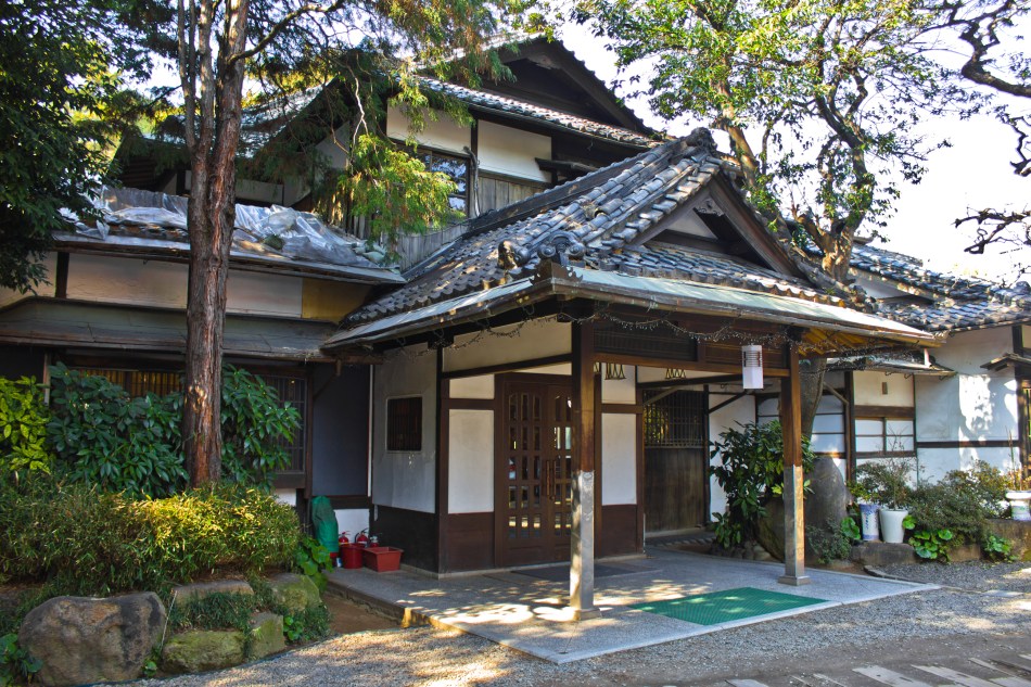
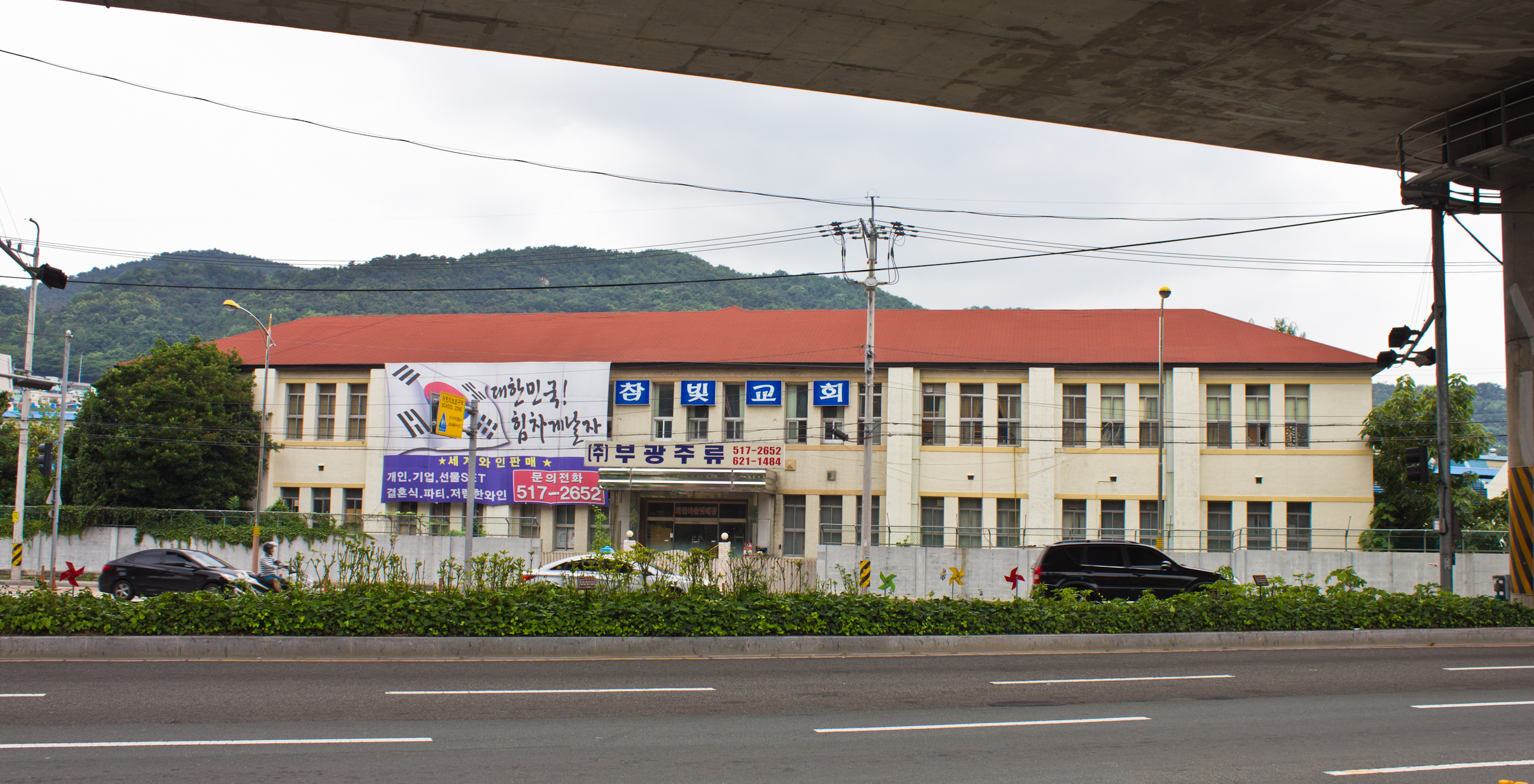
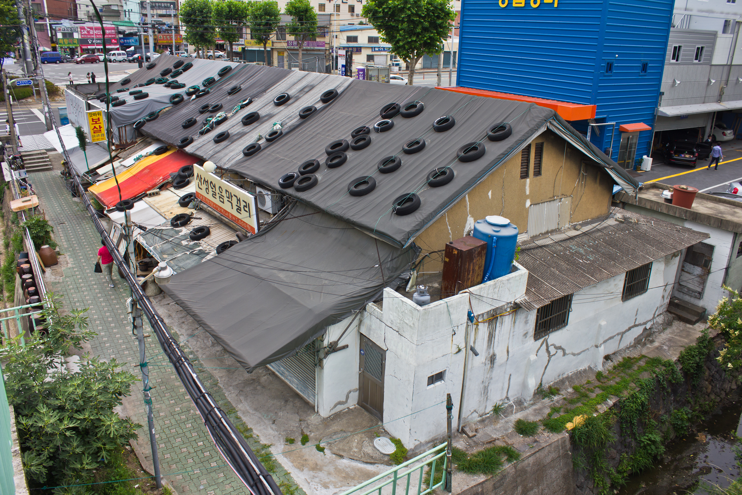
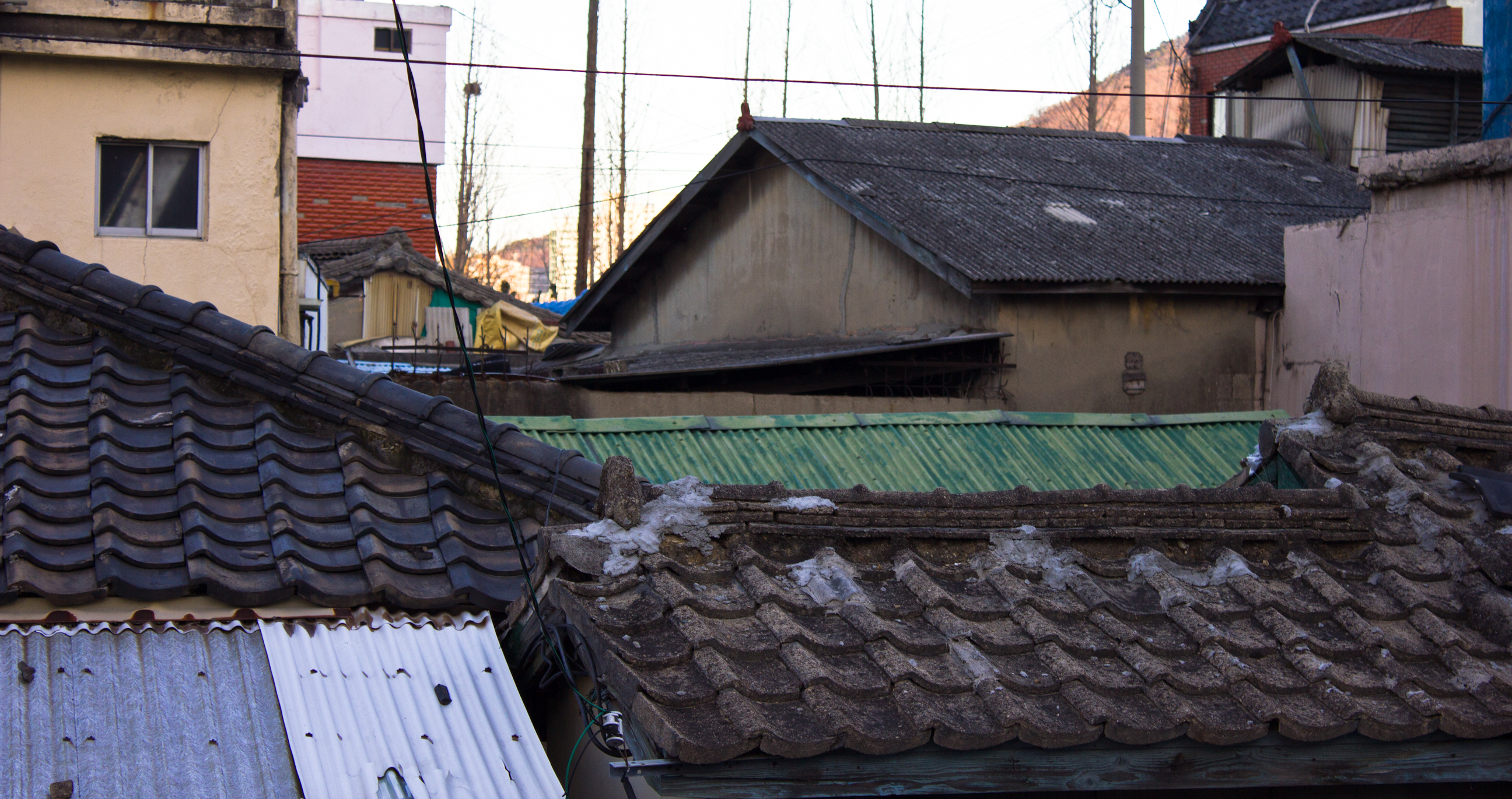
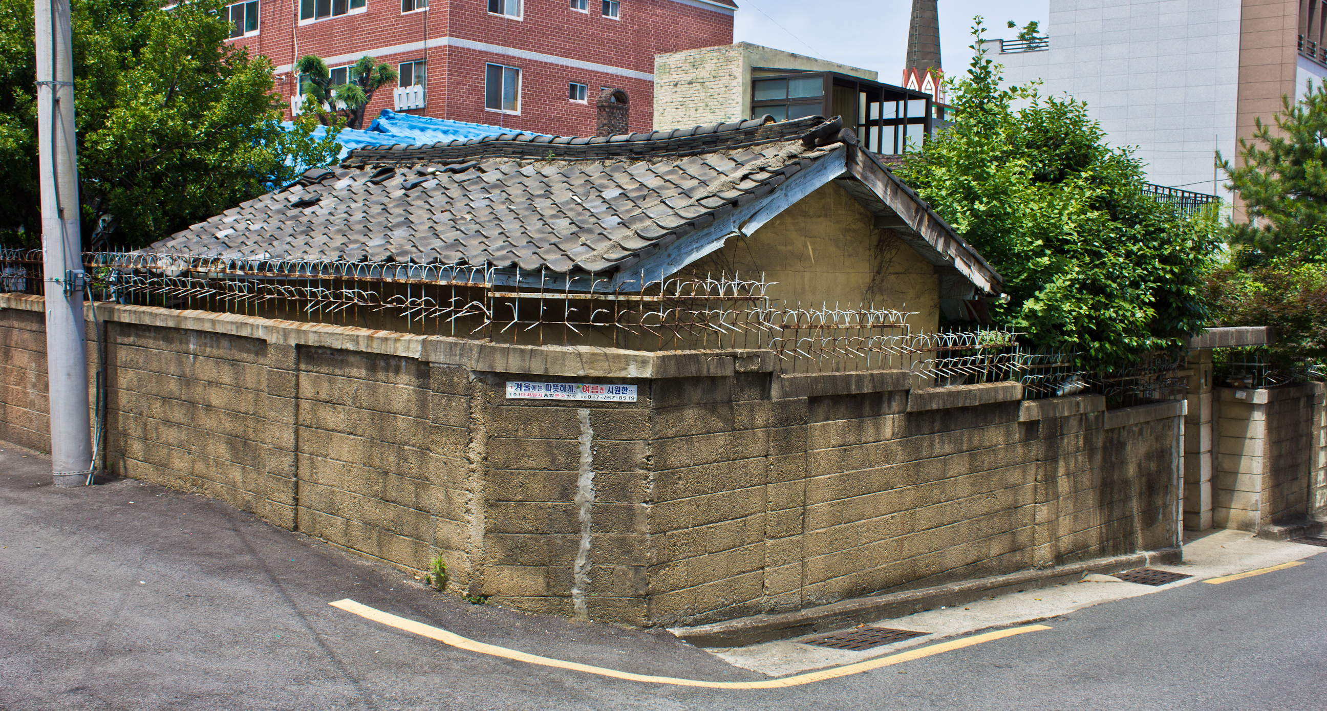
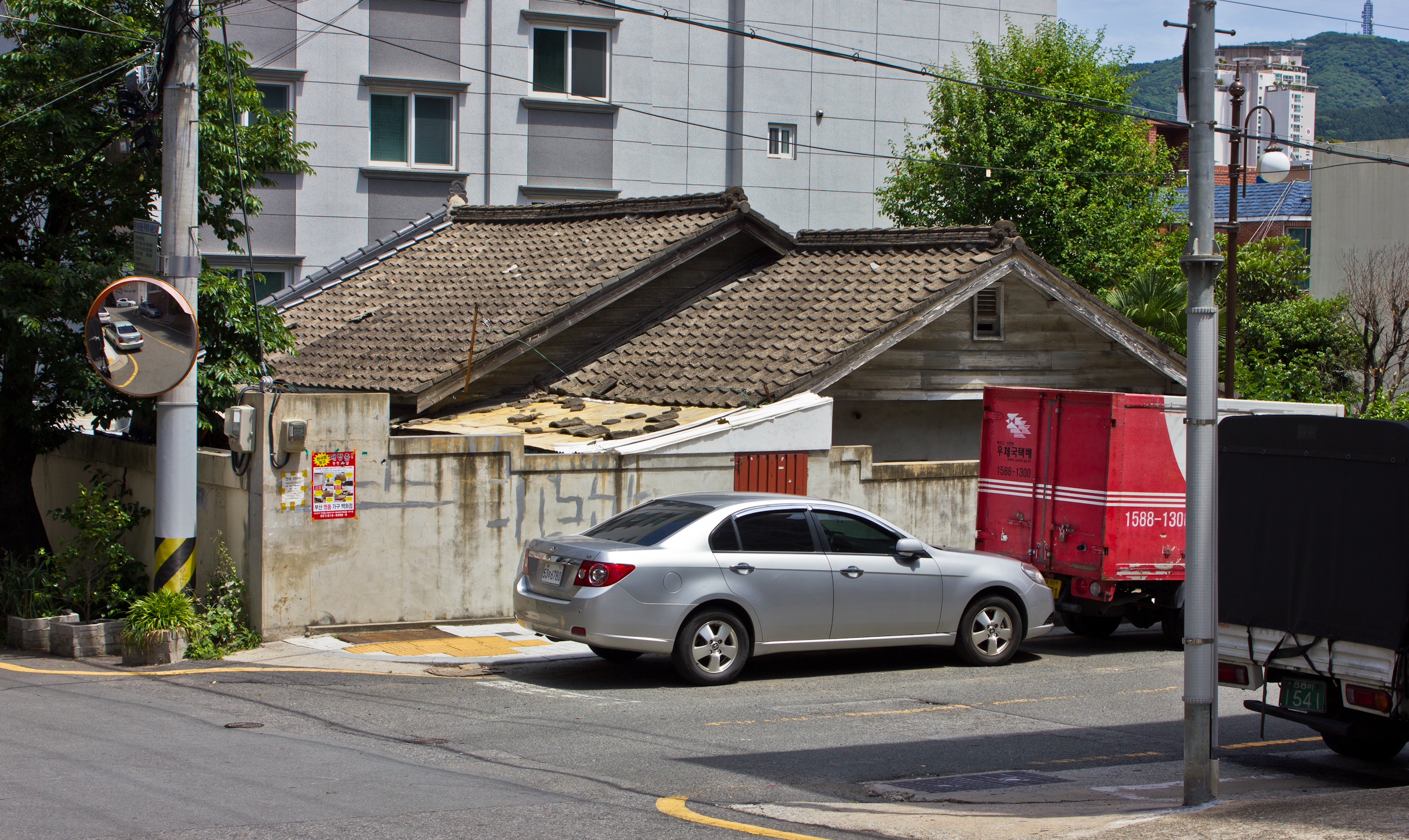
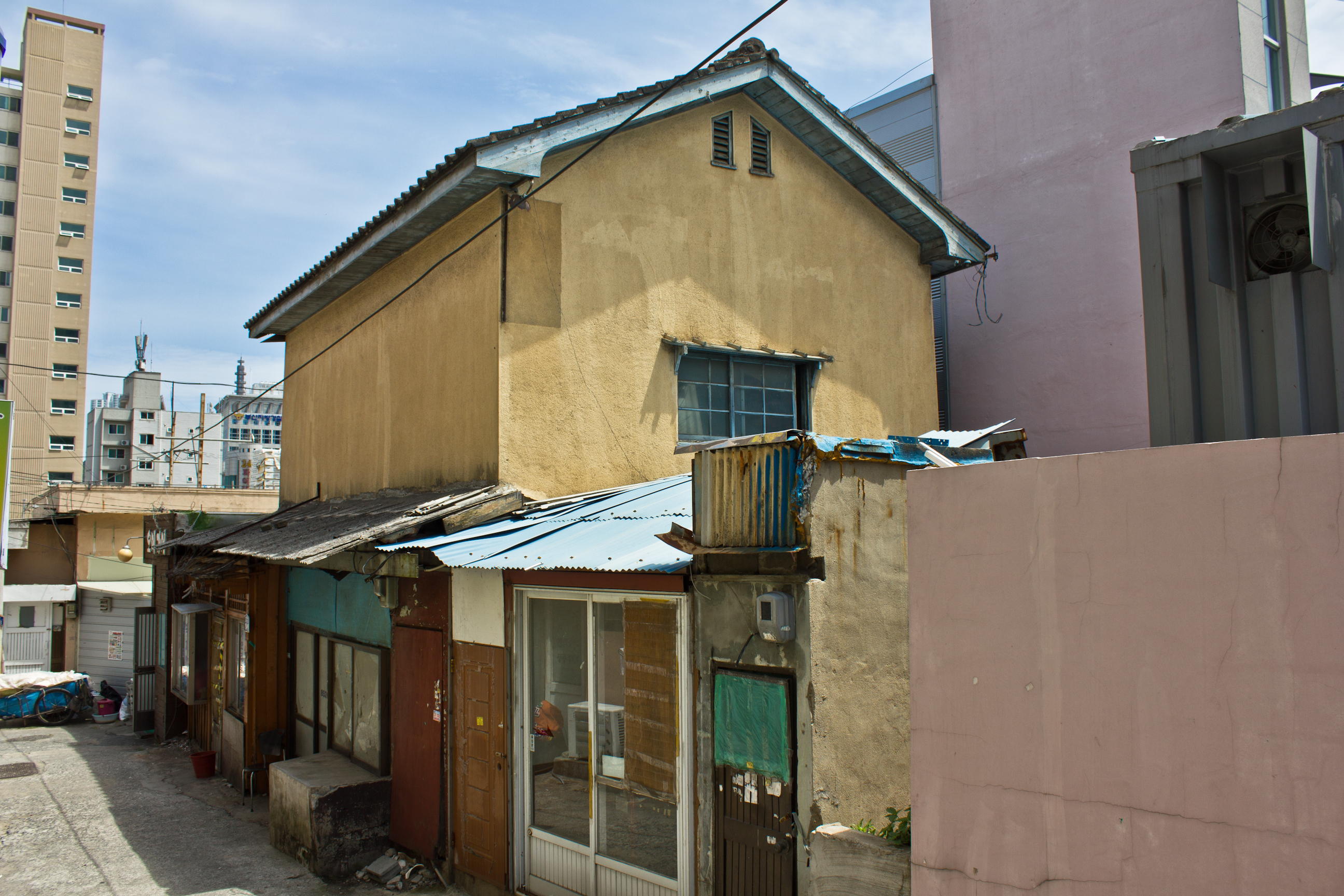
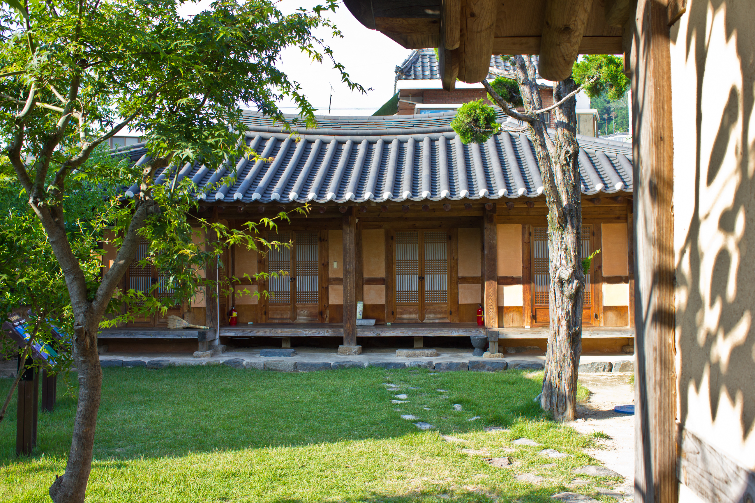
The most noteworthy area in Nam-gu with regard to Japanese occupation architecture must then be Uam-dong. The neighborhood is home to an alley of perhaps two colonial buildings, only one of which is really visible from the street. As you walk down this alley off of Uambeonyeong-ro, the buildings all appear to be individual structures. However, if you look at their roofs, you see some old colonial style warehouse vents sticking up above the more modern facades. Therefore, it is likely that the structures lining this alley are actually just a few long warehouses that have since been subdivided into individual units, with newer exteriors added on over time. One of the buildings in the center of the alley still retains its old exposed wood paneling, which is in surprisingly great shape – perhaps because of the vertical supports that were nailed into the horizontal boards. Some of the walls of these wooden Japanese buildings seem to bulge at the center over time, but this one doesn’t have that problem.

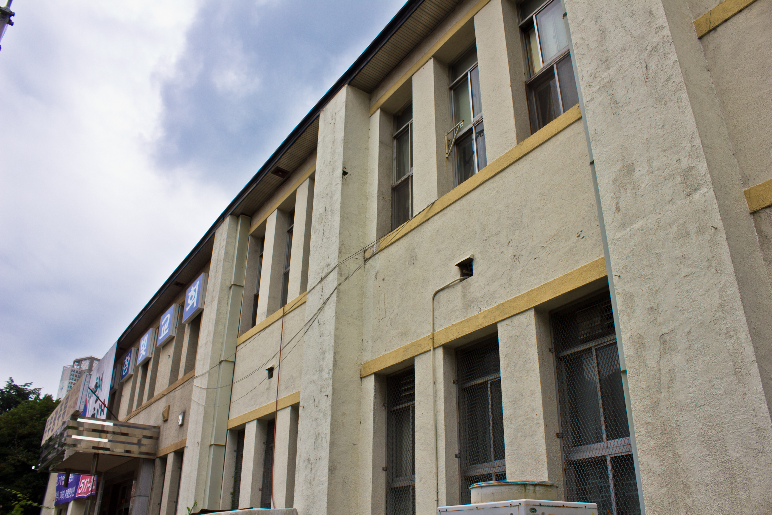
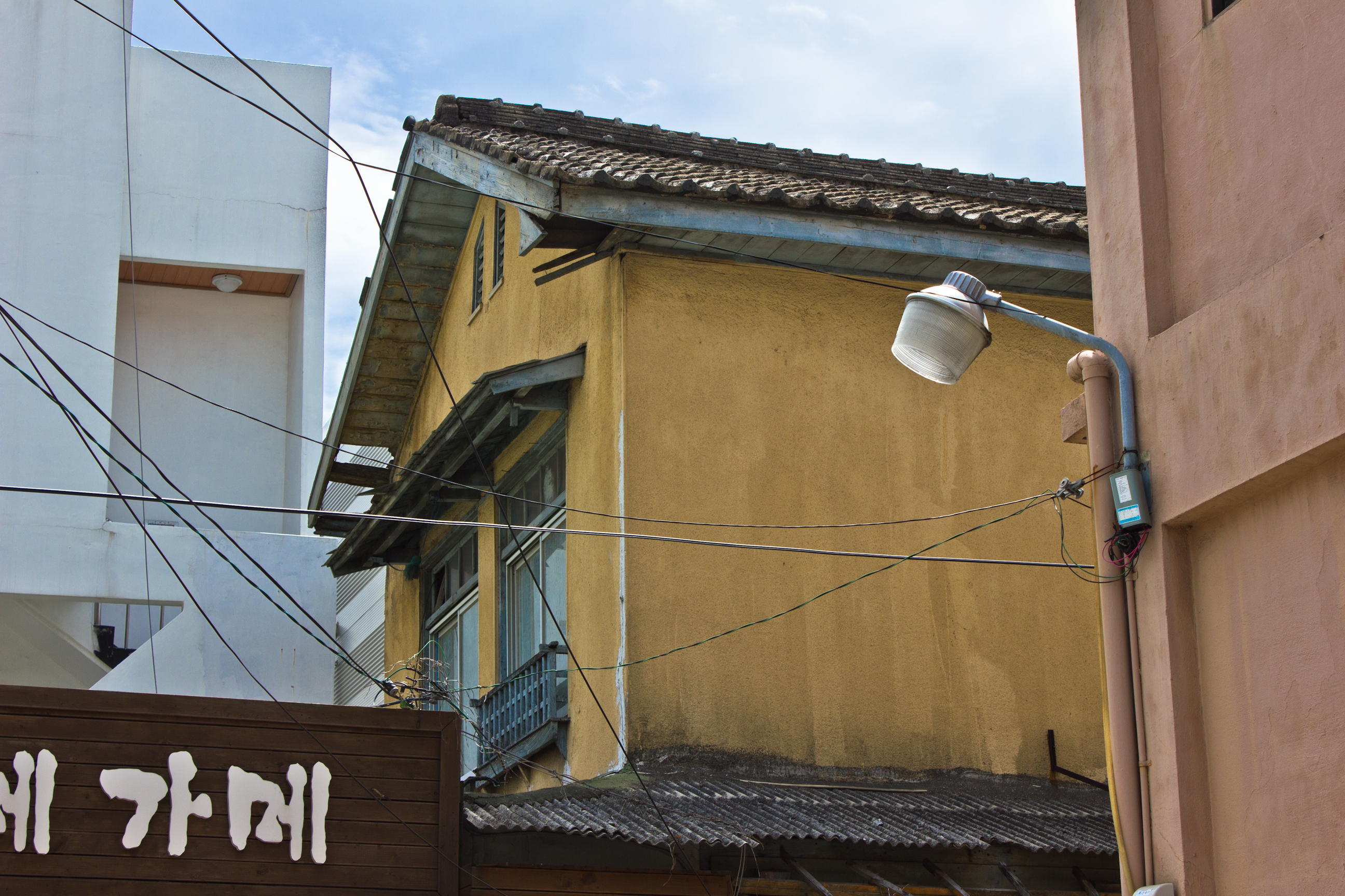
Another minor colonial era building in Uam-dong sits as a two-story brick one. Also interesting are the older electrical line insulators still stuck on the facade, though I can’t be sure of their age.


Haeundae-gu
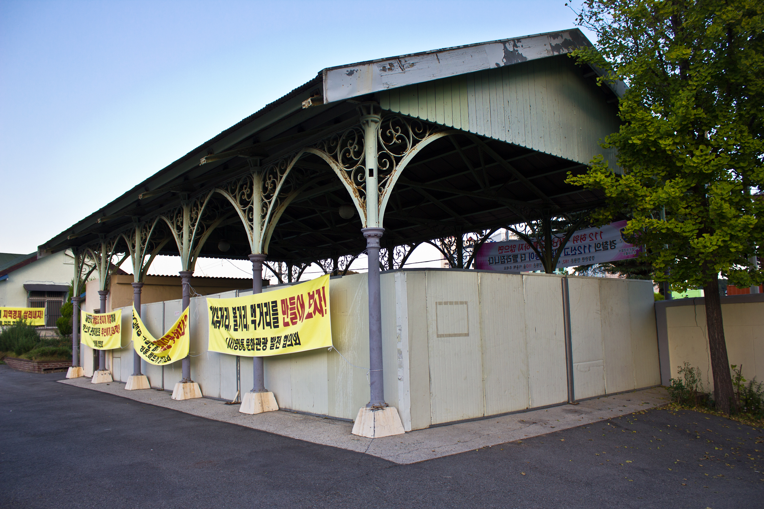
Like a number of other colonial stations across the peninsula, Songjeong Station has seen so many renovations that it isn’t really very representative of the period anymore. However, its general frame and remaining canopy columns are indicators of when it was constructed. The first train on this Southeastern Coast Rail Line ran at the end of 1934 and was used for transporting military supplies. By the time of the station’s construction in 1941, marine products from the East Sea, along with other coastal resources, were making their way down the rail line.4 The station itself is typical of the period, but of particular note is the beautiful metalwork on the open air pavilion. This is a design that I have yet to see at any other remaining train station in Korea.
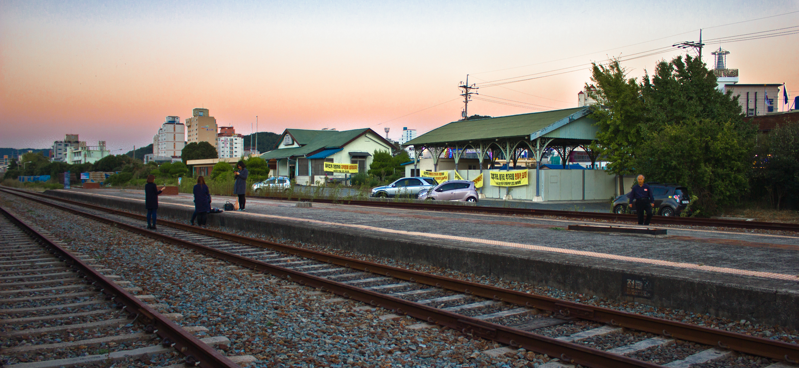


Down the street lies just a handful of old structures that are barely hanging in there, including one hamlet that is distinctly Japanese. Songjeong Station from Songjeongjungang-ro 8beon-gil.


Busanjin-gu
Beomcheon 2(i)-dong
Coming back around to the area above Choryang we get to Beomil, Bujeon, and Seomyeon. This area sits just north of present day Jwacheon, which was written about in the last post in this blog series. Between 1913-1918 and 1927-1932, just over 991,000 square meters of land had been reclaimed from the sea.5 After the 1920s, Beomil became an emerging industrial district.6 However, unlike some other areas, it remained mostly occupied by Koreans.7 By 1933, it was the home of about 2,100 Japanese settlers and 9,186 Korean locals.8 In addition to factories, a handful of colonial railroad maintenance and service buildings remain fenced off in a train yard near the old Beomil train station. The one closest to the road is a simple two story rectangle that probably would have been more aesthetically pleasing at the time of its construction.


There also exists a block of early modern structures on the other side of the highway.

Near a pedestrian bridge off Jungangdae-ro is a long colonial building that now houses junk and art dealers. On the other side is another colonial house at an intersection.
Beomcheon 4(sa)-dong
Up the hillside behind the train yard are an old factory and a few Japanese houses. A few renovated hanoks are also scattered throughout this neighborhood. The factory has its old center roof vent and wall supports in the form of mini-buttresses upon a retaining wall. Another Japanese era building now houses a cobbler or shoemaker. He allowed me in a for a minute to photograph the remains of the interior. We can see from an exterior photo below that the building was extended out into the street by about two feet.


Beomcheon-dong
Just a few years ago, a U.N. military camp named Hialeah sat in present day Busan Citizens’ Park. Prior to this, it was a Japanese military camp. Even lesser known is the fact that this was the location of a popular horse racing track that brought in hundreds of thousands of won in its later years.
In Yeong-do, horses were bred from the Three Kingdoms era all the way up until Joseon.9 Horse racing as a big money-making sport then began during the Japanese occupation. After a Western styled riding festival was held in the Yongsan military area in Seoul in 1914, Busan also became interested in horse competitions.10 Horses kept at the maechukji village in present day Jwacheon-dong were being used for land reclamation work. However, these same horses were also being used for sport.11 In 1921, Busan’s first horse race was held at a small, eighty meter diameter stadium in the maechukji area.12 In 1924, horses from Kyeongseong, Pyeongyang, Gunsan, Daegu, etc, were brought down to the Namseon Horse Racing Competition, which was hosted by the Busan Riding Club and organized with Akutagawa Tadashi, the CEO of Busan Ilbo.13 The Busan Riding Club made betting pamphlets for their audiences and special trains were arranged to run on race days.14 Parking discounts were given to those with cars, as well.15 Held every spring and fall season, the races were so crowded that the stadium was decided to be too small, which is why the Seomyeon track was later established.16
In 1930, Japanese entrepreneurs opened a new race track on old agricultural ground in present day Beomjeon-dong. Today, it is referred to as Seomyeon Racetrack. Prior to this, the land had been appropriated by the Dongyang Cheoksik Company (Oriental Development Company) and therefore had to be purchased from them.17 The Busan Land Association (Busan Tojijohab) bought up about 30,000 pyeong of land (almost 100,000square meters) from Dongyang Cheoksik, displacing at least 30 Korean farmers in the area.18 In 1932, the Government-General passed a law for tax purposes that only allowed races to be run at select facilities across the country.19 Every track had to be at least 1,600 meters in length and 30 meters wide.20 This law gave the government 5% of overall earnings.21 By 1935, the race track was bringing in 360,000won a year.22 By 1939, they hit 1,160,000won.23 While, Seomyeon Racetrack was making a lot of money, not everyone was thrilled. The public school in Seomyeon and the families living in the area were reportedly quite bothered by the noise and smell.24
About a year after the passing of the Government-General’s tax law, the Joseon Horse Racing Association was established in 1933 as a non-governmental regulatory body that oversaw horse racing clubs throughout the nation, meaning that Seomyeon Racetrack probably also operated under the association.25 During the Second Sino-Japanese War in 1937, a cavalry unit was formed and the site was used as a military training center. The 72nd logistics unit was then formed in 1941 in response to the growing American threat as the Japanese military went into overdrive by 1938, using up some seventy percent of Japan’s national budget on military alone.26 The site was used as a military supply yard until U.S. forces took control of the camp between 1945 and 1948, after which it was handed over to the United Nations and the U.S. Consulate. It was at this time that it became Camp Hialeah, which was transferred back to the city of Busan in 2006. As of 2014, it now exists as Busan Citizens’ Park.
Unfortunately, the renovation methods used on the remaining structures seem rather theme-parkish, but at least they weren’t all destroyed. The most interesting one is the former Officers’ Club. Built in 1949, the windows have been closed and the interior completely gutted, but the main room’s ornate ceiling still remains. Despite not being built until after liberation from the Japanese, somehow something resembling the Japanese rising sun flag got painted on the ceiling. The 8th Army seal was added to the middle of the ceiling by U.S. forces. The building is now used as a museum showcasing bits of history from the area.


Buam 1(il)-dong
The streets to the west of here are lined with some pretty old buildings that will probably get bulldozed in the next few years. Most of them are insignificant, but a few appear to date to the colonial period. This includes one early modern warehouse that will probably stick around for awhile as it is presently getting a lot of use.


Yeonje-gu
Geoje 4(sa)-dong and Geoje 3(sam)-dong
Yeonje-gu was the site of the old Geoje Station. The area also had a block of colonial structures that have since been demolished. They appeared to be some kind of row or group housing. The few structures that are left are hardly noteworthy, yet these are some, if not all, of the ones that remain. One lone Japanese two-story house sits hidden in an alleyway, and it is the most significant structure I could find there.


Dongnae-gu
Prior to 1910, the fortress town of Dongnae was the seat of power in the region. The fortress, which was then referred to as Dongnae-bu, had had a long history of being both the provincial administrative center and trade center of the area. Before Japanese settlers made their way into the southern coastal areas, Dongnae would have handled all administrative and port business. This is made evident by it being the location for international affairs and communication with Japan and, by the late 1800s, Westerners. For example, an 1894 report of Prussian diplomat Max Von Brandt’s first experience in Korea by writer William Elliot Griffis shows one such encounter in Dongnae.
Heir M. Von Brandt, had landed from the Hertha at Fusan, and
attempted to hold an interview with the governor of Tong-nai. He
was accompanied by the Japanese representatives at Fusan, who
politely forwarded his request. A tart lecture to the mikado’s sub-
ject for his officiousness, and a rebuff to the Kaiser’s envoy were
the only results of his mission. After sauntering about a little,
Heir Von Brandt, who arrived June 1, 1878, left June 2d, and the
era of commercial relations between the Central European Empire and Chosen was postponed.27
This excerpt has not been included here to show a lack of hospitality on the governor’s part – for there are numerous accounts of Joseon officials being generous to outsiders and even aiding those who were, for example, shipwrecked and stranded on Korea’s coast – but rather to show an example of international interaction at Dongnae around the time of the port’s opening. Here, we see that isolationism was still very present in the minds of Joseon officials. Additionally, we see that the treaty of 1876, which really only opened Busan up to Japanaese trade, is being honored in that the governor refuses to trade with a country other than Japan. However, perhaps more importantly, the interaction here arguably illustrates how the Dongnae governor still had quite a bit of power. Not only did the Japanese official from Fusan report to the governor of Dongnae in this instance, but the Japanese may not have had permission to handle trade propositions despite being in control of port affairs since the 1876 treaty. After ruling for centuries, it is then significant that Dongnae’s power and influence would be undone a mere thirty years later. Japanese merchants did move into the Dongnae-bu market at some point,28 but it wasn’t until the development of Busan’s coastal new town areas that Dongnae’s influence began to wane. The early modern history of Dongnae-bu is then one of transformation and destruction as some parts of the town were occupied while other parts were redeveloped. By the time of the construction of the Residency-General in 1906, Dongnae-bu and its administrative system traditional buildings, like the gaeksa, were living out the last few years of its traditional lives.29
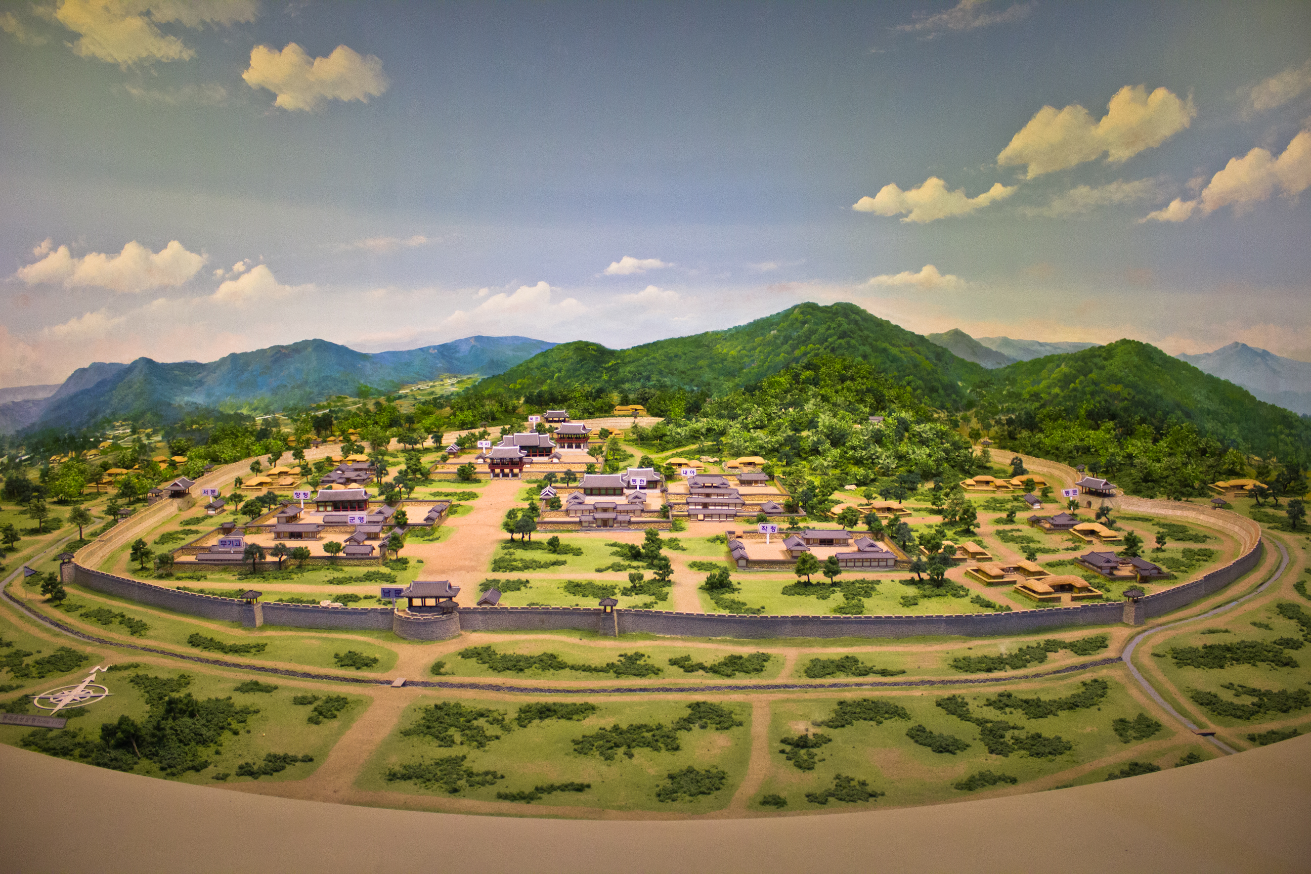
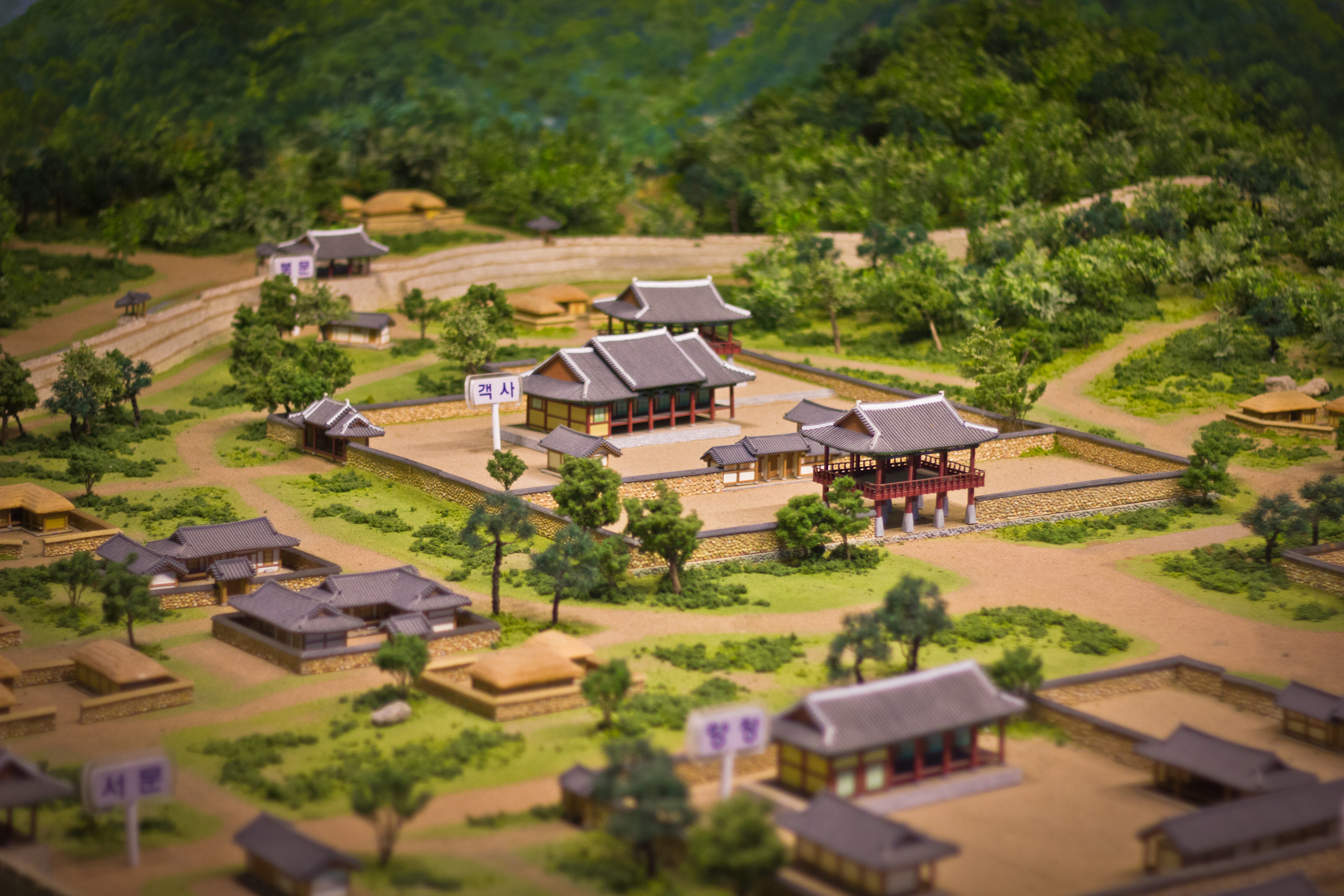
The gaeksa was the administrative center guest hall of Dongnae-bu. It was a palatial structure built at the meeting point of the two largest roads that ran from the south and west gates inside the fortress walls.30 As such, it was an architectural symbol of the traditional government representing the power of the region of Dongnae. Located towards the northern part of the fortress, the gaeksa was a giant structure with about thirty-nine rooms, three gates, and a couple of smaller minor entrances.31 Pictures from the late Great Han Empire show it be built in the same style as other Joseon era palaces and temples. A nice 1:100 scale model at Suan Station gives us a good idea of what the area probably looked like, though it is based on the fortress as it was during the early Joseon period. It is not known exactly how or when the gaeksa building was destroyed, but we can look at the events surrounding its final years to get an idea of what it looked like, how it operated, and why Dongnae-bu in general changed so much.
By 1907, a number of buildings near the gaeksa had already been torn down to make way for more modern institutions. However, the gaeksa structure itself survived awhile longer. Then, in 1909, the gaeksa was given a new purpose. Ye Wanyong (이완요), the politician that would later sign the treaty that annexed Korea, wanted to build a public school in Dongnae, so he dispatched an officer to look at the area and find an appropriate site.32 It was then decided that the gaeksa hall could be used as the school. However, this area fell under the jurisdiction of the Land Surveying Administration (탁지부). Ye Wanyong submitted a bill to the government bidding to have the land handed over for establishing schools.33 It has been suggested that the permission to convert gaeksa was hidden in bill number 216 amongst unrelated articles.34 After the document passed, the gaeksa hall then lost its original role. During its conversion, the main government system at the gaeksa itself was annulled by November of 1909. When Dongnae was absorbed by the city of Busan in 1910, the old local government offices became offices of the Japanese government, and the land was transferred to the banking and educational systems.
It was also in this year that the fortress walls surrounding the town of Dongnae (Dongnae-eupseong) were demolished. Unlike the dismantling of Daegu-eupseong, there seems to be little information available in either Korean or English on the actual process of its deconstruction. Though we may not know how it was done, or what the stones were used for, we do know why it was done. The fortress’ deconstruction was a result of city planning and the Japanese central government’s desire for standardization across the peninsula. A map from 1927 shows how the roads and drainage systems were redesigned.35 When comparing the present day streets with the past, we see that we’re still using the infrastructure laid out by the Japanese settlers. Though the walls are long gone, part of the town’s moat was discovered during the construction of Suan Station. A cross-section of the excavation site shows a 2.3 meter difference between the ground level today and ground level during the early Joseon period. Dongnae went on to attain gun status in 1914.36 The redistricting put all of Gijang and part of Yangsan under Dongnae’s administrative jurisdiction. Dongnae was incorporated back into the city of Busan in 1942.37
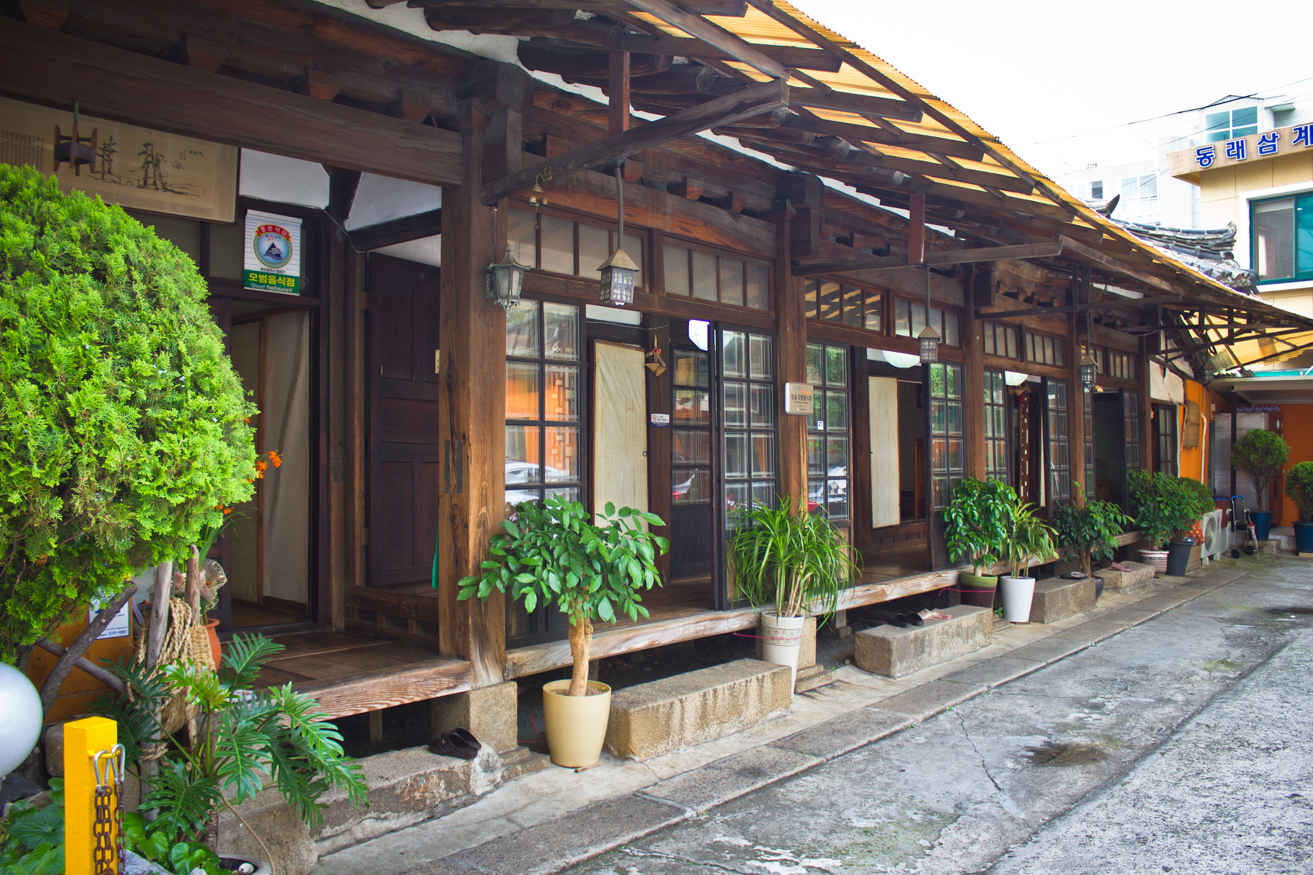
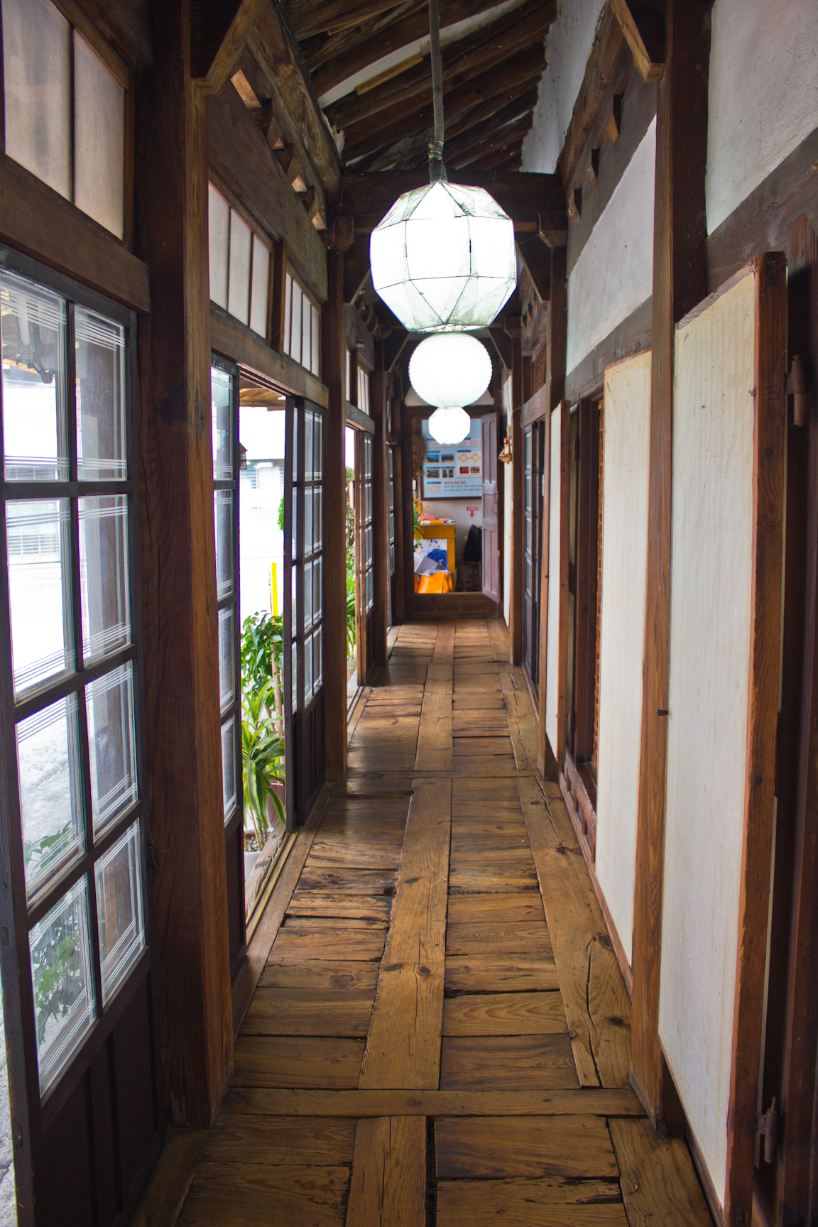
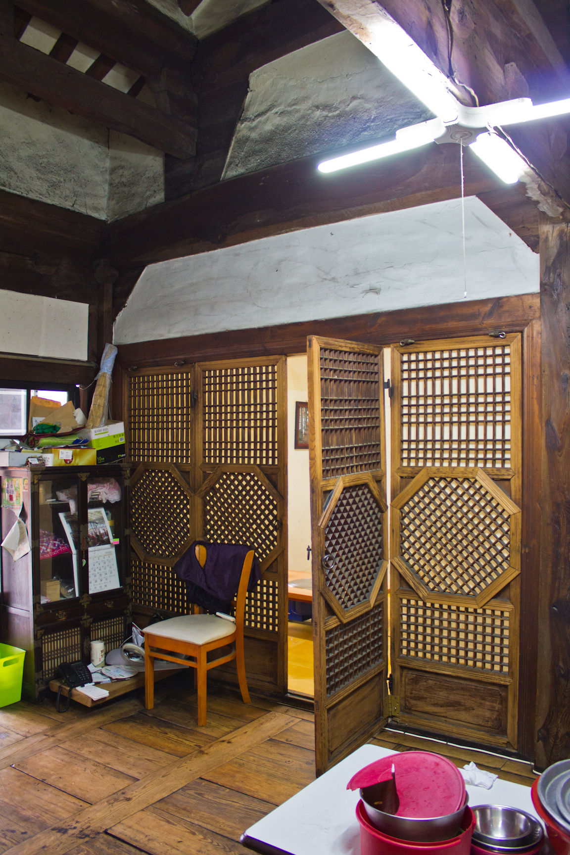
Bokcheon-dong
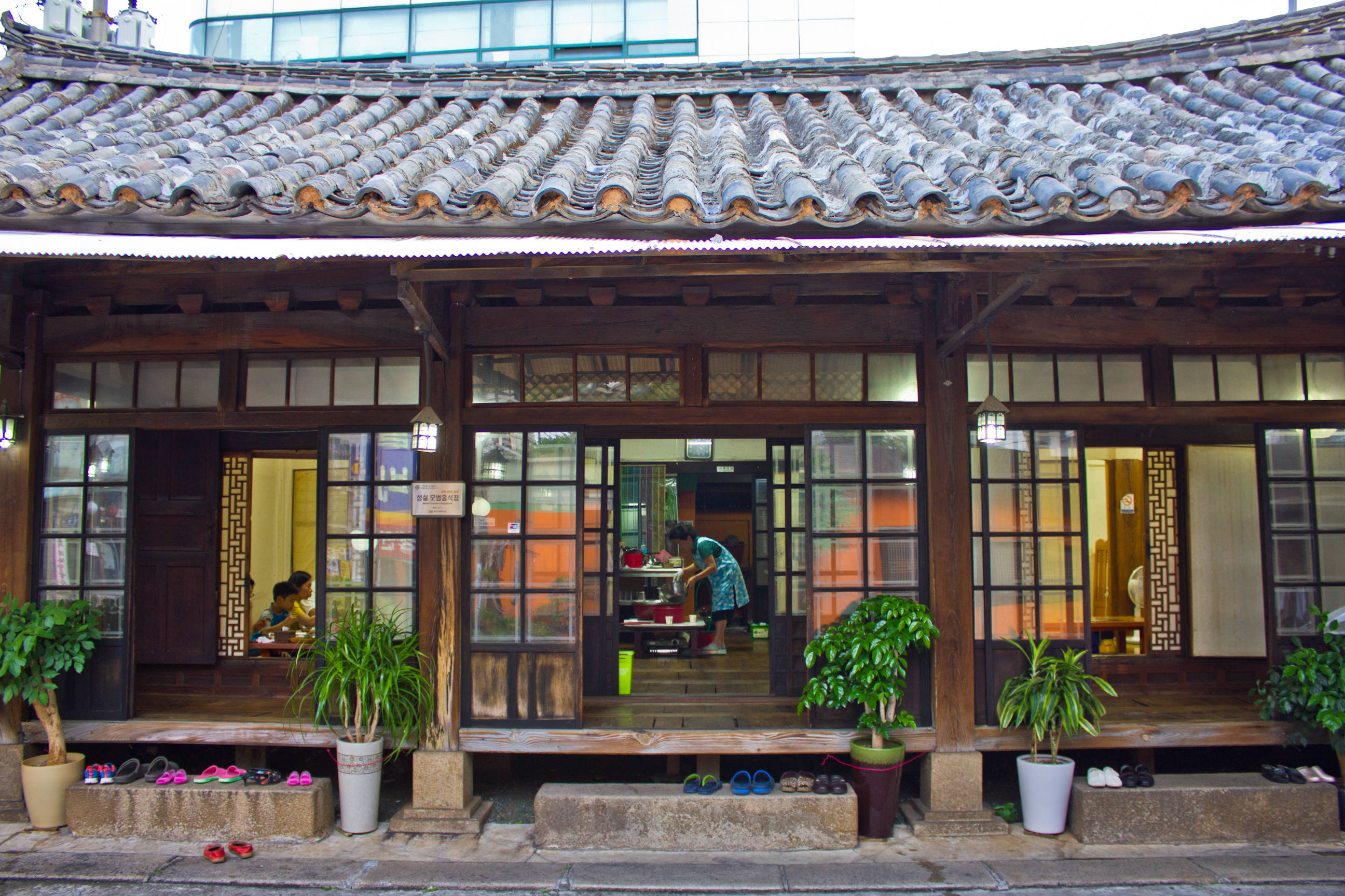
What’s left of Dongnae’s early modern architecture amounts to little clusters of renovated hanoks, like the first one pictured below, whose exteriors date to the 1950s or 1960s. What lies underneath their walls could be as much as a few decades older. However, according to maps with overlays of the old town, there is one beautiful hanok sitting in a place that would have been within the old fortress walls – specifically near Hyangcheong, which was one of the structures seen in the previously pictured model of the town. Now a restaurant, the wait staff said this hanok is over one hundred years old, yet it is not protected by the government. While it’s hard to believe that a pre-1915 hanok in the historical district of Dongnae wouldn’t get cultural heritage status, perhaps there are other forces at play – assuming it truly is that old. Regardless, it is a great example of what other buildings in the area would have looked like at the time of its construction.


Myeongnyun-dong
A strip of early modern buildings alone the road outside Dongnae Subway Station remains today, though it is covered with signs and difficult to see. These buildings have likely seen nonstop use since before the station’s construction.
Nangmin-dong
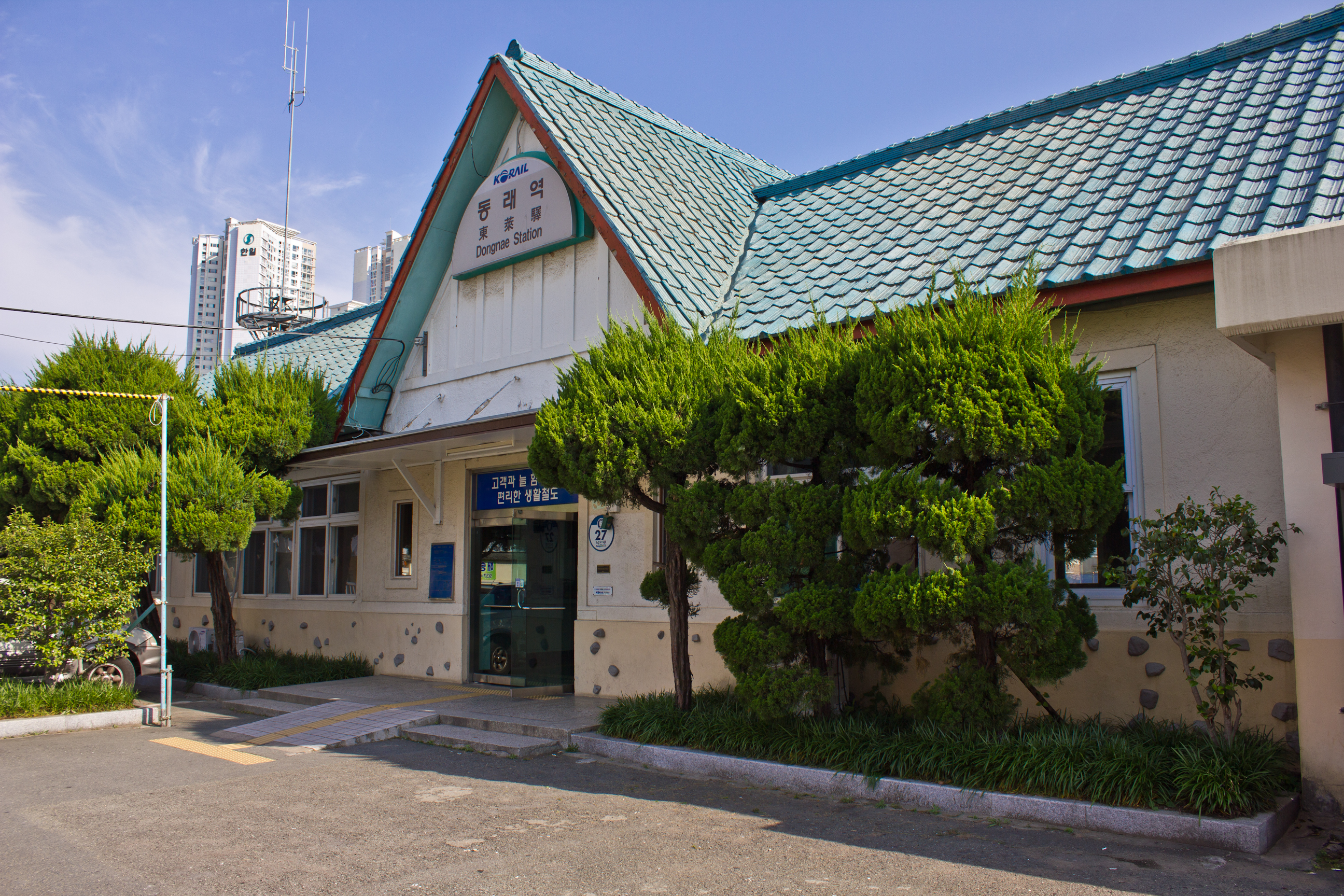
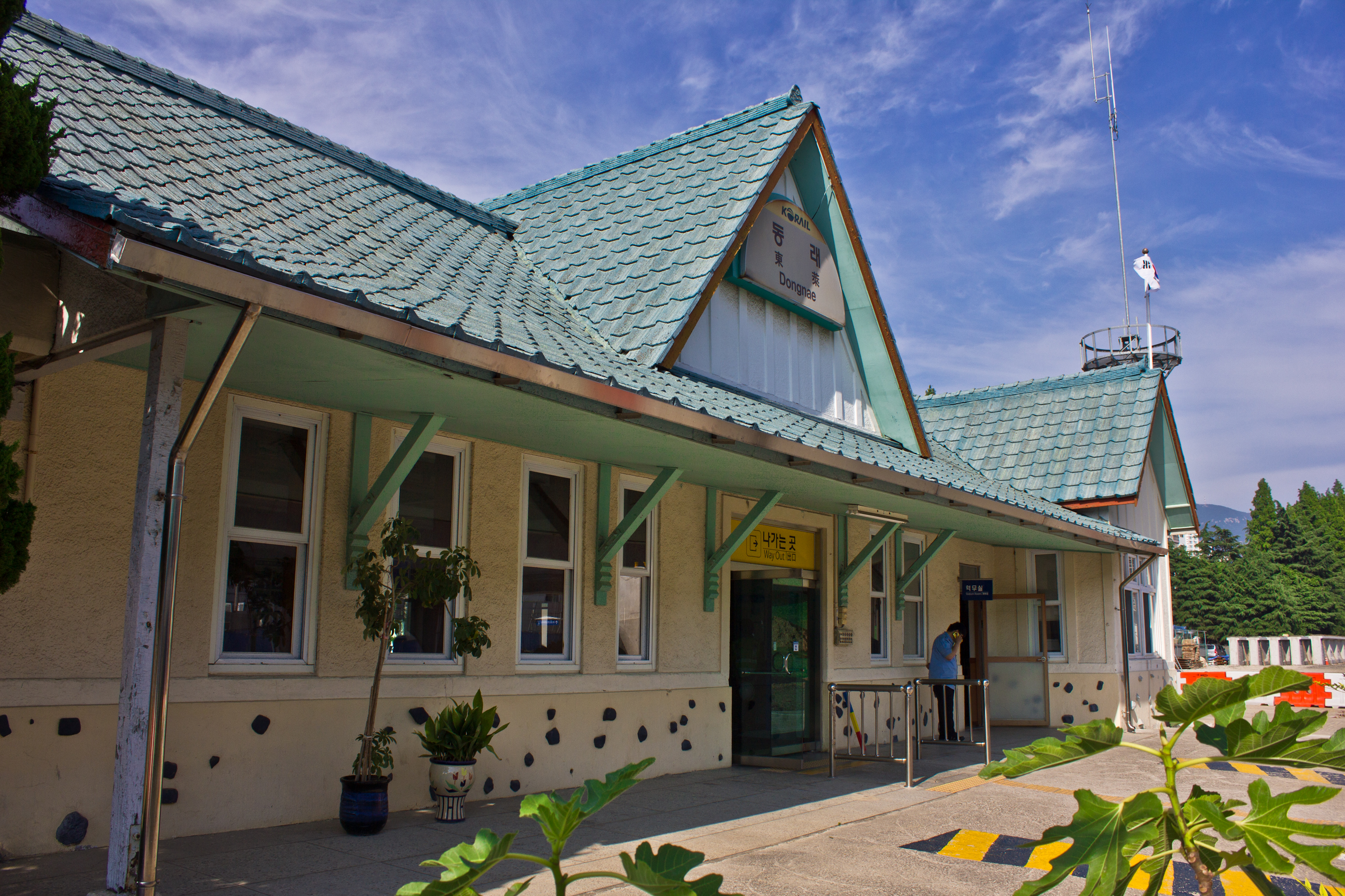
In 1934, Dongnae Station was established. The rail line to this area was, however, constructed some time in 1933. Typical of colonial era train stations, it features a gabled roof. This station has recently been discontinued and its tracks ripped up – presumably because nobody uses it anymore.
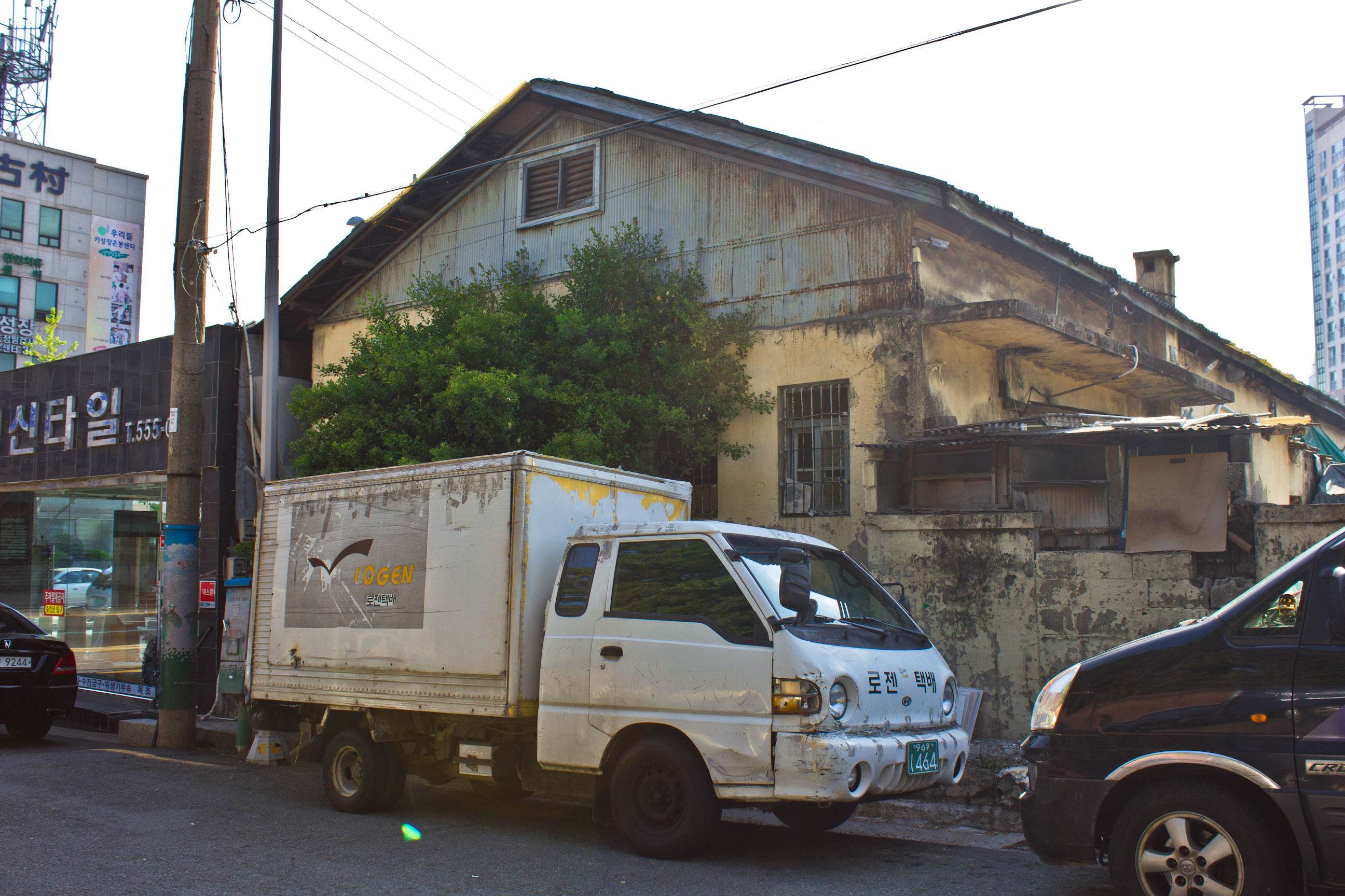
Boksan-dong and Chilsan-dong
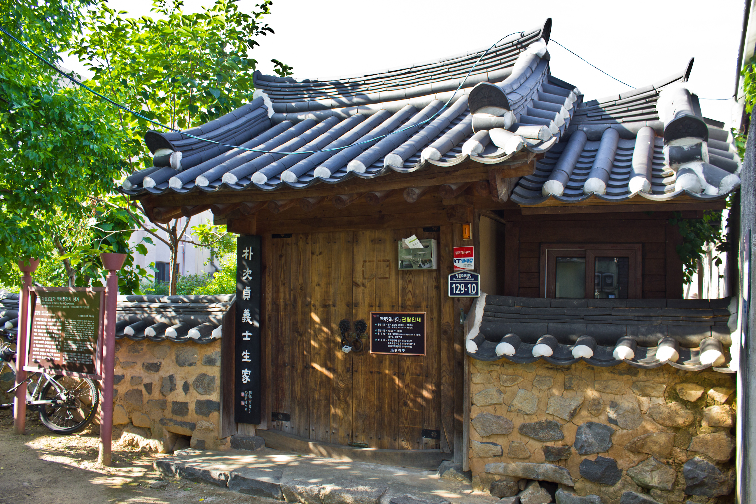
Up the street from the station are a couple of old warehouses and a Japanese house. A tiny alley leads to the birthplace of one Park Cha-jeong, who was an independence fighter and activist. Born in this hanok, which was discovered in ruins and restored in 2005, her most memorable fight is noted as being the Battle of Kunfunguan, China. The house dates to the time of the Japanese occupation or the Great Han Empire. Most of the structure appears to be a reconstruction and not original.


The hot spring facilities in present day Oncheon were a result of a thirty household village that had been there since the Three Kingdoms period.38 For hundreds of years, this is all that was the Oncheon hot springs. It probably wasn’t until 1766 that the area received any kind of development as the chief administrator of the Dongnae prefecture, Gang Pil-ri, renovated the baths and documented the work on the Onjeong Gaegeonbi stone (Monument of Busan No. 14).39
It was then that around the time of the absorption of Dongnae into the city of Busan, about one-hundred-fifty years later, that the hot spring area began to drastically change. Modern development of the hot springs began as early as the 1890s when a lease signed in 1898 allowed for Japanese entrepreneurs to construct the Yatsushi Hotel in the area. The formation of Busan Light Bulb Inc. in 1902 allowed for the development of Busan Railroad Inc. and its tram lines.40 The line between Busanjin and Oncheonjang was completed in October of 1915. The newly established tram system gave residents of the coastal new towns and Japanese concession easy access to an area that was relatively far away at the time. Not only was the Oncheon area invested in and developed, but it was promoted to tourists – so much so that the Joseon Gas and Electricity Corporation, which had built a spa there in 1925, began selling packaged deals that gave tourists combined rail and spa tickets at a discount.41 By that point, as of May of 1910, Busan Railroad Inc. had been completely transferred over to Joseon Gas & Elec. Inc., thus the tram system would have had a lot of freedom in creating such packaged deals.42 Such promotions may have been used as a way to compete with the Mancheol Hotel and its owner, the South Manchurian Railroad Corporation, which was established in 1922 and had some level of management rights over the hot spring.43 The trolley system would go on to operate for fifty eight years before finally being put out of service in 1968.44
Toyota Fukutaro, a Japanese investor, also established a large hotel in the area called Bongnaegwan. This hotel would later become the present day Nongshim Hotel. Thus, Oncheon was not only a site that attracted colony tourists, but it was a hub of wealthy Japanese residents in Korea.
In addition to the spa made by the Joseon Gas & Elec. Corp., the Yatsushi, the Mancheol Hotel, and the Bongnaegwan, other sites for visitors included the Daeji Hotel and Dongnae Byeoljang.45 Dongnae Byeoljang, byeoljang meaning a holiday or getaway house, was established some time prior to 1924 by Hazama Fusataro, a wealthy Japanese entrepreneur who not only became the director of both the Busan Bank of Commerce and Joseon Savings Bank, but was also the president of the Busan Land Company. However, this entrepreneur came from much humbler beginnings. Born around 1859 in the Wakayama prefecture, Hazama moved to Busan in 1880 after a stint as a clerk in Osaka. The young twenty-one year old started to establish himself in fishery, warehousing, and food trading. He later gained a fortune through money-lending and property ownership.46 The tycoon eventually became one of the three wealthiest people in Busan, whose land ownership extended from Busan out to Gimhae, Yangsan, and Miryang.47
Oncheon 1(il)-dong
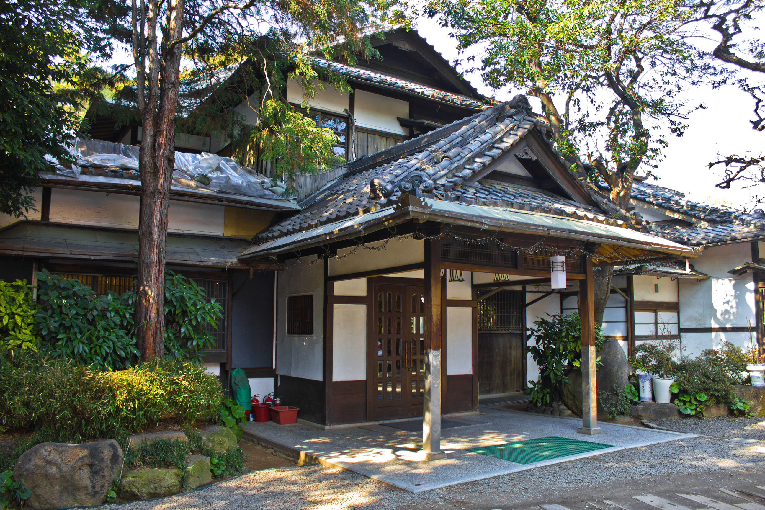
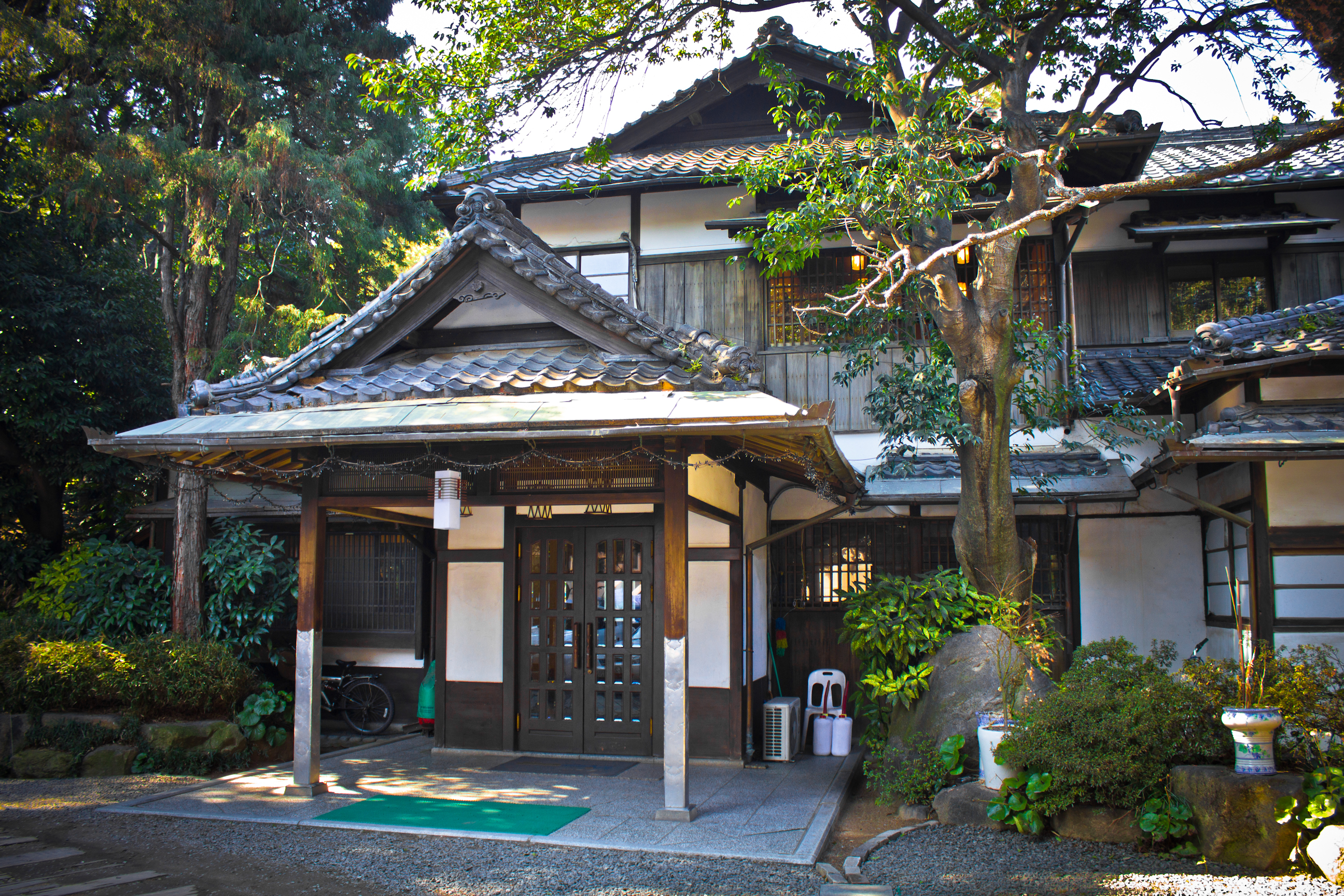
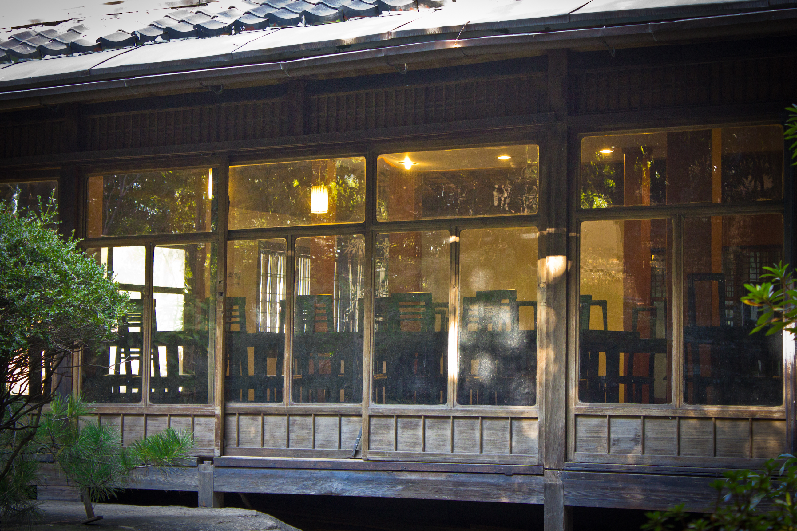
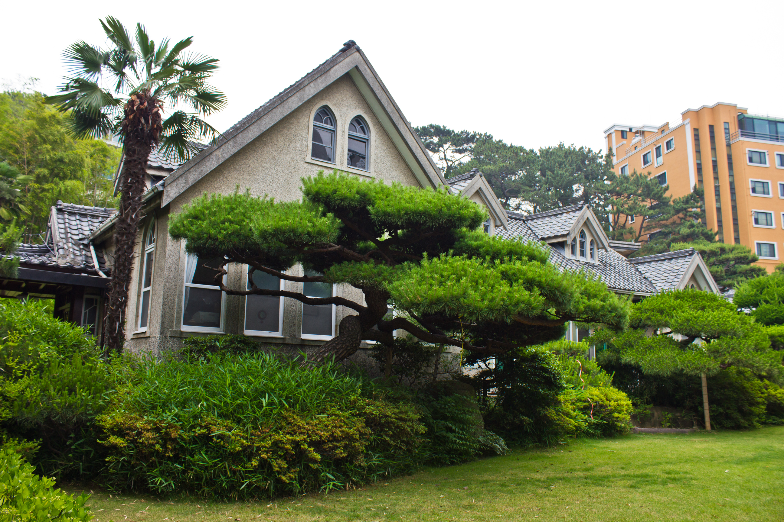
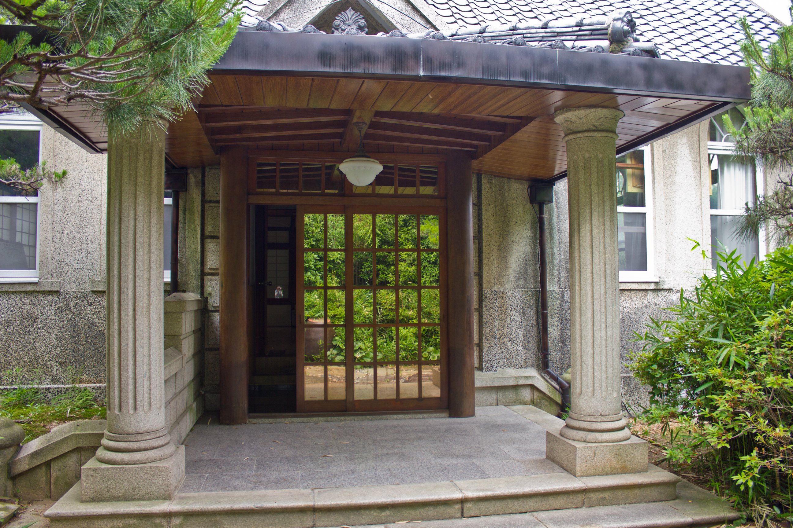
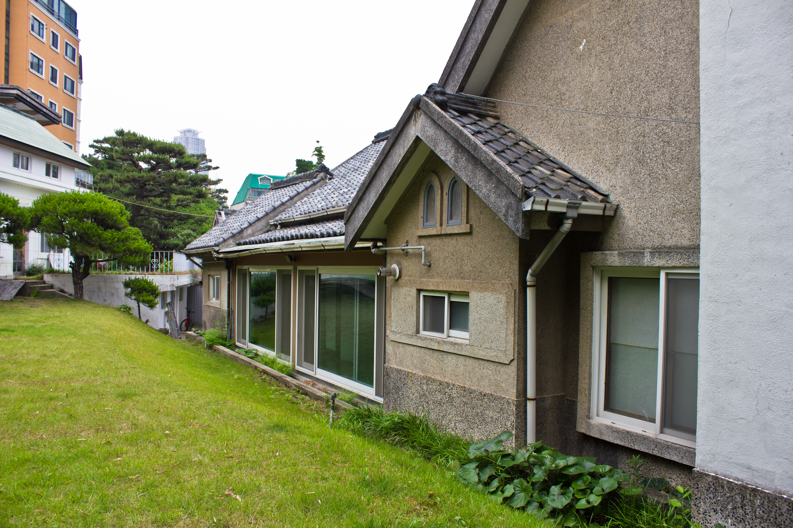
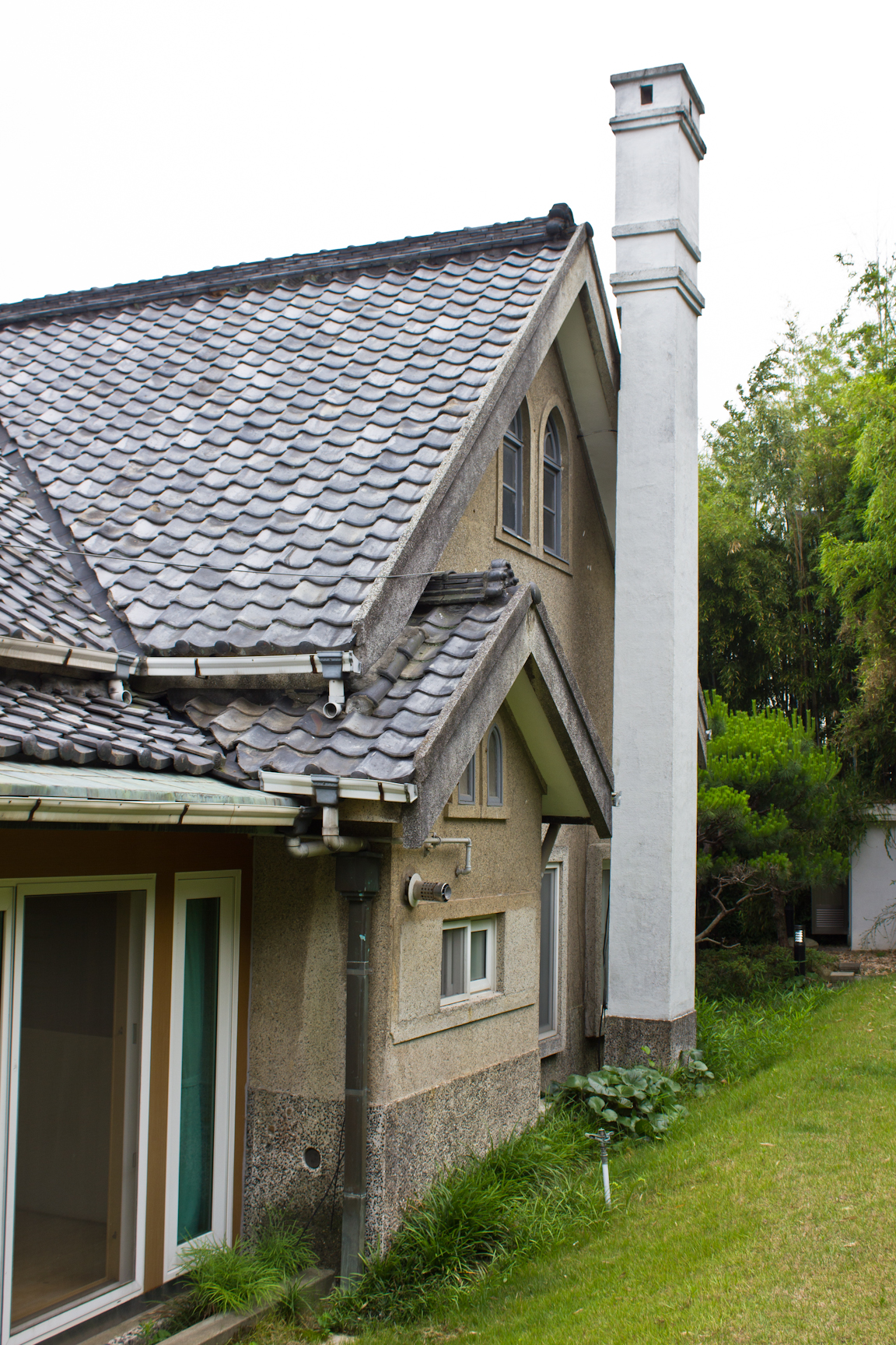
Dongnae Byeoljang is then an excellent example of the kind of properties Hazama may have owned. Originally built as a private villa named Hazama Yugen, its interior is no longer intact. However, the exterior is well preserved. The house sits as a typical two story, wooden Japanese style structure with a wall lined with windows facing a small garden. In addition to housing the wealthy, the villa once accommodated the Kan’in Haruhito family when the prince visited in September of 1924. The U.S. Army used it as an office and for recreation after liberation before returning it to the Korean government in the 1950s. At that time, it served as the temporary residence of the Korean vice president when southern forces were pushed back to the Nakdong River. From 1965 into the 1980s it was remade as an elite restaurant that was supposedly incredibly expensive.48 It now serves as an event center.


Up a street that passes a crumbling old building with giwa tiles is a private residence that is noted for some Goryeo era carvings, including a five story stone pagoda, that are kept inside the garden. The main house itself, however, is quite interesting. It features a gabled roof and arched, Victorian inspired windows that neatly line the first floor. Dormer windows are on the roof. The window frames are made of wood whose paint looks somewhat worn, and it’s the kind of style that would have been used during the Japanese occupation. However, the house doesn’t quite look like a Western-styled Japanese-built colonial era structure. In fact, it looks more like some of Korea’s early modern missionary homes. The giwa roof and pebbled concrete walls could put it in 1950s, but the front porch and inner hall look like designs from the 1970s or 1980s. This kind of pebbled concrete facade was sometimes used to build new, or cover over old, exterior walls in the 1950s, making me curious as to whether or not there is anything underneath the current facade. Behind the home is a two story building that also appears to be relatively old. There seems to be no information available on the house, so if you’re reading this and you know something about it, please comment below. Construction workers doing lawn maintenance, who were nice enough to let me in to photograph the Goryeo pagoda, also knew nothing about the house except that it just changed hands and had a new owner.


UPDATE: Sadly, this structure has recently been demolished. Apparently it did actually date to the colonial period and is thought to have been about a hundred years old. It’s also frustrating to know that an unsuccessful effort was made to protect the building in 2007. You can read the full Busan Ilbo article (click here).
Geumjeong-gu
Jangjeon 2(i)-dong
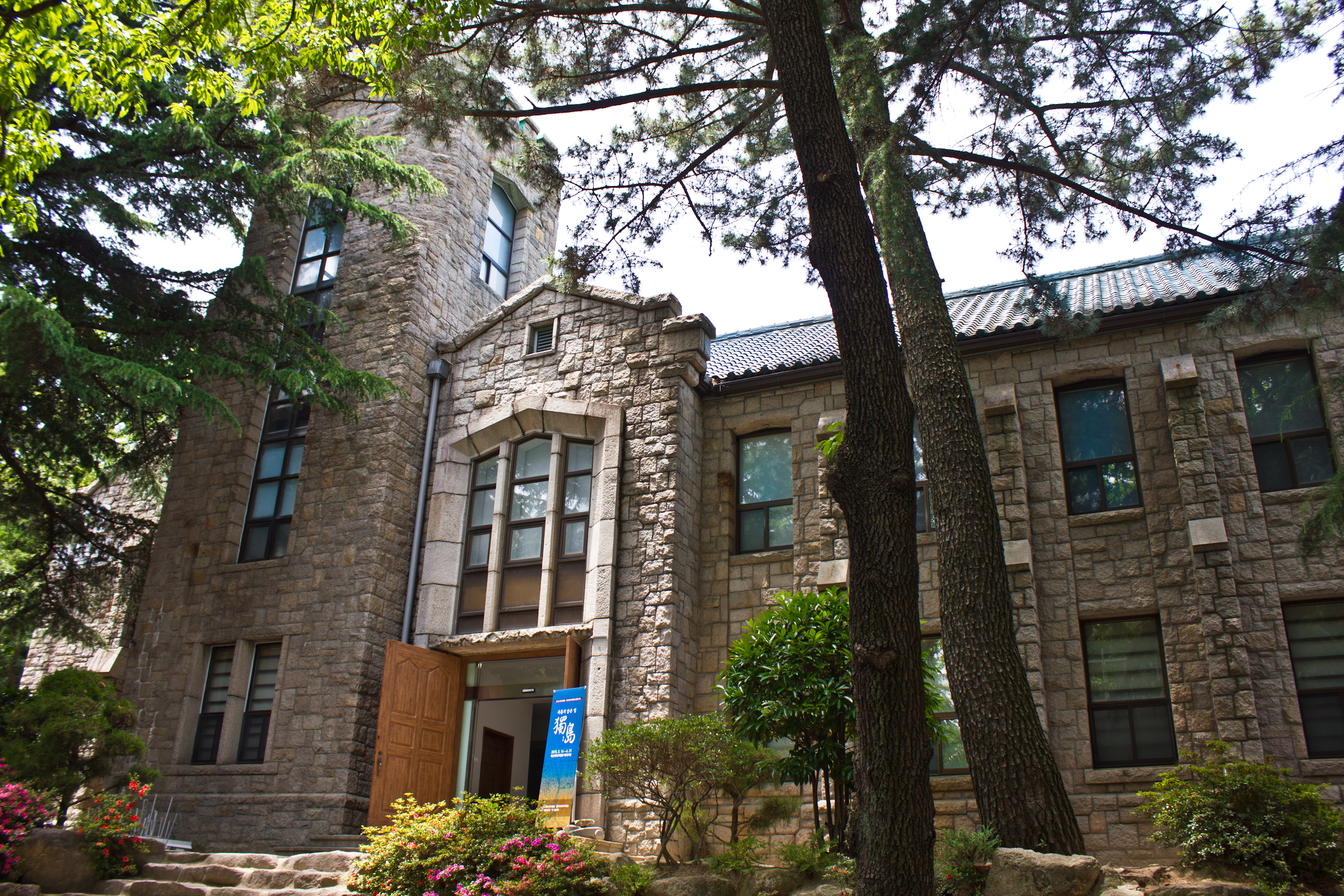
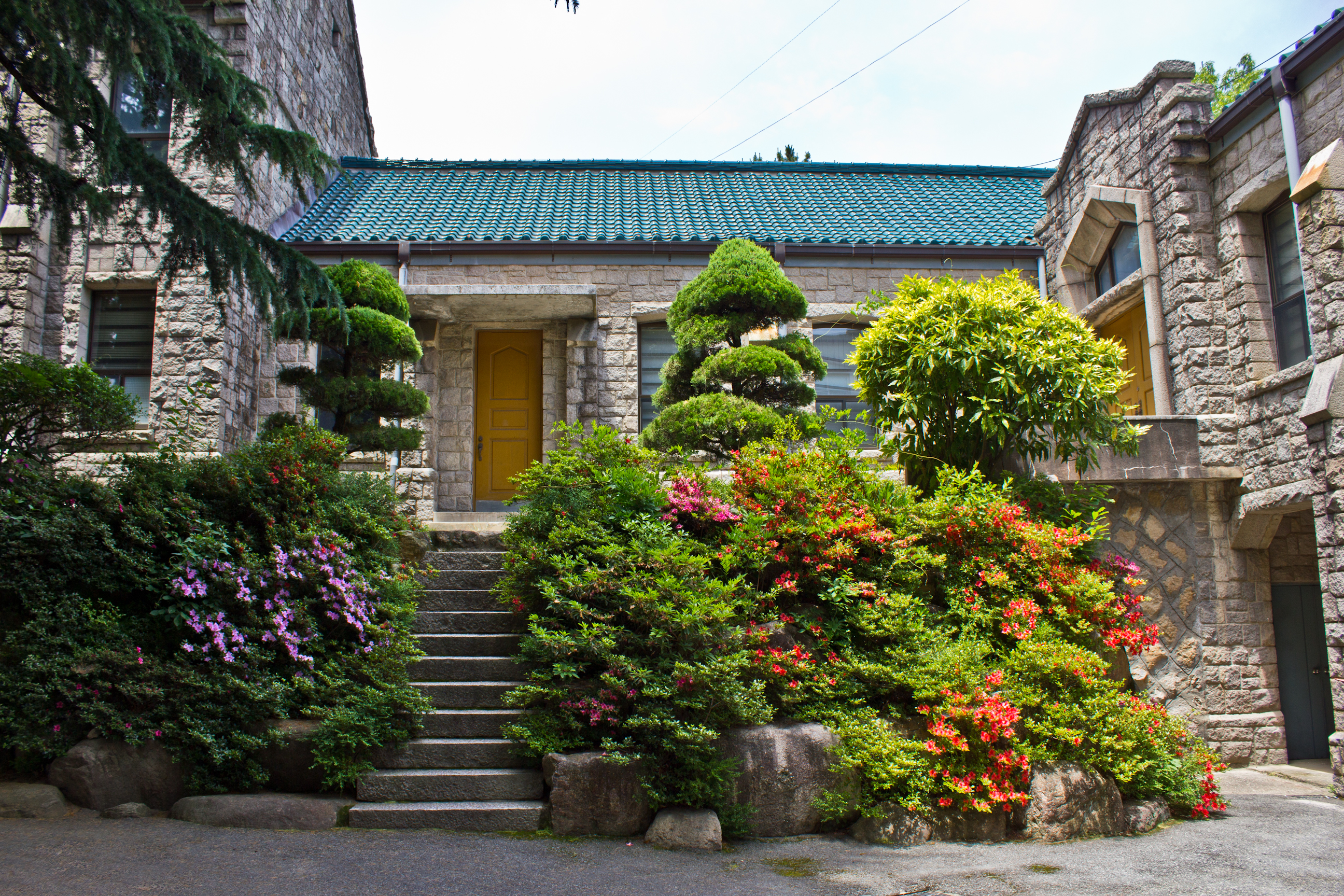
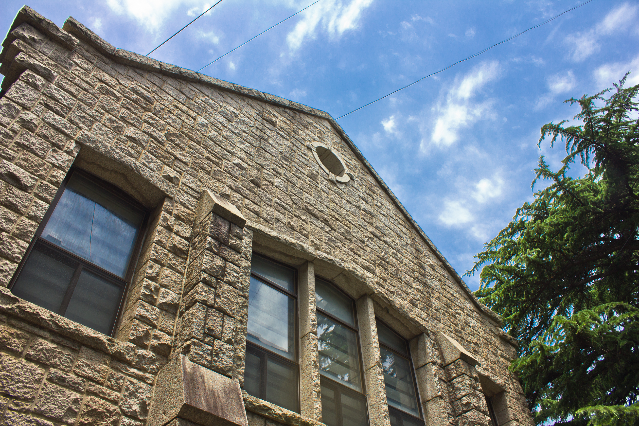
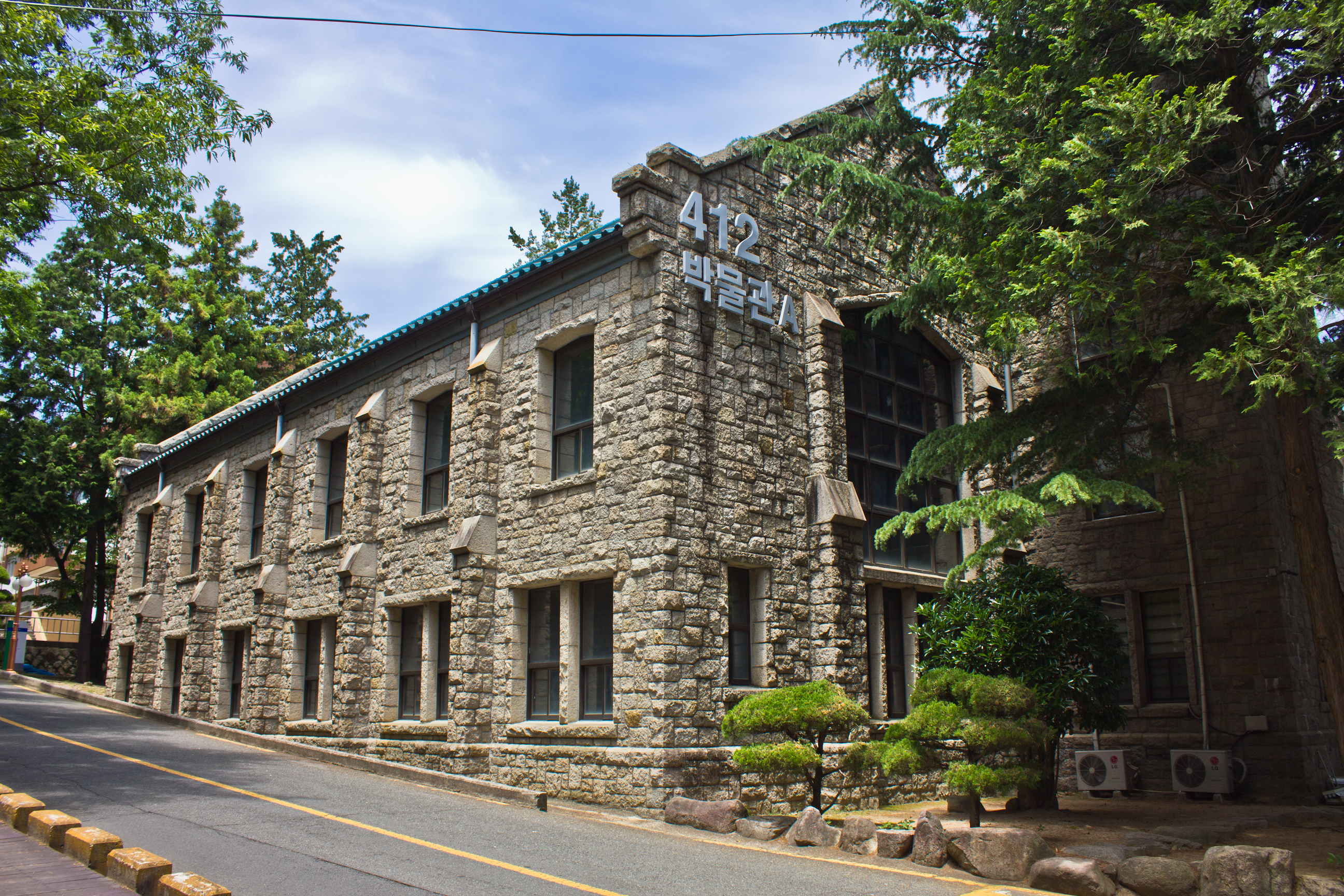
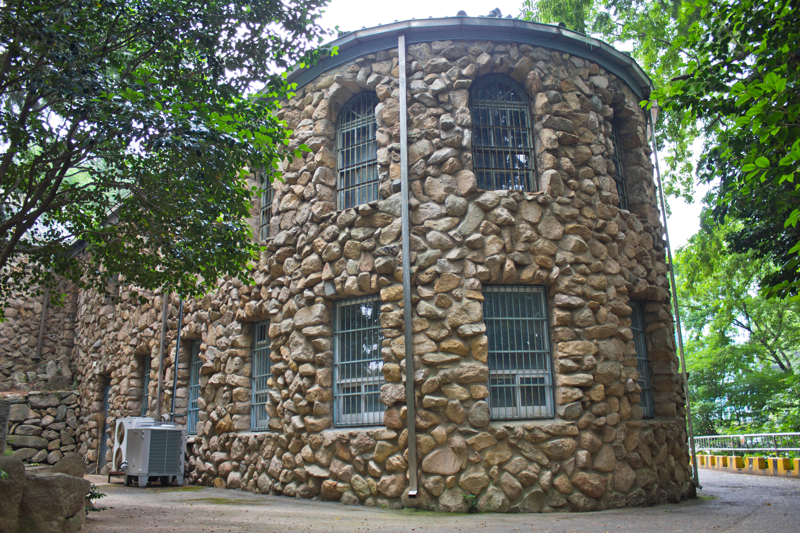
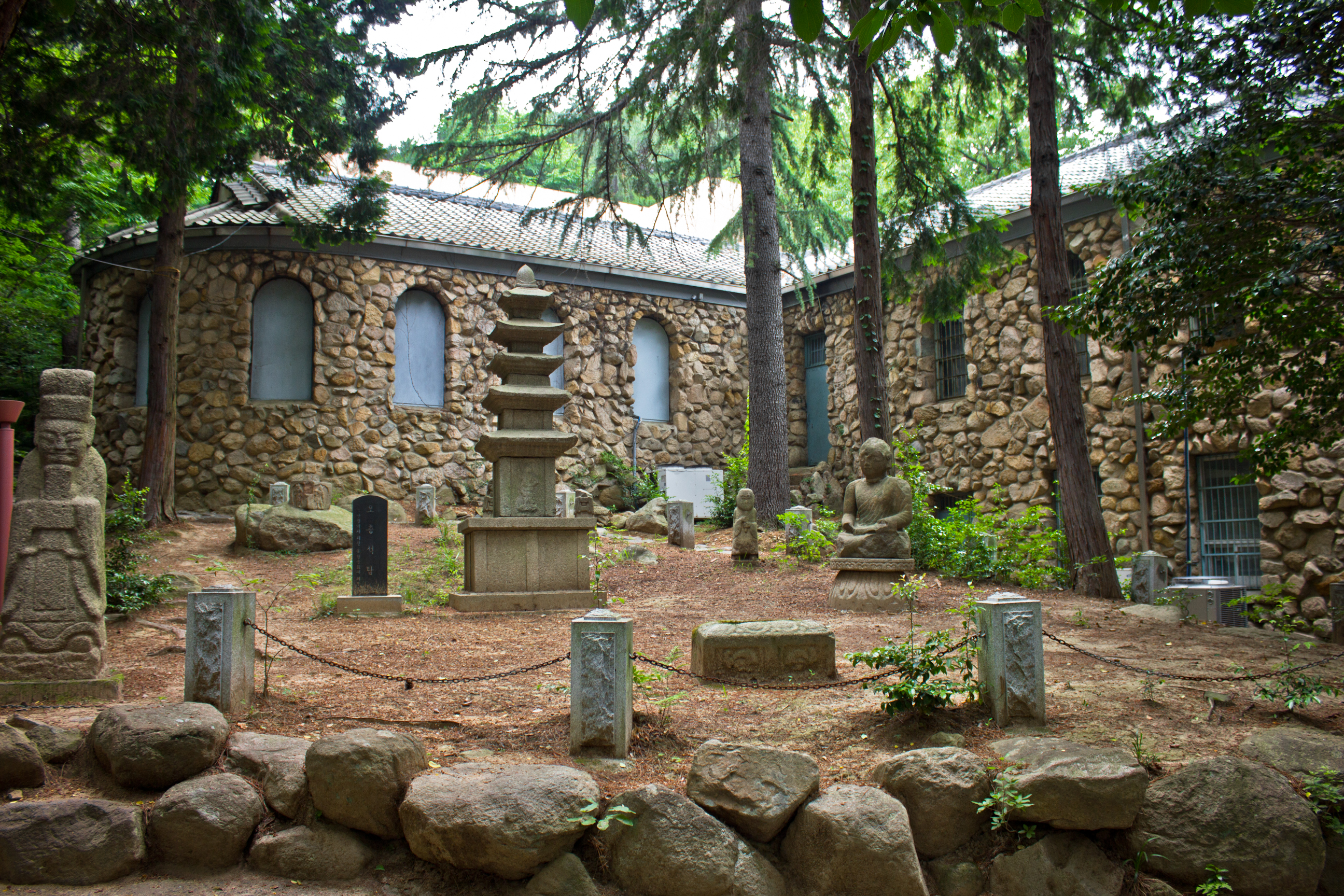
There are two mid-century structures remaining on the campus of Pusan National University. Its Gothic style museum was built of square-cut stones in 1959 by architect Kim Jung-eop (김중업).49 The present day annex, however, was constructed in 1956.50 It was built using a rocaille (pebble) style exterior that makes use of uneven, uncut stones. However, the building also seems to be influenced by early Italian and Byzantine architecture. Judging by old photos, the roof was replaced at some point. The annex was built in an “L” shape with rows of arched windows lining the first and second floors of the long part of the “L” while only one row of windows line the short part of the “L.” Though the annex was used to store “evacuated” national treasures between 1957 and 1960, it wasn’t until 1963 that the building obtained museum status.51 The annex yard now serves as a display for carved stones made before the Joseon era.


To see the entire Flickr gallery, click here.
Footnotes
1This map is in the Busan Citizens’ Park museum (Former Officers’ Club)
2Public Health in Asia and the Pacific: Historical and Comparative Perspectives (Oxford, United Kingdom: Routledge, 2011), p. 80.
3Roadside plaque
4Informational Plaque
5Oh Mi-il, “The Spatial Arrangement and Residential Space of a Colonial City: The Spatio-temporality of Hill Villages in Busan, ” Korea Journal 53, no. 1 (2013): 185.
6Oh Mi-il, “The Spatial Arrangement and Residential Space of a Colonial City: The Spatio-temporality of Hill Villages in Busan, ” Korea Journal 53, no. 1 (2013): 186.
7Oh Mi-il, “The Spatial Arrangement and Residential Space of a Colonial City: The Spatio-temporality of Hill Villages in Busan, ” Korea Journal 53, no. 1 (2013): 188.
8Oh Mi-il, “The Spatial Arrangement and Residential Space of a Colonial City: The Spatio-temporality of Hill Villages in Busan, ” Korea Journal 53, no. 1 (2013): 200.
9유승훈, “부산 경마 타짜와 하야리아 부대,” 국제신문 2014.
10유승훈, “부산 경마 타짜와 하야리아 부대,” 국제신문 2014.
11유승훈, “부산 경마 타짜와 하야리아 부대,” 국제신문 2014.
12유승훈, “부산 경마 타짜와 하야리아 부대,” 국제신문 2014.
13유승훈, “부산 경마 타짜와 하야리아 부대,” 국제신문 2014.
14유승훈, “부산 경마 타짜와 하야리아 부대,” 국제신문 2014.
15유승훈, “부산 경마 타짜와 하야리아 부대,” 국제신문 2014.
16유승훈, “부산 경마 타짜와 하야리아 부대,” 국제신문 2014.
17유승훈, “부산 경마 타짜와 하야리아 부대,” 국제신문 2014.
18유승훈, “부산 경마 타짜와 하야리아 부대,” 국제신문 2014.
19유승훈, “부산 경마 타짜와 하야리아 부대,” 국제신문 2014.
20유승훈, “부산 경마 타짜와 하야리아 부대,” 국제신문 2014.
21유승훈, “부산 경마 타짜와 하야리아 부대,” 국제신문 2014.
22유승훈, “부산 경마 타짜와 하야리아 부대,” 국제신문 2014.
23유승훈, “부산 경마 타짜와 하야리아 부대,” 국제신문 2014.
24유승훈, “부산 경마 타짜와 하야리아 부대,” 국제신문 2014.
25Asian Racing Federation, History of Korean Horse Racing, 2015.
26“The Road to War – Japan.” YouTube. Flash video file. http://www.youtube.com/watch?v=yDv8NxGv9Yg&t=38m51s (accessed July 2nd, 2015).
27William Elliot Griffis, Corea, The Hermit Nation (Charles Scribner’s Sons: 1894).
28Song Hye-Young and Seo Chi-Sang, “The Process of Dissolution on the Lots-Subdivision at Gaeksa of Dongnae-bu by Japanese Imperialism,” Journal of Architectural History 22, no. 3 (2013): 27.
29Song Hye-Young and Seo Chi-Sang, “The Process of Dissolution on the Lots-Subdivision at Gaeksa of Dongnae-bu by Japanese Imperialism,” Journal of Architectural History 22, no. 3 (2013): 28.
30Song Hye-Young and Seo Chi-Sang, “The Process of Dissolution on the Lots-Subdivision at Gaeksa of Dongnae-bu by Japanese Imperialism,” Journal of Architectural History 22, no. 3 (2013): 28.
31Song Hye-Young and Seo Chi-Sang, “The Process of Dissolution on the Lots-Subdivision at Gaeksa of Dongnae-bu by Japanese Imperialism,” Journal of Architectural History 22, no. 3 (2013): 28.
32Song Hye-Young and Seo Chi-Sang, “The Process of Dissolution on the Lots-Subdivision at Gaeksa of Dongnae-bu by Japanese Imperialism,” Journal of Architectural History 22, no. 3 (2013): 28.
33Song Hye-Young and Seo Chi-Sang, “The Process of Dissolution on the Lots-Subdivision at Gaeksa of Dongnae-bu by Japanese Imperialism,” Journal of Architectural History 22, no. 3 (2013): 26.
34Song Hye-Young and Seo Chi-Sang, “The Process of Dissolution on the Lots-Subdivision at Gaeksa of Dongnae-bu by Japanese Imperialism,” Journal of Architectural History 22, no. 3 (2013): 28.
35Song Hye-Young and Seo Chi-Sang, “The Process of Dissolution on the Lots-Subdivision at Gaeksa of Dongnae-bu by Japanese Imperialism,” Journal of Architectural History 22, no. 3 (2013): 33.
36Dongnae-gu Office, History (2008).
37Dongnae-gu Office, History (2008).
38Byun Kwang-seok, “Dongnae Byeoljang and the Hot Springs,” Localities, no. 4 (2014): 254.
39Byun Kwang-seok, “Dongnae Byeoljang and the Hot Springs,” Localities, no. 4 (2014): 255.
40Hong Soon Kwon, “Formation of the Modern City of Busan: Focusing on the Space and Culture of the Japanese Settlement in Busan before 1910,” Korea Journal 48, no. 3 (2008): 15.
41Byun Kwang-seok, “Dongnae Byeoljang and the Hot Springs,” Localities, no. 4 (2014): 257-258.
42Hong Soon Kwon, “Formation of the Modern City of Busan: Focusing on the Space and Culture of the Japanese Settlement in Busan before 1910,” Korea Journal 48, no. 3 (2008): 13.
43Byun Kwang-seok, “Dongnae Byeoljang and the Hot Springs,” Localities, no. 4 (2014): 258.
44Dongnae-gu Office, History (2008).
45Byun Kwang-seok, “Dongnae Byeoljang and the Hot Springs,” Localities, no. 4 (2014): 256.
46Byun Kwang-seok, “Dongnae Byeoljang and the Hot Springs,” Localities, no. 4 (2014): 256.
47Byun Kwang-seok, “Dongnae Byeoljang and the Hot Springs,” Localities, no. 4 (2014): 256.
48Byun Kwang-seok, “Dongnae Byeoljang and the Hot Springs,” Localities, no. 4 (2014): 259.
49부산대학교박물관, 한국민족문화대백과.
50부산대학교박물관, 한국민족문화대백과.
51Pusan National University Museum, Museum History (2005).
Building Locations
Japanese warehouses in Uam-dong
Colonial building with electrical insulators on the facade
Songjeong Station in Haeundae
Railroad buildings
Junk and art dealers in colonial warehouse
Shoemaker in Japanese building (the factory with buttress supports is 50meters away on the same street)
Former Officers’ Hall at Camp Hialeah
Two story Japanese building in Geoje 3(sam)-dong
Restaurant in beautiful old hanok, Dongnae
Old Dongnae Train Station
Old Dongnae warehouses (the lone, one story Japanese house pictured in the previous “Dongnae” section is in this same block)
Park Cha-jeong hanok
Dongnae Byeoljang (Hazama Yugen)
Western styled (mid-century?) house with Goryeo pagoda and stones
PNU Museum
PNU Museum Annex

Pingback: Suncheon | Colonial Korea
Pingback: Busan (5) – Colonial Korea