Iksan was established as a colonial town in the middle of the Honam breadbasket at the turn of the twentieth century. For a town that is off the radar for most tourists, it may be surprising to know that a significant portion of its early modern architecture remains. Unfortunately, its murky colonial past makes it difficult to write about with much certainty. Due to a lack of publicly available information, I admittedly have reservations about publishing this post since it won’t give a fully informed overview of its early modern history. This is especially true of the 1900-1910 period, where I’ve found little information of any substance. Despite this, its remaining old architecture is too interesting to ignore and deserves some recognition. As such, I’m hoping what I’ve written here will be a good jumping off point for someone else with better resources than I.
Modern Iksan’s Origin Story
Iksan’s early modernization could be said to have started around 1896 when some of this area became Iksan-gun (county) during the Gabo Reforms. However, at the time Iksan-gun mostly consisted of farmland dotted with a few villages, meaning that a town of any significant size didn’t exist here until the 1900s. According to one story, prior to the colonial period there was a tiny Joseon agricultural village named Som-ri, spelled in Hangul as either 솜니 or 솝리, as translated from the original Chinese (裡里). Here it is important to note that language seems to have played an important role in the area’s naming. The Japanese language shares some characters with Chinese, but it pronounces them differently. As such, when Japanese settlers made their way to the area, they pronounced the village’s name, “Som-ri,” as “Iri” (이리, 裡里). Thus, the Iri name was born and was later attached to a number of colonial institutions. The name can still be found incorporated into many present-day institutions around Iksan.1
It is then likely that the area that would later become Iksan’s colonial town center was referred to as Iri (at least by the Japanese) in the early 1900s, while the name “Iksan” probably only would have been used to refer to the entire county. The lack of publicly available information regarding the 1900-1910 period could indicate that relatively little development occurred here during that time. We know that the Jeonju-Gunsan road was constructed nearby in 1908, but it is unclear whether or not this influenced Iri and its neighboring communities. Some kind of change must have been happening in Iksan-gun since its County Office, which was located in a small community named Geumma (northeast of present day Iksan city), shifted in August of 1911 to Namil-myeon (a township that doesn’t exist anymore). A shift in the county seat is often a result of urban and commercial growth, but the significance of the county office change is unclear.
We can see evidence of Iri’s growth in 1911 when there may have been about 3,776 people living there, as reported by the Iksan Newspaper in a 2009 article.2 With a train station yet to be built in the area, this population number then becomes more impressive. Unfortunately, the Korean Statistical Information Service doesn’t have a record specifically for Iri/Iksan during this time period. In fact, this 3,776 number is the only population data I have been able to find at all from the colonial period.
While I can’t speak to the gap between 1900-1910, I can make note of Iksan-gun’s early foreign population, which appears to have started to form here in the 1890s. American Presbyterian missionaries were active in establishing churches in nearby villages. Namjeon Church, which sat a few kilometers south of what would eventually become downtown Iksan, was established in 1897.3 Seodu Church was also established the next year in 1898 about ten kilometers north.4 With the larger Presbyterian institutions in Jeonju, Namjeon and Seodu would have been tiny countryside churches in small hanok or chogajip (thatched-roof) buildings. These were spread out across the county and not at all centrally located. Given the story about Som-ri’s altered-pronunciation by Japanese, it is likely that some kind of Japanese population could be found in Iksan-gun at the time, too. When considering Japanese interest in the Honam region in general, this becomes more probable. However, again, it’s been frustratingly difficult to find any population statistics for this specific area.
Regardless of what small changes were occurring around Iksan-gun, one thing is pretty clear: it was the railway that sparked Iri’s growth and allowed for the colonial development of Iksan’s early modern urban center. On March 6, 1912, Iri Station was opened on the Honam Line (click here for image). It is then after 1912 that we can begin to see further evidence of development. Goods, primarily rice, passed through Iksan from Jeonju and Gimje on its way to Gunsan. Since the present day city of Iksan is surrounded by agricultural land on all sides, it gives the appearance of having popped up out of nowhere. It is for this reason that it might have some parallels to Daejeon, a former land-locked village that essentially became an urban center because of its rail interchange. In the same way, without Iri Station, colonial Iksan may not have ever developed to the extent that it did during the Japanese occupation. (Iri Station was destroyed when a train exploded in 1977, resulting in a tragic loss of life.)
It is clear that Iksan’s development after the establishment of Iri Station was largely a response to Japanese interest in farming the immediate region, yet this then begs the question of how Japanese settlers in Iksan-gun were first able to purchase farmland around the county. Was it simply done through the county office in the early days? Did its larger neighbors, Ganggyeong, Jeonju, and Gunsan, play a role in this? Or was Iksan’s colonial urban center (Iri) established precisely to help facilitate Japanese land purchasing? Unfortunately, these are questions I don’t have answers to. Additionally, it would be interesting to know the extent to which Iksan’s urban center was planned. The present-day rhetoric surrounding Japanese colonialism often makes use of the idea that modernization was part of some grand evil scheme (Japanese agriculture restructuring did have a terrible impact on small Korean farmers), but it could have been that Iksan’s development occurred organically, with banks, rice barons, and businesses flocking to the area in a gold-rush manner simply because of the easy access to farmland that Iri Station provided.
Iksan’s administrative divisions changed over the colonial years, where other counties and townships were gradually incorporated into Iksan-gun. By October 1, 1914, the urban center had grown so much that it was elevated to a township (myeon). In April of 1931, Iksan-myeon became Iksan-eup (town), only to have its name changed to Iri-eup a few months later in November. The Iri name lasted for decades until 1995.5
Iksan’s Spatial Arrangement
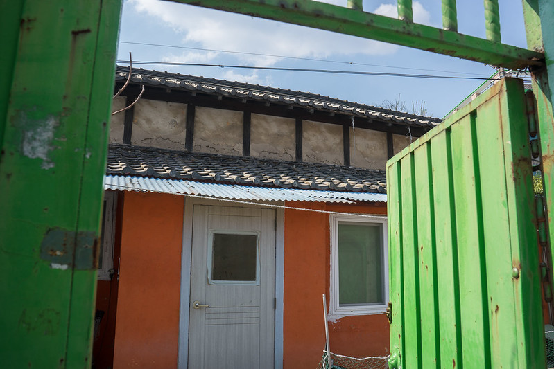
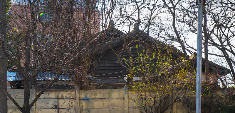
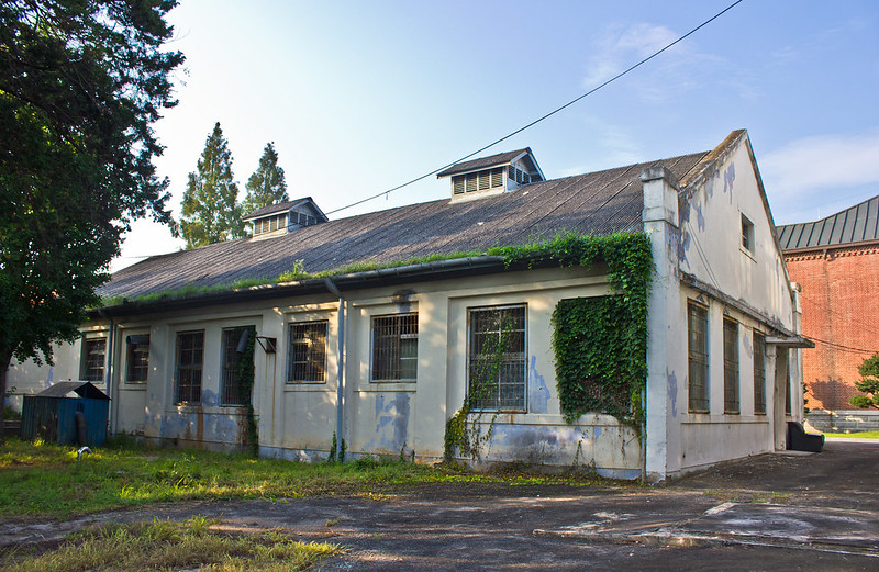
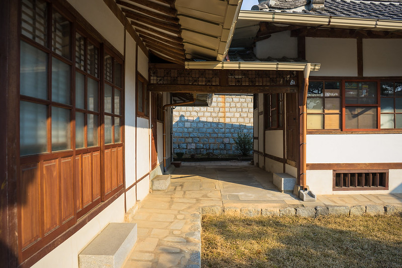
Despite a lack of information, we can make some reasonable assumptions about the city’s growth simply by looking at a present day map. It appears that, like Gunsan, all the newest developments were built on the outskirts of the old town. In fact, such structures almost form a circle around the old Jungang-dong neighborhood, where buildings decrease in age as you move away from Jungang-dong in any direction. There are a number of Japanese structures in Jungang-dong and its surrounding neighborhoods. Then, just north and east of here, there sit a number of curious housing projects that look older than 1960, but are hard for me to date since I’ve never seen anything quite like these (discussed later on in this blog post). Once you get past these old housing projects, you can see that almost the entire eastern half of the city is occupied by large apartments and industrial complexes that date to the 1990s and 2000s. There is then a Buddhist school at the northern outskirts that has been around since the Japanese occupation. Near the southern river, outside of Iksan proper, sit some Japanese buildings near Chunpo Station and also in Samnye.
Here I’d like to note that present day Iksan seems to be largely devoid of any really old hanok neighborhoods. While they exist, they aren’t many – and they are scattered around the city’s current spatial arrangement. The reason I looked for these structures is that the spaces with old hanoks can usually indicate where some of the Korean population resided. In light of this, it makes it difficult to pinpoint where different kinds of people lived exactly. It may even be that one of the reasons Iksan’s history isn’t better known is because the city might have had a large Japanese population. If this were the case, it wouldn’t be surprising that we don’t have more public information since Japanese colonial sites are rarely promoted. The city’s colonial socio-spatial arrangement and demographics are then impossible for me to accurately comment on, so take my speculation with a grain of salt, but I can offer my observations – and the remaining buildings may suggest that Iri was very Japanese.
Jungang-dong
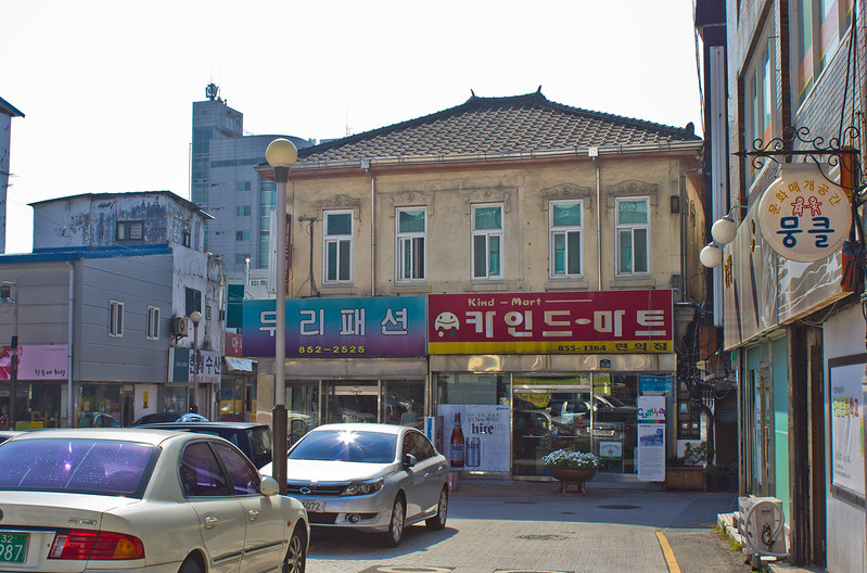
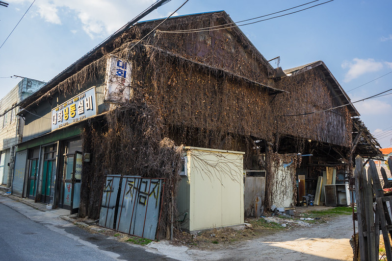
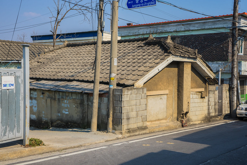
The Jungang-dong area appears to have been the old urban center. Here we can find the last traces of Japanese influence in Iksan’s former downtown. For example, the street named Pyeongdong-ro 1-gil contains a number of colonial structures. The first one is an interesting two story building with a hipped roof and ceramic tiles. Its windows feature a regal, decorative motif with a design in the center of each circle. This design is actually the Hanja/Kanji character for the number five ( 五 ). If you zoom in on the photo below, you’ll be able to see it well. This isn’t the only character on the facade, though. Another smaller one can be seen in the top right corner of the front wall. At first I assumed it to be a company emblem of some kind, but a friend was able to recognize it as being the character 堂, meaning “house.” The structure certainly looks more like a business than a house, but it is always possible the 堂 character was added after colonization. The character for the number five 五, however, surely looks to be original as it is part of the window design. Why was this character used to decorate the facade? Was this part of the company’s original name? On the map at the bottom of this post, I’ve labeled it ‘The Five Building.’


Nearby are a pair of early modern structures, one of which may have been cemented over. This one’s old roof tiles are still hiding under a newer metal roof. The building next to it still retains its original wood siding. Installed vertically, you can see how the middle has started to bow out a bit. I’ve seen this happen on other colonial wooden buildings that opted for this design instead of placing the boards horizontally. If you zoom in, you can see newer screws have recently been put in to hold the boards down.

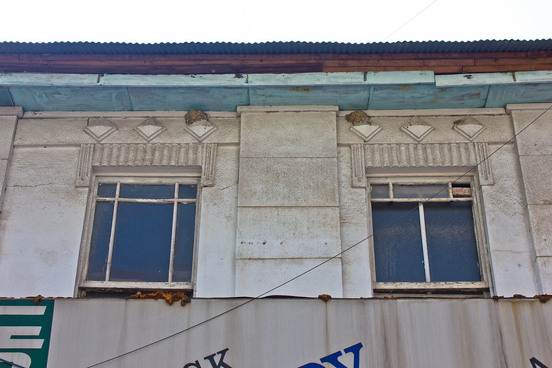
Next is a picturesque two-story colonial structure whose front facade has been cemented over and its side covered in corrugated metal. At first glance, the blocky window awnings on this structure are unremarkable. However, after photographing multiple colonial structures with this same awning design, it is then interesting to see that this was a reoccurring style in Iksan’s early modern buildings. It is of course not unique to Iksan, yet it is worth recognizing that it may have been a trend.

A colonial two-story structure that was likely a business or office of some kind still retains its decorative facade featuring a diamond design. Next to it is another minor wooden structure. Down one of these alleys I found the remaining woodwork of a colonial building (fourth picture below).


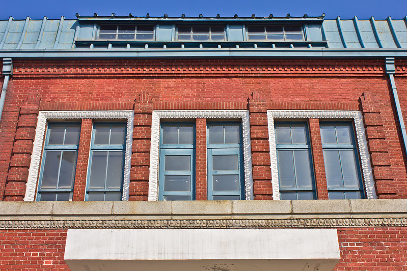
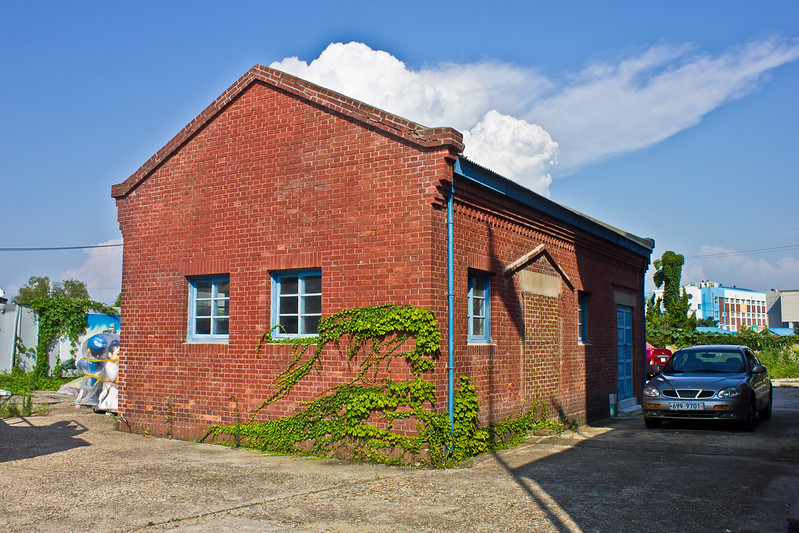
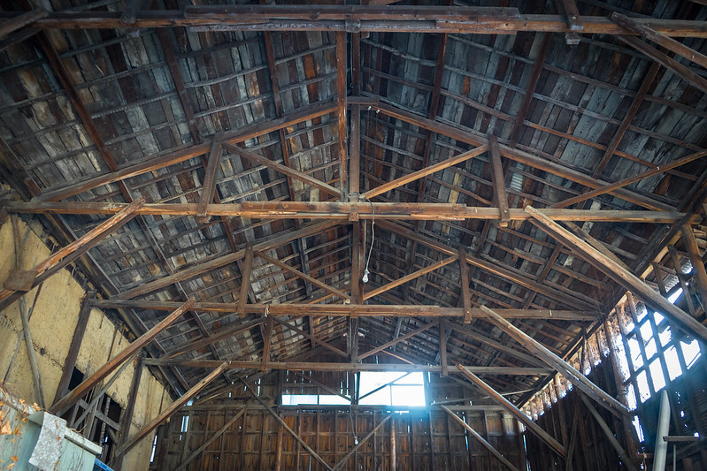
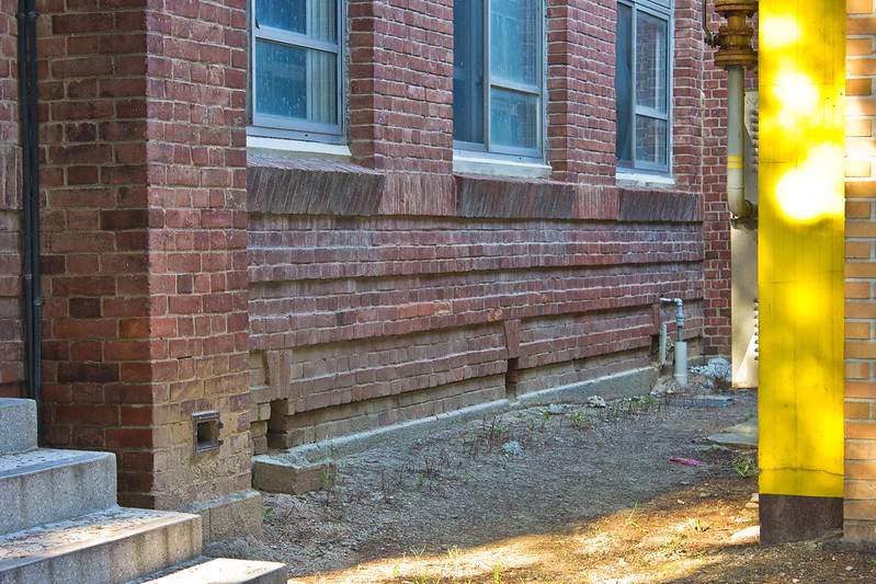
The largest and most impressive structure here is the former Igok Irrigation Association building. This association was founded by Japanese land owners, but the financial cost of the institution and its irrigation system seems to have been at least partially imposed on farmers. Water taxes were also levied against farmers via the Igok Irrigation Association – and while this surely affected small farms and tenants, it is unclear what other effects the association’s policies had on local business.
The building was constructed in 1930 of red brick and features a short Mansard style roof with dormer vents supported by a wooden truss. Imitation stonework, probably cement, was used to create decorative borders on the entry porch and second floor windows. Its first floor seemed abandoned when I visited as I got a peak inside, but it was littered with office furniture and the space hardly looked original. The second floor appears to be empty. Right next to this is a small, gabled roof brick building that probably functioned as an annex. The photo below shows that one of its entrances has been bricked over.

Though outside the scope of this blog, I include the next building here for two reasons: it was literally right next to the former Igok Association building and not much has been said about it online. It is a large, three-story concrete structure done in the Brutalist and Functionalist styles. A turret sits on the flat roof, and a massive furnace and chimney can be seen at its rear. Though it now serves as an art space, I assume it was built as some kind of public office in the 1960s or 1970s.

In a grassy space next to the Igok Irrigation Association (IIA) building sits a crumbling Japanese-style house. Then, beind the IIA building, there is a pair of gabled red brick buildings that could date as late as the 1960s. The reason I say these could date as late as 1960 is because of the brick style and the chimneys. They are built half-way into the side of the structure, which I can’t recall having ever seen on a colonial era structure before. As I will discuss later in this blog post, these two aren’t the only unusual early to mid-century modern buildings in Iksan that are confusingly difficult to date.

In a gravel-parking lot area whose edges have been overgrown with vegetation, we can just make out the facade of another colonial era building. It looks to be on its last leg and may only have a few years of life left.
At an intersection sits a two-story Japanese-style building whose first floor has since been expanded upon and completely changed. The second floor retains its roof design and one little square window towards the rear appears to have its original wooden frame. The three big second-floor windows all have the same blocky-styled awnings that I mentioned earlier.


On Pyeongdong-ro 7-gil we can find the former Samsan Law Office (삼산의원), a well preserved colonial era building that doesn’t seem to get much attention. Established in 1922, it is a decorative two-story, red brick structure that centers around an impressive entry. Imitation stonework is used throughout the facade to make opal-shaped motifs, Fleur-de-lis inspired designs, and some ribbony emblems towards the top. The structure contains a series of Neo-Gothic inspired arched windows. Its interior reveals that it was recently used as restaurant, and the first floor was anything but original. The building has fortunately become a Registered Cultural Property. However, this may largely be a result of the law office’s supposed involvement in Korean independence activities.6

Update June 20, 2020: This building has apparently been dismantled and reconstructed on Jungang-ro as the Iksan Modern History Museum. How much of the original structure remains is unclear. It previously sat on Pyeongdong-ro 7-gil between 61-2 and 65-1, at the address 전북 익산시 중앙동3가 114-2. The pictures you see in this essay are from 2016 as it sat on Pyeongdon-ro 7-gil before it was dismantled.

Iri Jungang Church was established in 1933, though it is unclear when the present structure was built.7 The stone porch and steeple are clearly newer, but the red brick sanctuary seems to date to the colonial or post-liberation period. It is a simple, rectangular building with a stone base and a series of stone chimneys lining each side of the hall. Series of uniform arched windows feature stone keystones.

Inhwa-dong & Juhyeon-dong
In this neighborhood just south of Jungang-dong there is a block of early modern buildings a few paces away from the gated 3.1 monument on Inbuk-ro 10-gil. The most noteworthy is a long, moderately well preserved colonial building that is, unfortunately, mostly concealed by new walls and difficult to fully photograph. Based on the Hanja/Kanji script etched into the ceiling (大橋), it is thought that this was the name of an office of a large farm. “大橋” is pronounced as “Ohashi” in Japanese and, translated into Korean as “대교” (Daegyo).” “大橋” and “대교” translate to “Bridge”, perhaps indicating where the farm previously sat. Rather than refer to the farm as “Bridge Plantation”, I will use its Japanese name as that is likely how it was referred to at the time. (Note: In Korean, it is now called “대교농장사무실.”)
The former Ohashi Plantation Office was built in 1914, making it one of the few Korean buildings to make it past the one hundred year mark. The title “office” may be misleading in that it certainly wouldn’t have at all been, for example, like the previously mentioned Samsan Law Office. Rather, it seems to have been more like a granary warehouse that facilitated the selling of rice from Ohashi Plantation. Its high roof allows for ventilation and its style matches that of other warehouses I have seen. The farm itself was established in September of 1907, so the office’s construction in 1914 probably shows that the farm was growing as a company. The 1907 establishment of this farm is also one of the few concrete examples I have found of growth around Iri during the 1900-1910 period. The former Ohashi Plantation Office was used as an elementary school for Chinese expats post-liberation. It now appears to be a private residence (there were people living there when I visited) and is a Registered Cultural Property under someone named Chu Bon-gi (추본기).8

Next to this is a two story Japanese-style building with a pointy, gable center section of the roof. Given its appearance, it probably served a company or business of some kind. There are two more colonial structures behind it. One looks to have been a Japanese house given its remaining decorative elements. The other one looks too simple to have been a residence.


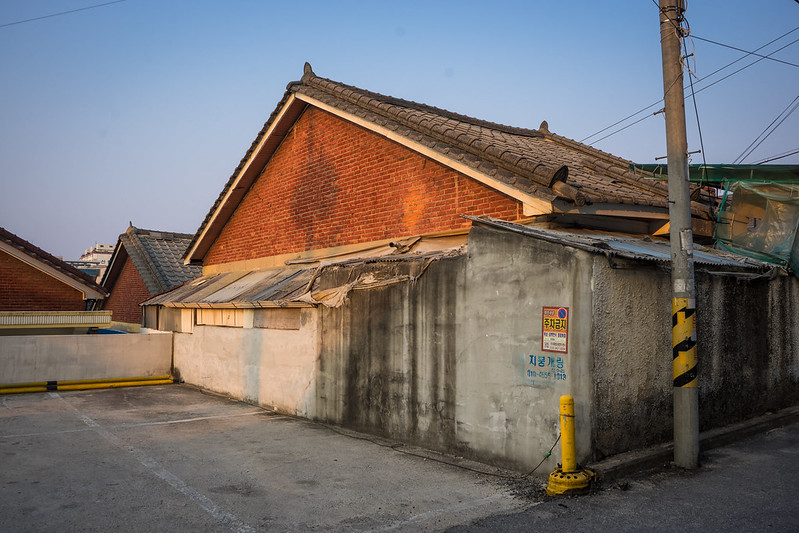
A long, rectangular structure near a parking lot has been renovated since industrialization, but its frame suggests it to be from the colonial period. A brick chimney and walls, the remainders of some demolished building, also may be from the colonial to post-liberation periods.

A farm vehicle business occupies an early modern building, as revealed by its wooden exterior frame. Next, in an alleyway, the wooden facade of a two-story colonial building is exposed while the rest of it is covered in metal to protect against rot. Its neighbor, a large two to three story building, is also covered in corrugated metal, yet its old window style suggest it to be from the colonial or post-liberation periods. It certainly coincides with window designs found in the early 1950s, anyway.


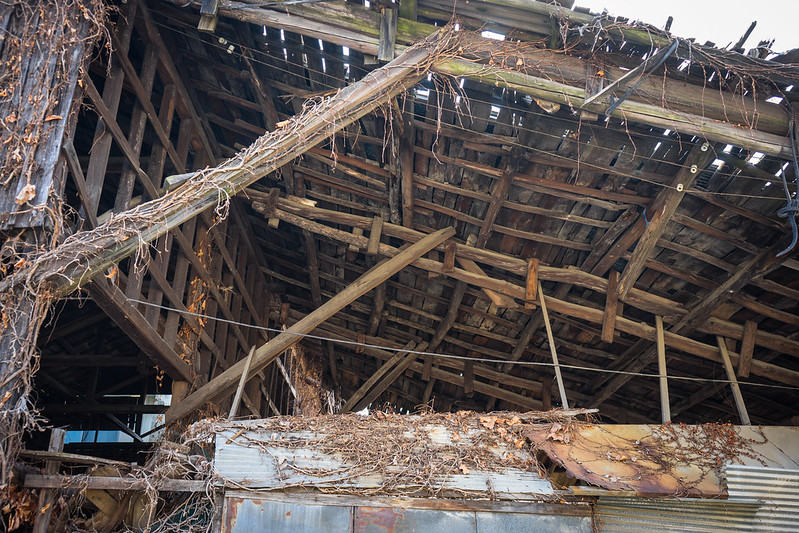
In this same neighborhood, there are two large double warehouses built with vertical facing planks on its facade. The interior reveals its colonial-era wooden frame and clay walls. The frames of the two main buildings use cut wood, yet a side section makes use of uncut logs to support its roof, which leans against the main structure. Its currently being used by a refrigeration company.

Kalsan-dong & Changin-dong
Near Jungang Intersection, we can see a lone two-story Japanese influenced colonial building that is moderately well preserved. Much of its wooden facade is exposed, though a few parts are covered in corrugated metal.

More interesting are the early modern buildings across the street near Iri Chimnye Church. Situated upon an earthen retaining wall, there is a long Japanese building divided in half by a cement covered brick wall, creating two structures that share the one wall. Even today, the structure appears to be divided for use, where half of it has been recently renovated (fourth picture below) and the other half still shows its original wooden facade (first-third pictures). Also notice the layers of gabled roofing.

Its neighbor also makes use of a cement covered brick wall, forming a structure that is quite similar in frame. As such, one wonders whether or not these were built uniformly as a set. There may have been more like it on this hill at the time. Sets of structures such as these are usually indicative of official housing of some kind, though I’ve found no information regarding the immediate area’s history.
Ma-dong
Iri Elemenary School opened on April 10, 1915,9 yet the age of the old brick building that sits on the current campus doesn’t appear to have been printed anywhere. Given the wear on its exterior it certainly looks like it could date to 1915, but there is always the possibility that the school was first established in a different structure prior to this one. It is a small, two-story building done in a typical colonial school style. Aside from the decorative placement of some bricks that form string courses and faux-keystones, it is a very simple structure. Mini faux-gable porch entrances also made use of brick in the same way. A lone circular window by the old entry offers a little relief to an otherwise aesthetically-boring building. It is not a cultural heritage property.


In May of 1922, the Iri Agricultural School opened. Later becoming the Iksan branch of Chonbuk National University, it is on this campus we can find three well preserved modern buildings, one of which has received little attention despite being such an impressive old college building. At first I thought this building might date as early as the 1930s. The bricks are certainly of an older composition and style that never appeared again after industrialization (1960s-70s) and the architecture itself follows a Western design. Even an old (undated) photo showing the building’s construction led me to believe it surely came from the colonial period. However, there are a few things here that aren’t quite in line with colonial Japanese brick buildings.
First, there is a lack of environmental wear on the facade that colonial brick buildings usually have. Second, the highest string courses feature a brick pattern that is typically seen on industrialization architecture. The granite facade work also appears to be rather new. After some digging, I came across a lone blogger claiming the structure was erected in 1963.10 If this is accurate, it would make this one of just a few post-liberation buildings to be constructed in such a grand Western style with a kind of red brick that became less common after the Japanese occupation. It is currently being used as some kind of foreign studies or international department. Its immediate neighbor, a minor mid-century building with a vented roof, sits just nearby.


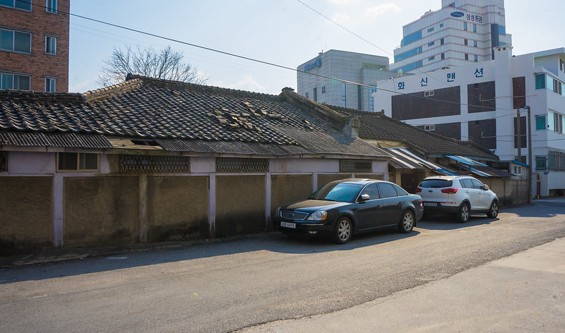
The old animal husbandry department building of the former Iri Agricultural School can be found a couple hundred meters north by an intersection. Unlike the previously mentioned college building, this one does date to the colonial period and was built as a 399 square meter school in 1932. It is a basic one-story, red brick building that has received Cultural Heritage status. For sixty-nine years, the building served as classrooms for the animal husbandry department. It is now used as a club room, presumably for student activities.

Along Jungang-ro 13-gil there are a few more interesting structures. A couple of hanoks sit infront of an old red brick warehouse. There is a minor colonial structure and then a Japanese-influenced building that still shows its wooden facade. Two more colonial buildings sit down a side street.


Dongsan-dong
Update (5/6/2016): The Dongsan-dong Citizen Center is a modern building that easily could have been built during the colonial period as it has deco/expressionist influence. I haven’t found anything on its history, and I actually forgot to include it here when I first published this blog post, but I’m doing so now in case someone finds out more about it and comments below.
Namjung-dong
In this neighborhood we can find a set of red brick buildings that appear to date to the 1950s and 1960s. There are two styles that I’ve noticed in the area, one with a single gable roof, and another with a triple gable design. Confusingly, the triple gable design feels Japanese in that such little half-gabled sections as seen here were also used in wooden Meiji-influenced architecture. What’s interesting is that these seem to have been uniformly built as a planned housing project. The second photo below shows a row of identical houses.

The reason this deserves to be mentioned here is because this set of buildings isn’t the only example in Iksan. While I didn’t get to photograph all of them, there are at least five areas of the city that contain housing project style neighborhoods filled with red brick buildings. Such brick buildings are becoming rare as well, so it is interesting that Iksan has so many left. The uniform nature of these projects can be seen below in a snapshot from Daum Map. I’ve also mapped out these parts of the city below using Google Maps.

Though outside the scope of this blog, I’ve included it here because Iksan would surely be a great place for those specifically interested in Korea’s mid-century history – especially with regard to spatial arrangements, infrastructure and architecture. The large number of these mid-century brick buildings also begs the question of how the city and its residents had the resources and wealth to construct such relatively lavish buildings so soon after the Korean War. There is surely an interesting industrialization story here.
Sinyong-dong
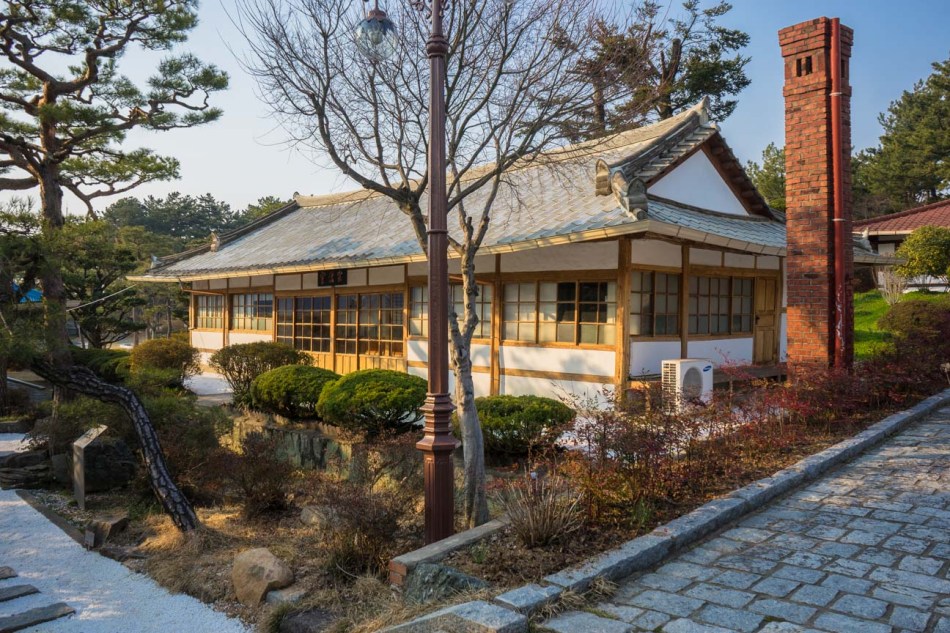
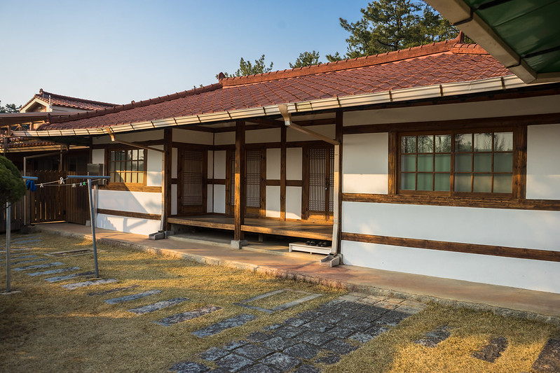
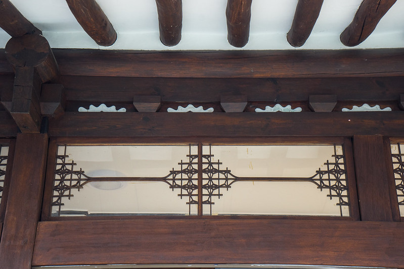
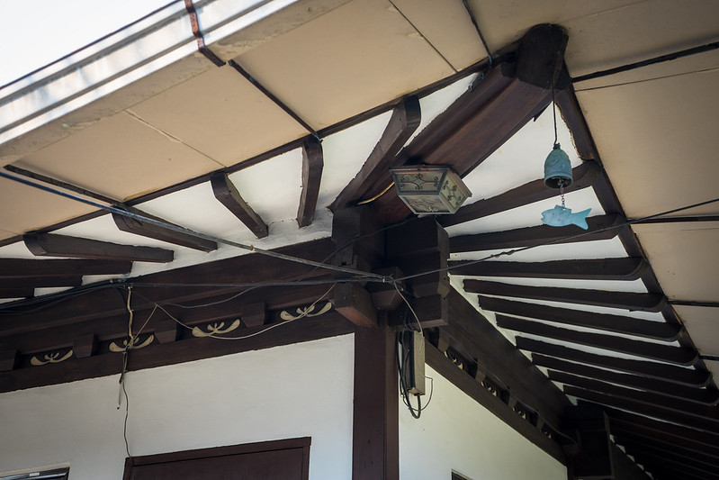
Perhaps the most beautiful place within the city of Iksan can be found at an important Buddhist site. It is here, in autumn of 1924, that a man named Park Jung-bin became the founder of Won Buddhism. Known by his Buddhist name as the Great Master Sotaesan, he and his followers developed a commune during the colonial era. This commune became a center for study and research of the Buddhadharma. Almost all of the architecture built under the Buddhist order here can still be found today within a gorgeously well-maintained garden. Sotaesan, at least in part, sought to bring about practical application of Buddhist spirituality to a modernizing world under Japanese rule. Much of the colonial era architecture here then seems to be a reflection of what could be called Won Buddhism’s semi-acceptance of modernization. While all of the buildings draw from traditional Korean architecture, they also embrace bits of Western-Japanese architecture.
Rather than discussing them in order of appearance, I will approach each structure chronologically, beginning with the oldest building first. The oldest one, Bonwon-sil, is a simple, rectangular early modern structure whose walls were built out of clay with, presumably, some kind of wood or bamboo supports as was the tradition. Its small porch (toenmaru) is also built like a hanok’s, but only occupies the entry in a recessed manner, rather than wrapping around the entire structure. Built in 1924, it is the first place that Sotaesan and his disciples lived and studied. At the time of its construction, it was known as Dochi-won, named for its reclamation of land that was previously known as Thieves Pass Hill. The informational sign doesn’t make this clear, but the structure immediately next to it appears to date to the same time and, if this is true, was probably an auxiliary building with perhaps a kitchen. A protective metal support has been added between the roof tiles and the eaves.
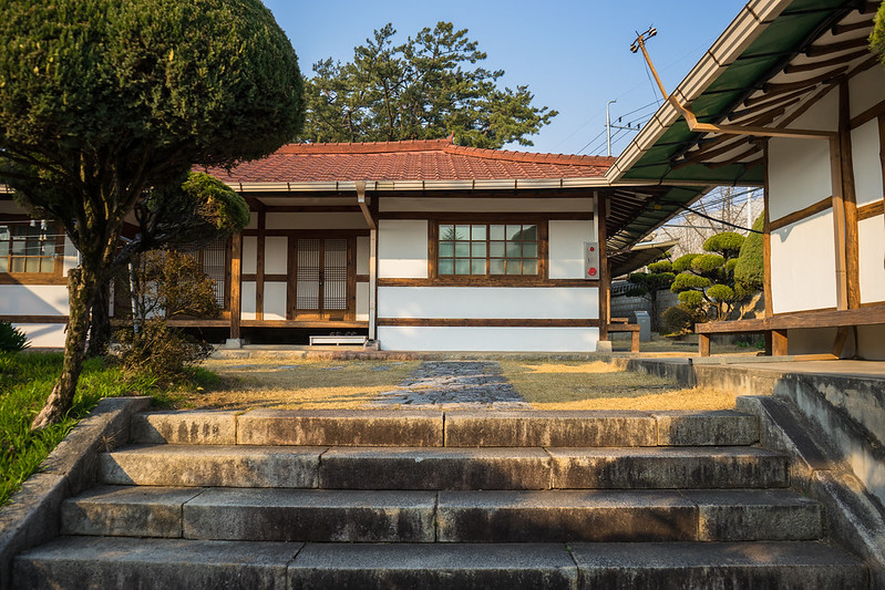

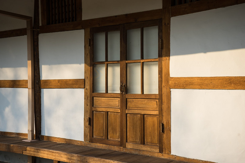
In 1927, the Master’s Quarters were built. Sotaesan got his own residence, presently known as Geumgang-won, from where he would teach his followers until he changed residences again in 1937. Built in a hanok style, the structure is a departure from traditional Korean architecture in that it makes use of an enclosed, sliding glass door entry space. It still features a toenmaru around the left side, but the entry shows the Japanese influence of the time. A protective metal support has been added between the roof tiles and the eaves, and some ugly faux-brick has been added to the gable.


The next year, in 1928, the young Won Buddhist order established the Office of the Founding Master, then known as Yeongchun-won. Now referred to as Jongbeob-sil, it was a multi-functional space used for meetings and lodging. It was used in this way until 1937, at which time Sotaesan began living here. The interior contains partitions that allowed for rearranging the space as needed depending on the required function of the day. As such, the building is an even greater departure from traditional architecture than the former Master’s Quarters and reflects Japanese influence. The building is another example of how Korean architecture was evolving at the time. Its ondol chimney looks like it could date as late as the 1980s. A small outhouse or kitchen sits behind the structure. Currently, a picturesque white pebble path leads directly to the entrance.


In 1929, Gonghoe-dang, the Old Public Hall, was constructed. It features a wrap-around toenmaru and a gabled entryway that, again, reflects the Japanese influence of the time. Its interior is similar to the previously mentioned former Office of the Founding Master in that it contains partitions used to separate the space into different arrangements as needed. The roof is obviously not original. Used for training and ceremonies, it also served as a silkworm nursery during the colonial era. In 1946, it was used by a school that would later become Wonkwang University. Known as Yuil-Haklim, the name could be translated as Only One College. Ten years later, the Central Retreat Center made use of the structure, and in 1978, the Sangju Retreat Center.


A building meant to be used as a private residence, Cheongha-won, was constructed in the Buddhist commune in 1934. It belonged to an important contributor, known as the Venerable Lee Gong-ju who helped establish and develop the Won Buddhist Order. Though it was donated to the Order and used for small meetings shortly after, it is unclear how long Lee lived in this house, for the next year it was commandeered by the Japanese police. In 1935, this building became a police substation for the Buk-il area. It is from here that the Iri Police Department monitored Won Buddhist activities as Japanese officials were known for being suspicious of religious institutions. In 1963 it became a convalescent home for retired ministers.
The structure seems less authentic than others at the site in that the bricks on the facade might be new, possibly added as part of its restoration. As such, they take away from the building’s authenticity, in my opinion. The timber has all been painted over and its ondol chimney, though made of old brick, may date as late as the 1960s. Its toenmaru does not wrap around the entire structure. A metal protective support has been added between the roof tiles and the eaves Its immediate neighbors are unmarked, but at least one of them appears to be of the same age and sits next to an old well.


In 1935 and private residence was built for one Shin Yeong-gi. Given its location on the Order’s grounds, it is likely he was an influential individual like the previously mentioned Lee Gong-ju. Shin donated the house to the Order the next year in 1936. It was in 1937 that it became an administration office and was used as such until 1964. Later used as lodging, it is now known as the Former Administration Building (구정원). Its woodwork has been painted. The interior contains four rooms. Its entryway is thought to have been added after its initial construction but it is unclear exactly when it was extended. The window design above the entry at least goes back to the early 1950s, though it could be older.

Jayuk-won, a childcare facility, was constructed in 1941 under a woman called the Venerable Hwang On-sun. Known as the “Mother of Korean orphans,” she donated the buildings to the Order, after which they were given her dharma name, Jeongsin-won. Like the Old Public Hall, this former daycare was used as an office of Yuil-Haklim (Only One College) in 1946. It also found use as a temporary temple until 1948. It features a large ondol chimney that could date as late as the 1960s. Though unclear, it appears that the woodwork has been sanded and painted as it looks rather clean. Ugly, new faux-bricks have been placed in the gable section of the roof, and a metal protective support has been added between the roof tiles and the eaves.


Behind the former daycare are three unlabeled structures that could also be rather old, with one of them featuring an old well.


On the opposite side of the path, we can see another unlabeled structure that could date to the 1960s given its similarity to its neighbor. It features some decoratively carved woodwork and a protruding entrance influenced by Japanese-Western designs.


Next to this is Jeong-hwa Jeong-sa, a newer structure from 1963 that was used as a student dormitory until its renovation in 1988. It is now the quarters for celibate male ministers. This structure actually replaced another one from around 1935 that was used as a silkworm nursery to raise money for a student scholarship fund. In 1961, that building was used as classrooms for Yuil-Haklim (Only One College) before it was either demolished or destroyed and replaced by the new 1963 structure.


Towards the center of the compound are a few large, open fields. Here we can find the Pine House (Song-dae), a lone structure dating to the fall of 1941. The timber has fortunately been left unpainted, showing its beautifully worn pine woodwork. A toenmaru can be found along the rear as well as the front, though it is split at the entry. The glass windows are another example of early modern influence. Unfortunately the roof is new.
The Pine House was used by Sotaesan to write The Principal Book of Won Buddhism just a couple of years before his death in 1943. The official journal of the Order, Wonkwang, was also written here beginning in April of 1949. In 1962, the house was used to temporarily store the relics of Prime Dharma Master Jeongsan. It was later used as a residence by Prime Dharma Master Daesan.


Other Locations
There are a number of noteworthy sites outside of Iksan proper that I haven’t had a change to visit. While I would’ve liked to have photographed them, I just haven’t had time and have put off posting about Iksan for long enough. That being said, here is a list of other places you should visit nearby. They’ve been included on the map at the end of this post.
Nabawi Cathedral, though closer to Ganggyeong, actually falls under the jurisdiction of Iksan today. It is a beautiful old church that is well worth the visit. In Chunpo, there is a restored and protected Japanese farmhouse (click here) and the old Chunpo Station, which was formerly known as Daejjang Station (click here). Robert Koehler has some great photos of these places from a few years ago on his Flickr page (click here).
In Samnye, there is an art and culture space that makes use of old colonial buildings (click here). Samnye also contains the old waterworks building that supplied water to Iri (click here and scroll down a bit).
Though outside the scope of Iksan, I mention this because I passed it on the bus ride and I’m not going to be writing a blog post about the township, Jinan, specifically. In Jinan, perhaps more interesting is an old hanok styled church with a beautiful slate roof (click here) out in the middle of nowhere. Maybe three kilometers from the slate roof hanok is a mysterious red and gray brick chapel (click here) built in the same style as Jeondong and Nabawi. It doesn’t even seem to have a proper name as it and the slate roofed hanok share the same title on Daum Map as just being a branch of Jinan church. This is unfortunate as it is clearly a very old chapel in great condition, yet there is absolutely no information available on it. Because of its obscurity, I will make a point of going to visit it in the future and will update this post after the fact.
To see the entire Flickr gallery, click here.
Footnotes
1익산시, 나무위키 (2016).
2“역세권,시장현대화로 옛 명성 되찾는 중앙동,” 익산신문 (2009).
3“익산 남전교회,” 한국기독교회사 (2010).
4“익산 서두교회,” 한국기독교회사 (2010).
5“익산의역사,” 익산시.
6“익산 중앙동 구 삼산의원,” Korea Tourism Organization (2015).
7정재영, “이리중앙교회 70주년,” 기독신문 (2003).
8“구 일본인(대교)농장사무실,” 전북관광.
9오명관, ‘익산 이리초교, “100살 기념 생일상 차려요”,’ 오마이뉴스 (2015).
10“전북대학교 익산캠퍼스 교양관,” 익산의 숨결 (2008).
11All information about the Won Buddhism colonial structures was taken from the site’s informational plaques. The Cultural Heritage Administration has done a good job of documenting the place.
Building Locations

Pingback: Suncheon | Colonial Korea